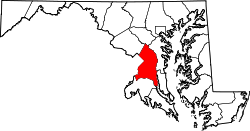
Brown Station, Maryland

Last updated

Brown Station
USA Maryland location map.svg
Red pog.svg
Brown Station
Location within the state of Maryland
Usa edcp location map.svg
Red pog.svg
Brown Station
Brown Station (the United States)
Coordinates: 38°51′14″N76°47′53″W / 38.854°N 76.798°W / 38.854; -76.798
Country Flag of the United States.svg  United States of America
State Flag of Maryland.svg  Maryland
County Flag of Prince George's County, Maryland (1963-present).svg Prince George's
Area
[1]
  Total6.22 sq mi (16.12 km2)
  Land6.17 sq mi (15.97 km2)
  Water0.06 sq mi (0.15 km2)
Population
 (2020)
  Total3,298
  Density534.78/sq mi (206.49/km2)
Time zone UTC-5 (Eastern (EST))
  Summer (DST) UTC-4 (EDT)
FIPS code 24-10737

Brown Station is an census designated place in Prince George's County, Maryland, United States. [2] [3] Per the 2020 Census, the population was 3,298. [4]

Contents

History

The Brown Station CDP was first defined by the U.S. Census Bureau for the 2020 U.S. Census. [5] The areas for Brown Station were taken from Brock Hall and Westphalia as defined in the 2010 U.S. Census. [6] [7]

Demographics

Historical population
CensusPop.Note
2020 3,298
U.S. Decennial Census [8]
2020 [9]

2020 census

Brown Station CDP, Maryland – Racial and ethnic composition
Note: the US Census treats Hispanic/Latino as an ethnic category. This table excludes Latinos from the racial categories and assigns them to a separate category. Hispanics/Latinos may be of any race.
Race / Ethnicity (NH = Non-Hispanic)Pop 2020 [9] % 2020
White alone (NH)1434.34%
Black or African American alone (NH)2,69981.84%
Native American or Alaska Native alone (NH)60.18%
Asian alone (NH)732.21%
Pacific Islander alone (NH)30.09%
Some Other Race alone (NH)80.24%
Mixed Race or Multi-Racial (NH)1243.76%
Hispanic or Latino (any race)2427.34%
Total3,298100.00%

Education

It is in Prince George's County Public Schools. [10]

Schools in the CDP include: [11] Barack Obama Elementary School, [12] and Dr. Henry A. Wise Jr. High School. [13] These schools, in the 2010 U.S. Census, were in the Westphalia CDP. [14]

School zones include:

Obama Elementary was the first school in the Washington, D.C., area that was named after the former president. [18] It is adjacent to Wise High School. [19] The Prince George's County school board approved of the name of the school on June 25, 2009; [18] all board members voted in favor of the renaming. [19] The school opened on August 23, 2010, and had a cost of $25 million. The architect was Grimm + Parker Architects, [20] and it was built for 792 students. [19] The school's cooling system relies on over 144 geothermal pumps. [21] The initial enrollment was 798, slightly higher than the school's stated capacity. [18] Its opening relieved Arrowhead, Marlton, Melwood, Patuxent and Perrywood, elementary schools. [20] The first principal was Pearl Harmon, a Liberian American; [21] in 2014 she was reassigned to an administrative position in the PG County school system. [22] Several school board members argued that naming a school after Obama would inspire area students. Many schools in PG County were named after African-Americans, and PG County voters primarily support the Democratic Party, Obama's political party. [23] In the 2008 U.S. Presidential Election, 89% of PG County residents voted for Obama. The chairperson of the PG County Republican Party Central Committee, Mykel Harris, argued that the county should not name a school after a current president, while the chairperson of the board, Ron L. Watson, stated that the vote was not done out of political considerations. [19]

Related Research Articles

<span class="mw-page-title-main">Camp Springs, Maryland</span> Census-designated place in Maryland

Camp Springs is an unincorporated area and census-designated place (CDP) in Prince George's County, Maryland, United States. The population was 22,734 at the 2020 census. Camp Springs is not an official post office designation; the area is divided among the surrounding mailing addresses of Temple Hills, Fort Washington, Clinton, and Suitland.

<span class="mw-page-title-main">Capitol Heights, Maryland</span> Town in Maryland

Capitol Heights is a town in Prince George's County, Maryland, United States, located on the border of both the Northeast & Southeast quadrants of Washington. Per the 2020 census, the population was 4,050. The town of Capitol Heights is officially bounded between Southern Avenue NE/SE to the north, Yost Place, and Eastern Avenue NE to the east, the Watts Branch Stream, Brooke Road, and Capitol Heights Boulevard to the south, and Marlboro Pike to the west. The zip code of Capitol Heights is 20743.

<span class="mw-page-title-main">Chillum, Maryland</span> Census-designated place in Maryland

Chillum is an unincorporated area and census-designated place in Prince George's County, Maryland, United States, bordering Washington, D.C., and Montgomery County.

<span class="mw-page-title-main">District Heights, Maryland</span> City in Maryland

District Heights is an incorporated municipality in Prince George's County, Maryland, United States, located near Maryland Route 4. Per the 2020 census, the population was 5,959. For more information, see the separate articles on Forestville and Suitland.

<span class="mw-page-title-main">Forestville, Maryland</span> CDP in Maryland

Forestville is an unincorporated area and census-designated place (CDP) in Prince George's County, Maryland, United States. Per the 2020 census, the population was 12,831. The community is a mixture of garden apartments, single-family homes, and shopping centers built mostly from the 1930s through 1970s, adjacent to the communities of District Heights, Suitland, Morningside, Westphalia and Camp Springs.

<span class="mw-page-title-main">Greater Upper Marlboro, Maryland</span> Unincorporated area in Maryland

Greater Upper Marlboro is an area of Prince George's County, Maryland, United States, that completely surrounds Upper Marlboro, the county seat. It was formerly a census-designated place (CDP), with a population of 18,720 at the 2000 census. However, the 2010 census divided the area into several smaller CDPs, including portions of Marlboro Meadows, Brock Hall, Marlboro Village, Queenland, and Croom.

<span class="mw-page-title-main">Kettering, Maryland</span> Census-designated place in Maryland, United States

Kettering is an unincorporated area and census-designated place in Prince George's County, Maryland, United States. At the 2020 United States Census, the population was 14,424,. Kettering is adjacent to Prince George's Community College, the upscale gated community of Woodmore, Six Flags America, Evangel Temple megachurch, and the community of Largo at the end of the Washington Metro Blue Line. Watkins Regional Park in Kettering offers a large playground, a colorful carousel, miniature golf, a miniature train ride, and various animals.

<span class="mw-page-title-main">Largo, Maryland</span> Census-designated place in Maryland, United States

Largo, located within Greater Upper Marlboro, Maryland, is an unincorporated area and census-designated place in Prince George's County, Maryland, United States. The population was 11,605 at the 2020 census.

<span class="mw-page-title-main">Marlton, Maryland</span> Census-designated place in Maryland

Marlton is an unincorporated area and census-designated place (CDP) in Prince George's County, Maryland, United States. The population was 9,802 at the 2020 census. The Marlton housing development, at first briefly called "Brandywine Country", grew up along U.S. Route 301 in the 1970s, and is part of the greater Upper Marlboro community. Originally made up of only single-family homes, more recently townhouses have been added.

<span class="mw-page-title-main">Rosaryville, Maryland</span> Census-designated place in Maryland, US

Rosaryville is an unincorporated area and census-designated place (CDP) in Prince George's County, Maryland, United States, located south of Cinton and Upper Marlboro beside U.S. Route 301. Per the 2020 census, the population was 11,548. including housing developments and rural open space. It was named for a local Roman Catholic church. Close to Rosaryville are the Marlton housing development, Maryland Veterans Cemetery, the Southern Maryland Farmers Market, and Rosaryville State Park.

<span class="mw-page-title-main">Upper Marlboro, Maryland</span> Town in Maryland, United States

Upper Marlboro, officially the Town of Upper Marlboro, is the seat of Prince George's County, Maryland. As of the 2020 census, the population within the town limits was 652, although Greater Upper Marlboro, which covers a large area outside the town limits, is many times larger.

Largo High School is a public High School in Largo census-designated place, Prince George's County, Maryland, United States. Operated by Prince George's County Public Schools, it serves students of grades 9 to 12.

Frederick Douglass High School (FDHS), is an American public high school established in 1935 and located in the Croom census-designated place of unincorporated Prince George's County, Maryland, United States, with a mailing address of Upper Marlboro and near Upper Marlboro.

Dr. Henry A. Wise Jr. High School is a public high school in unincorporated Prince George's County, Maryland, United States, with an Upper Marlboro postal address. A part of the Prince George's County Public Schools (PGCPS), it opened in the fall of 2006.

<span class="mw-page-title-main">Brock Hall, Maryland</span> Census-designated place in Maryland

Brock Hall is an unincorporated area and census-designated place in eastern Prince George's County, Maryland, United States, located south of Largo and Bowie, and north of Upper Marlboro. As of the 2020 census, the CDP had a population of 13,181.

<span class="mw-page-title-main">Marlboro Meadows, Maryland</span> Census-designated place in Maryland

Marlboro Meadows is an unincorporated community and census-designated place (CDP) in Prince George's County, Maryland, United States. Per the 2020 census, the population was 3,655. It was newly delineated for the 2010 census prior to which the area was part of the Greater Upper Marlboro census-designated place.

Marlboro Village is an unincorporated community and census-designated place (CDP) in Prince George's County, Maryland, United States. Per the 2020 census, the population was 9,221.

Queensland is a census-designated place south of Upper Marlboro in Prince George's County, Maryland, United States. The population of the CDP was 2,191 at the 2020 census. It was formerly known as Queenland until 2014 when its name was changed to Queensland and a small portion of its geography was transferred to Upper Marlboro.

Westphalia is a census-designated place in southern Prince George's County, Maryland, United States. The population of the CDP was 11,770 at the 2020 census.

References

  1. "2020 U.S. Gazetteer Files". United States Census Bureau. Retrieved April 26, 2022.
  2. "Brown Station Census Designated Place". Geographic Names Information System . United States Geological Survey, United States Department of the Interior . Retrieved March 13, 2021.
  3. Rowlands, DW (January 20, 2021). "A first look at our region's new Census-Designated Places". "GGWash". Washington, DC. Retrieved February 26, 2021.
  4. "Brown Station CDP, Maryland". United States Census Bureau . Retrieved March 13, 2022.
  5. "2020 CENSUS - CENSUS BLOCK MAP: Brown Station CDP, MD" (PDF). U.S. Census Bureau . Retrieved February 5, 2024. - Compare to the schools' addresses.
  6. "2010 CENSUS - CENSUS BLOCK MAP (INDEX): Brock Hall CDP, MD." U.S. Census Bureau. Retrieved on August 28, 2018. Pages: 1, 2, 3, and 4.
  7. "2010 CENSUS - CENSUS BLOCK MAP (INDEX): Westphalia CDP, MD." U.S. Census Bureau. Retrieved on August 27, 2018. Pages: 1, 2, 3, and 4.
  8. "Decennial Census of Population and Housing by Decades". US Census Bureau.
  9. 1 2 "P2 Hispanic or Latino, and Not Hispanic or Latino by Race – 2020: DEC Redistricting Data (PL 94-171) - Brown Station CDP, Maryland". United States Census Bureau .
  10. "2020 CENSUS - SCHOOL DISTRICT REFERENCE MAP: Prince George's County, MD" (PDF). U.S. Census Bureau . Retrieved February 5, 2024. - Text list
  11. "2020 CENSUS - CENSUS BLOCK MAP: Brown Station CDP, MD" (PDF). U.S. Census Bureau . Retrieved February 5, 2024. - Compare to the schools' addresses.
  12. Home. Barack Obama Elementary School. Retrieved on August 28, 2018. "Barack Obama Elementary 12700 Brooke Lane Upper Marlboro, MD 20772"
  13. "Dr. Henry A. Wise Jr. High (2021–2022 school year)". National Center for Educational Statistics (NCES). Mailing Address: 12650 Brooke Ln Upper Marlboro, MD 20772
  14. "2010 CENSUS - CENSUS BLOCK MAP (INDEX): Westphalia CDP, MD" (PDF). U.S. Census Bureau. p.  4 . Retrieved February 5, 2024. - Compare to the schools' addresses.
  15. "NEIGHBORHOOD ELEMENTARY SCHOOLS AND BOUNDARIES SCHOOL YEAR 2023-2024." Prince George's County Public Schools. Retrieved on February 5, 2024 - Compare to the CDP map
  16. "NEIGHBORHOOD MIDDLE SCHOOLS AND BOUNDARIES SCHOOL YEAR 2023-2024." Prince George's County Public Schools. Retrieved on February 5, 2024 - Compare to the CDP map
  17. "NEIGHBORHOOD HIGH SCHOOLS AND BOUNDARIES SCHOOL YEAR 2023-2024." Prince George's County Public Schools. Retrieved on February 5, 2024 - Compare to the CDP map
  18. 1 2 3 Dickson, Akeya (October 21, 2010). "Much hope at dedication of Barack Obama Elementary School in Upper Marlboro". Washington Post . p.  1.
  19. 1 2 3 4 King, Megan (June 26, 2009). "School board approves Barack Obama Elementary name". The Gazette .
  20. 1 2 Dickson, Akeya (October 21, 2010). "Much hope at dedication of Barack Obama Elementary School in Upper Marlboro". Washington Post . p.  2.
  21. 1 2 Tillman, Zoe (2010). "Upper Marlboro school makes final touches". Prince George's County The Gazette . Retrieved August 28, 2018.
  22. Wiggins, Ovetta (June 30, 2014). "Barack Obama Elementary School principal in Prince George's County is transferred". Washington Post . Retrieved August 28, 2018.
  23. Hernandez, Nelson (June 24, 2009). "Prince George's County Board of Education May Name Upper Marlboro School After Obama". Washington Post . Retrieved August 28, 2018.