North Brentwood, Maryland

Last updated
North Brentwood, Maryland
North Brentwood MD seal.png
Prince George's County Maryland Incorporated and Unincorporated areas North Brentwood Highlighted.svg
Location of North Brentwood, Maryland
Coordinates: 38°56′39″N76°57′6″W / 38.94417°N 76.95167°W / 38.94417; -76.95167 Coordinates: 38°56′39″N76°57′6″W / 38.94417°N 76.95167°W / 38.94417; -76.95167
Country Flag of the United States.svg  United States of America
State Flag of Maryland.svg  Maryland
County Flag of Prince George's County, Maryland (1963-present).svg Prince George's
Incorporated June 12, 1924 [1]
Area
[2]
  Total0.11 sq mi (0.29 km2)
  Land0.11 sq mi (0.29 km2)
  Water0.00 sq mi (0.00 km2)
Elevation
10 ft (3 m)
Population
 (2020)
  Total593
  Density5,247.79/sq mi (2,028.33/km2)
Time zone UTC-5 (Eastern (EST))
  Summer (DST) UTC-4 (EDT)
ZIP code
20722
Area code(s) 301, 240
FIPS code 24-56375
GNIS feature ID0597814
Website northbrentwood.com

North Brentwood is a town in Prince George's County, Maryland, United States. [3] The population was 593 at the 2020 census. [4] The municipality of North Brentwood is located north of Washington and is surrounded by the communities of Brentwood, Hyattsville, and Cottage City, and the nearby Mount Rainier. The Town of North Brentwood was incorporated in 1924, and was the first African-American-majority municipality in Maryland.

Contents

History

19th century

The town is named after the Brentwood estate built in 1817 by Robert Brent in Northeast Washington, D.C. The town was originally settled by African-American veterans of the American Civil War, who purchased lots from their former commander, Capt. Wallace A. Bartlett, beginning in 1887. [5]

The town was developed beginning in the 1890s around the Highland Station of the Washington Branch of the Baltimore and Ohio Railroad and the Columbia and Maryland Railway. "Brentwood" was created by Wallace A. Bartlett, a Civil War veteran, former foreman for the Government Printing Office, Patent Office examiner, and inventor originally from Warsaw, New York. Captain Bartlett lived in Washington, D.C., until 1887, when he purchased 206 acres (0.83 km2) of farmland from Benjamin Holliday, which abutted the Highland subdivision. Bartlett built a farmhouse for his family on the land and, with two partners J. Lee Adams and Samuel J. Mills, formed the Holladay Land and Improvement Company. [6] [7]

In 1891, the Company platted a residential subdivision called "Holladay Company's Addition to Highland" on 80 acres (320,000 m2) of the Bartlett Farm. The lots were approximately 40 feet (12 m) by 100 feet (30 m) and were arranged around an irregular grid of streets. The lots in the northern part of the subdivision, which eventually would become North Brentwood, were smaller and were subject to flooding from a mill race. [8] The first lots in the northern section were purchased in 1891 by Henry Randall, an African-American man from Anne Arundel County, who built a house on Holladay Avenue (now Rhode Island Avenue). In 1894, Randall's son, Peter Randall, constructed a house next to his father's. More family members moved into the community and built homes, and the area soon became known as Randallstown.

Other African-American families soon moved to the neighborhood, including the Plummer, Wallace, and Johnson families. They built two-story front-gable frame houses, as well as free-standing rowhouses. In 1898, the City and Suburban Railway was completed through Randallstown. By 1904 that name had been replaced by Brentwood. In the early 1900s, development was faster than in the southern areas also platted by Bartlett. A school and a church were built in 1904, and the Brentwood Colored Citizens Association was formed in 1907. The association helped acquire volunteers for a fire company, fire-fighting equipment, a community hall, and electric lights. After Bartlett's neighboring development was incorporated as the town of Brentwood in 1922, Jeremiah Hawkins pushed for the incorporation of North Brentwood. [9]
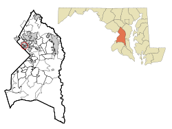
Incorporation

Historic district of N Brentwood North Brentwood Historic District Dec 10.JPG
Historic district of N Brentwood

In April 1924, Delegate Charles B. Ager sponsored a bill to incorporate North Brentwood. [1] The bill proposed a mayor, three council members, and a treasurer, all popularly elected. [1] The bill passed the House of Delegates. [1] The bill was put up to a vote of the proposed town's residents on June 12, 1924, [1] and it passed. [10]

At the time of its incorporation, North Brentwood was the first municipality in Maryland, and possibly the United States, without any white voters. [1] [10]

First election

The town held its first election on July 7, 1924. [10] Republican Jeremiah Hawkins ran unopposed for the town's first mayor. [11] Peter Randall and Frank Baden ran for Council member representing ward one. [11] Horace Allen ran unopposed to represent ward two on the council. [11] Julius Wheeler and Joseph L. Gordan ran for Council member representing ward three. [11] Mahlia Brown and John Gilmore ran for treasurer. [11] Hawkins, Randall, Allen, Wheeler, and Gilmore were elected. [12]

Growth

The town continued to grow after incorporation. In September 1924, the town's first school, a three-room schoolhouse, was built. [13] During the 1930s and 1940s, new homes were built, mostly bungalows and brick Cape Cod houses. New streets were laid out, while the existing streets were paved, extended, and renamed. [8]

Historic sites

The following is a list of historic sites in North Brentwood identified by the Maryland-National Capital Park and Planning Commission. [14] Much of the community is located within the North Brentwood Historic District; listed on the National Register of Historic Places in 2003. [15]

Site nameImageLocationM-NCPPC Inventory NumberComment
1 African Methodist Episcopal Zion Church of Brentwood 4037 Webster Street68-61-11
2 Mack Brown House 3907 Wallace Road68-61-4
3 Foursquares on Webster Street 3914, 3916, and 3918 Webster Street68-61-13
4 Jeremiah Hawkins House Site 4114 Webster Street68-61-1Demolished in 1991.
5Wigginton-Brown-Bellows House4005 Wallace Road68-061-24Demolished in 2009.
6 Edith Mason House 4501 41st Avenue68-61-8
7 McKenzie-Bullock House Site 4538 41st Avenue68-61-9Demolished in 1992 following fire.
8 Nelson-Queen House Site 4505 Church Street68-61-10Demolished in 1993 to allow for expansion of Town Hall.
9 Henry Newton House 4502 Church Street68-61-12
10 Robert Orr House 4528 40th Street68-61-2
11 Owings Houses 4533, 4535, and 4537 41st Avenue68-61-5
12 A.A. Randall House 4504 41st Avenue68-61-7
13 Peter Randall House 4508 Rhode Island Avenue68-61-37Built in 1892, it is the oldest dwelling in North Brentwood.
14 Seaburn House 4529 41st Avenue68-61-6
15 William H. Thomas House 3911 Wallace Road68-61-3

Geography

North Brentwood is located at 38°56′39″N76°57′6″W / 38.94417°N 76.95167°W / 38.94417; -76.95167 (38.944111, -76.951650). [16]

According to the United States Census Bureau, the town has a total area of 0.10 square miles (0.26 km2), all land. [17]

Demographics

Historical population
CensusPop.Note
1930 641
1940 82228.2%
1950 8381.9%
1960 8643.1%
1970 758−12.3%
1980 568−25.1%
1990 512−9.9%
2000 469−8.4%
2010 51710.2%
2020 59314.7%
U.S. Decennial Census [18]
2010 [19] 2020 [20]

2020 census

North Brentwood town, Maryland - Demographic Profile
(NH = Non-Hispanic)
Note: the US Census treats Hispanic/Latino as an ethnic category. This table excludes Latinos from the racial categories and assigns them to a separate category. Hispanics/Latinos may be of any race.
Race / EthnicityPop 2010 [19] Pop 2020 [20] % 2010% 2020
White alone (NH)10421.93%7.08%
Black or African American alone (NH)31529260.93%49.24%
Native American or Alaska Native alone (NH)000.00%0.00%
Asian alone (NH)9121.74%2.02%
Pacific Islander alone (NH)000.00%0.00%
Some Other Race alone (NH)000.00%0.00%
Mixed Race/Multi-Racial (NH)7161.35%2.70%
Hispanic or Latino (any race)17623134.04%38.95%
Total517593100.00%100.00%

2010 census

As of the census [21] of 2010, there were 517 people, 167 households, and 123 families residing in the town. The population density was 5,170.0 inhabitants per square mile (1,996.1/km2). There were 183 housing units at an average density of 1,830.0 per square mile (706.6/km2). The racial makeup of the town was 13.3% White, 63.6% African American, 0.4% Native American, 1.7% Asian, 16.2% from other races, and 4.6% from two or more races. Hispanic or Latino of any race were 34.0% of the population.

There were 167 households, of which 39.5% had children under the age of 18 living with them, 38.3% were married couples living together, 26.3% had a female householder with no husband present, 9.0% had a male householder with no wife present, and 26.3% were non-families. 21.0% of all households were made up of individuals, and 6.6% had someone living alone who was 65 years of age or older. The average household size was 3.10 and the average family size was 3.49.

The median age in the town was 36.4 years. 26.1% of residents were under the age of 18; 7.9% were between the ages of 18 and 24; 28.3% were from 25 to 44; 25.7% were from 45 to 64; and 12% were 65 years of age or older. The gender makeup of the town was 49.7% male and 50.3% female.

2000 census

As of the census [22] of 2000, there were 469 people, 158 households, and 112 families residing in the town. The population density was 4,450.8 inhabitants per square mile (1,718.5/km2). There were 181 housing units at an average density of 1,717.7 per square mile (663.2/km2). The racial makeup of the town was 6.40% White, 82.09% African American, 1.28% Native American, 1.28% Asian, 6.82% from other races, and 2.13% from two or more races. Hispanic or Latino of any race were 7.89% of the population.

There were 158 households, out of which 33.5% had children under the age of 18 living with them, 31.6% were married couples living together, 30.4% had a female householder with no husband present, and 29.1% were non-families. 22.8% of all households were made up of individuals, and 8.2% had someone living alone who was 65 years of age or older. The average household size was 2.97 and the average family size was 3.43.

In the town, the population was spread out, with 28.8% under the age of 18, 8.3% from 18 to 24, 25.6% from 25 to 44, 24.9% from 45 to 64, and 12.4% who were 65 years of age or older. The median age was 37 years. For every 100 females, there were 89.9 males. For every 100 females age 18 and over, there were 83.5 males.

The median income for a household in the town was $37,188, and the median income for a family was $45,893. Males had a median income of $32,188 versus $26,000 for females. The per capita income for the town was $18,547. About 12.6% of families and 14.2% of the population were below the poverty line, including 18.7% of those under age 18 and 22.2% of those age 65 or over.

Government

Prince George's County Police Department District 1 Station in Hyattsville serves North Brentwood. [23]

Mayoral Roster

History of Town of North Brentwood Mayors & Terms

1924 –1929, Jeremiah Hawkins

1929 –1931, George Lucas

1931 – 1933, William Allen

1933 – 1935, Julius Wheeler

1935 – 1937, John Gilmore

1937 – 1943, Sandy Baker, Sr.

1943 – 1963, William D. Bellows

1963 – 1965, Labarre Thornton

1965 – 1967, Raymond A. Hall

1967 – 1969, William D. Bellows

1969 – 1989, Raymond A. Hall

1989 – 1993, Sandy B. Johnson

1993 – 1995, Arthur J. Dock

1995 – 2007, Lillian K. Beverly

2007 – Present, Petrella A. Robinson

Transportation

US 1 southbound entering North Brentwood 2019-06-11 12 21 47 View south along U.S. Route 1 (Rhode Island Avenue) just south of the Northwest Branch of the Anacostia River in North Brentwood, Prince George's County, Maryland.jpg
US 1 southbound entering North Brentwood

U.S. Route 1 is the only highway serving North Brentwood. It connects southward to Brentwood, Mount Rainier and Washington, D.C. To the north, it passes through Hyattsville and College Park before intersecting Interstate 95/Interstate 495 (the Capital Beltway).

Education

North Brentwood is within the Prince George's County Public Schools district. [24]

During the era of legally-required racial segregation of schools, black students from North Brentwood attended Lakeland High School in College Park in the period 1928–1950; [28] Fairmont Heights High School, then near Fairmount Heights, replaced Lakeland High and served black students only from 1950 to 1964; around 1964 legally-required racial segregation of schools ended. [29]

Related Research Articles

<span class="mw-page-title-main">Prince George's County, Maryland</span> County in Maryland, United States

Prince George's County is a county located in the U.S. state of Maryland bordering the eastern portion of Washington, D.C. As of the 2020 U.S. census, the population was 967,201, making it the second-most populous county in Maryland, behind Montgomery County. The 2020 census counted an increase of nearly 104,000 in the previous ten years. Its county seat is Upper Marlboro. It is the largest and the second most affluent African American-majority county in the United States, with five of its communities identified in a 2015 top ten list.

<span class="mw-page-title-main">Adelphi, Maryland</span> Census-designated place in Maryland

Adelphi is an unincorporated area and census-designated place in Prince George's County, Maryland, United States. Per the 2020 Census, the population was 16,823. Adelphi includes the following subdivisions; Adelphi, Adelphi Park, Adelphi Hills, Adelphi Terrace, Adelphi Village, Buck Lodge, Chatham, Cool Spring Terrace, Hillandale Forest, Holly Hill Manor, Knollwood, Lewisdale, and White Oak Manor.

<span class="mw-page-title-main">Berwyn Heights, Maryland</span> Town in Maryland

Berwyn Heights is a town in Prince George's County, Maryland, United States. Per the 2020 census, the population was 3,345. It is bordered by College Park to the west, Greenbelt to the northeast, and Riverdale Park to the south.

<span class="mw-page-title-main">Bladensburg, Maryland</span> Town in Maryland, United States

Bladensburg is a town in Prince George's County, Maryland, United States. The population was 9,657 at the 2020 census. Areas in Bladensburg are located within ZIP code 20710. Bladensburg is 8.6 miles (13.8 km) from Washington, D.C.

<span class="mw-page-title-main">Brandywine, Maryland</span> Census-designated place in Maryland

Brandywine is the name of an unincorporated area in Prince George's County, Maryland, United States, that refers both to a census-designated place (CDP) and a zip code area which is much larger (20613), whose areas overlap. The population of Brandywine at the 2020 U.S. Census was 10,550 for the CDP, and the population of ZIP code 20613 was 11,860 in 2010.

<span class="mw-page-title-main">Brentwood, Maryland</span> Town in Prince Georges County, Maryland, US

Brentwood is a town in Prince George's County, Maryland, United States. Per the 2020 census, the population was 3,828. Brentwood is located within 1-mile (1.6 km) of Washington. The municipality of Brentwood is located just outside the northeast boundary of the District of Columbia and surrounded by the communities of Mount Rainier, Cottage City, North Brentwood, and the nearby Hyattsville. Along the Route 1 Corridor, Brentwood is part of the Gateway Arts District.

<span class="mw-page-title-main">Cheverly, Maryland</span> Town in Prince Georges County, Maryland, US

Cheverly is a town in Prince George's County, Maryland, United States, located very close to Washington, D.C., though not bordering it directly. The town was founded in 1918 and incorporated in 1931. Per the 2020 census, the population was 6,170. Cheverly borders the communities of Tuxedo, Chapel Oaks, Landover, Landover Hills, Villa Heights, and Bladensburg.

<span class="mw-page-title-main">Colmar Manor, Maryland</span> Town in Maryland

Colmar Manor is a town located in Prince George's County, Maryland, United States. As of the 2010 census, the town had a population of 1,404. As the town developed at the beginning of the 20th century, it assumed a name derived from its proximity to the District of Columbia—the first syllable of Columbia and that of Maryland were combined to form "Colmar". Colmar Manor was incorporated in 1927.

<span class="mw-page-title-main">Cottage City, Maryland</span> Town in Maryland

Cottage City, officially the Town of Cottage City, is a town in Prince George's County, Maryland, United States. Per the 2020 census, the population was 1,335. Cottage City is a small, quiet community lying between Eastern Avenue, Brentwood, Colmar Manor, and the Anacostia River. Cottage City was developed, beginning in 1870, under the name of "The Highlands". The area was incorporated in 1924 as Cottage City.

<span class="mw-page-title-main">Edmonston, Maryland</span> Town in Maryland

Edmonston is a town in Prince George's County, Maryland, United States. As of the 2010 census, the town population was 1,445.

<span class="mw-page-title-main">Forest Heights, Maryland</span> Town in Maryland

Forest Heights is a town in Prince George's County, Maryland, United States, and is part of the larger postal designation of Oxon Hill. The town straddles both sides of dual-lane Maryland Route 210 and includes two elementary schools. Per the 2020 census, the population was 2,658.

<span class="mw-page-title-main">Glenarden, Maryland</span> City in Maryland

Glenarden is a city in Prince George's County, Maryland, United States. Per the 2020 census, the population was 6,402.

<span class="mw-page-title-main">Hyattsville, Maryland</span> City in Maryland

Hyattsville is a city in Prince George's County, Maryland, United States, and also a close, urban suburb of Washington, D.C. The population was 21,187 at the 2020 United States Census.

<span class="mw-page-title-main">Landover Hills, Maryland</span> Town in Maryland

Landover Hills is a town in Prince George's County, Maryland, United States. Per the 2020 census, the population was 1,815. The town has a neighborhood named Defense Heights.

<span class="mw-page-title-main">Largo, Maryland</span> Census-designated place in Maryland

Largo, located within greater Upper Marlboro, Maryland, is an unincorporated area and census-designated place in Prince George's County, Maryland, United States. The population was 11,605 at the 2020 census.

<span class="mw-page-title-main">Morningside, Maryland</span> Town in Maryland

Morningside is an incorporated town in Prince George's County, Maryland, United States. Per the 2020 census, the population was 1,240. The town developed with the establishment of nearby Andrews Air Force Base and the federal Census Bureau. The government of the town is led by a mayor and town council. Morningside Elementary School and Benjamin Foulois Junior High School/Elementary/Creative and Performing Arts Academy (current) as well as Michael J Polley Neighborhood Park are located within the town limits. Morningside has one of the largest VFW posts (chapters) in the entire country. Morningside is also the city of license of one of Washington's most prominent radio stations, from the 1960s to the present, WJFK and WPGC-FM. Additionally, Morningside is home to one of the busiest volunteer fire departments in Prince George's County, Morningside VFD Station 827. In 2015, station 827 ran over 8,000 calls for service with 150 working fires in Morningside and the adjacent communities, and has garnered national recognition for their service to the community.

<span class="mw-page-title-main">Mount Rainier, Maryland</span> City in Maryland

Mount Rainier is a city in Prince George's County, Maryland, United States, bordering Washington D.C. The population was 8,333 at the 2020 census. Mount Rainier is contained between the Northwest Branch Anacostia River, Cedar Lane Alley, and 34th Street to the north, 37th Street and 37th Place to the northeast, Upshur Street and Queens Chapel Road to the west, the CSX Capital Subdivision train tracks to the east, and Eastern Avenue NE to the south. Mount Rainier got its start as a streetcar suburb, when tracks were laid for the 82 Streetcar Line. According to local tradition, surveyors from the Pacific Northwest named the town, giving the streets names such as Shasta and Cascade. Historic U.S. 1 runs through the center of the town and serves as the main street and central business district.

<span class="mw-page-title-main">New Carrollton, Maryland</span> City in Maryland, United States

New Carrollton is a city located in central Prince George's County, Maryland, United States. As of the 2020 census, the population was 13,715. New Carrollton is located 10 miles (16 km) east of central Washington, D.C. The Mayor of New Carrollton is Phelecia Nembhard. Elected in 2020, Mayor Nembhard is the first Black mayor of New Carrollton and the first woman elected as mayor.

<span class="mw-page-title-main">Riverdale Park, Maryland</span> Town in Prince Georges County, Maryland, US

Riverdale Park, formerly known and often referred to as Riverdale, is a semi-urban town in Prince George's County, Maryland, United States, a suburb in the Washington, D.C. metropolitan area. The population was 6,955 as of the 2010 U.S. Census. The population as of 2019 is approximately 7,304, according to the US Census Bureau and other entities.

<span class="mw-page-title-main">University Park, Maryland</span> Town in Maryland

University Park is a town in Prince George's County, Maryland, United States. The population was 2,548 at the 2010 census.

References

  1. 1 2 3 4 5 6 "News From Suburbs of Capital: Hyattsville". The Washington Post. April 27, 1924. p. ES18.
  2. "2020 U.S. Gazetteer Files". United States Census Bureau. Retrieved April 26, 2022.
  3. U.S. Geological Survey Geographic Names Information System: North Brentwood, Maryland
  4. "North Brentwood town, Maryland". United States Census Bureau . Retrieved March 13, 2022.
  5. "North Brentwood, Maryland History". North Brentwood, Maryland. Maryland Municipal League. 2008-05-10. Archived from the original on 2004-08-28. Retrieved 2004-08-04.
  6. "Community Summary Sheet, Prince George's County" (PDF). North Brentwood, Maryland. Maryland State Highway Administration, 1999. 2008-05-10.
  7. The Neighborhoods of Prince George's County. Upper Marlboro: Community Renewal Program, 1974.
  8. 1 2 Pearl, Susan G. Historical Survey: Brentwood, Maryland. Upper Marlboro: M-NCPPC, 1992.
  9. Denny, George D., Jr. Proud Past, Promising Future: Cities and Towns in Prince George's County. Brentwood, Maryland: Tuxedo Press, 1997.
  10. 1 2 3 "Suburban: North Brentwood". The Washington Post. June 29, 1924. p. 7.
  11. 1 2 3 4 5 "News From Suburbs of Capital: Hyattsville". The Washington Post. July 7, 1924. p. 5.
  12. "M'Quin Elected Edmonston Mayor: Defeats S.E. Smith: North Brentwood Elects Colored Man as Its First Mayor, Jeremiah Hawkins". The Washington Post. July 8, 1924. p. 8.
  13. "News From Suburbs of Capital: Hyattsville". The Washington Post. September 19, 1924. p. 2.
  14. M-NCPPC African-American Heritage Survey, October 1996: Properties Within or Closely Associated With Historic Communities (Prince George's County, Maryland), 1996 [ permanent dead link ].
  15. "North Brentwood Historic District". Maryland Historical Trust. Retrieved 2008-10-29.
  16. "US Gazetteer files: 2010, 2000, and 1990". United States Census Bureau. 2011-02-12. Retrieved 2011-04-23.
  17. "US Gazetteer files 2010". United States Census Bureau. Archived from the original on 2012-07-02. Retrieved 2013-01-25.
  18. "Decennial Census by Decade". US Census Bureau.
  19. 1 2 "P2 HISPANIC OR LATINO, AND NOT HISPANIC OR LATINO BY RACE - 2010: DEC Redistricting Data (PL 94-171) - North Brentwood town, Maryland". United States Census Bureau .
  20. 1 2 "P2 HISPANIC OR LATINO, AND NOT HISPANIC OR LATINO BY RACE - 2020: DEC Redistricting Data (PL 94-171) - North Brentwood town, Maryland". United States Census Bureau .
  21. "U.S. Census website". United States Census Bureau . Retrieved 2013-01-25.
  22. "U.S. Census website". United States Census Bureau . Retrieved 2008-01-31.
  23. "District 1 Station - Hyattsville. Prince George's County Police Department. Retrieved on September 9, 2018. Beat map.
  24. "2010 CENSUS - CENSUS BLOCK MAP: North Brentwood town, MD." U.S. Census Bureau. Retrieved on March 1, 2018.
  25. "NEIGHBORHOOD ELEMENTARY SCHOOLS AND BOUNDARIES SCHOOL YEAR 2017-2018." Prince George's County Public Schools. Retrieved on January 31, 2018.
  26. "NEIGHBORHOOD MIDDLE SCHOOLS AND BOUNDARIES SCHOOL YEAR 2017-2018." Prince George's County Public Schools. Retrieved on January 31, 2018.
  27. "NEIGHBORHOOD HIGH SCHOOLS AND BOUNDARIES SCHOOL YEAR 2017-2018." Prince George's County Public Schools. Retrieved on January 31, 2018.
  28. African-American Historic and Cultural Resources in Prince George’s County, Maryland . Maryland-National Capital Park and Planning Commission, February 2012. p. 63 (document page 67). Retrieved on September 6, 2018.
  29. "Fairmont Heights High School History". Fairmont Heights High School. 2018-09-04. Archived from the original on 2005-10-04. Retrieved 2018-09-04.