Largo, Maryland

Last updated
Largo, Maryland
Largo Becon.jpg
Downtown Largo station in Downtown Largo
Prince George's County Maryland Incorporated and Unincorporated areas Largo Highlighted.svg
Location of Largo, Maryland
Coordinates: 38°52′37″N76°49′50″W / 38.87694°N 76.83056°W / 38.87694; -76.83056
CountryFlag of the United States.svg  United States
State Flag of Maryland.svg  Maryland
County Flag of Prince George's County, Maryland (1963-present).svg Prince George's
Named for Largo Bay, Scotland [1]
Area
[2]
  Total3.06 sq mi (7.93 km2)
  Land3.06 sq mi (7.93 km2)
  Water0.00 sq mi (0.00 km2)
Elevation
174 ft (53 m)
Population
 (2020)
  Total11,605
  Density3,790.01/sq mi (1,463.43/km2)
Time zone UTC−5 (Eastern (EST))
  Summer (DST) UTC−4 (EDT)
ZIP code
20774
Area code(s) 301, 240
FIPS code 24-45825
GNIS feature ID0597664
Lake Largo is located in Upper Marlboro's neighborhood of Largo. Lake Largo .jpg
Lake Largo is located in Upper Marlboro's neighborhood of Largo.

Largo, located within greater Upper Marlboro, Maryland, is an unincorporated area and census-designated place in Prince George's County, Maryland, United States. [3] The population was 11,605 at the 2020 census. [4]

Contents

Largo is located just east of the Capital Beltway (I-95/495) and is home to Prince George's Community College and Largo High School. Six Flags America amusement park (formerly known as Wild World and Adventure World) is to the east in Woodmore, and FedExField, the Washington Commanders's stadium, is across the Capital Beltway in Summerfield. Watkins Regional Park in Kettering just to the east of Largo (operated by the Maryland-National Capital Park and Planning Commission) has an old-fashioned carousel, miniature train ride, miniature golf, the Old Maryland Farm, a playground, and animals on display. [5] Largo is not a post office designation, but is at the northern end of the Greater Upper Marlboro ZIP code area.

Since the transit system's expansion in late 2004, Downtown Largo station has served as the eastern end of the Blue and Silver Lines of the Washington Metro.

History

Largo was named after the Largo Plantation that was owned by the Beall family. The plantation is believed to be named after Largo Bay in Scotland. It was sold to John Contee in 1745. [6]

Arelis R. Hernández of The Washington Post stated in 2015 that "There has been talk for decades of relocating the [Prince George's County] government to Largo". [7] In 2015 Rushern Baker, the county executive, expressed a desire to move the county seat from Upper Marlboro to Largo since the latter has a more central location and access to the Washington Metro network. A spokesperson for Thomas V. Mike Miller Jr., the President of the Maryland Senate, expressed opposition to this idea. [7]

Transportation

The WMATA (Washington Area Transit Authority), Blue and Silver Lines eastern terminus is Downtown Largo station. Downtown Largo Station is served by several regional bus routes operated by both WMATA and Prince Georges County's The Bus.

Geography

Largo is located at 38°52′37″N76°49′50″W / 38.87694°N 76.83056°W / 38.87694; -76.83056 (38.876850, 76.830651). [8]

According to the United States Census Bureau, the CDP has a total area of 3.0 square miles (7.8 km2), all land.

Demographics

Historical population
CensusPop.Note
1980 5,557
1990 9,47570.5%
2000 8,408−11.3%
2010 10,70927.4%
2020 11,6058.4%
U.S. Decennial Census [9]
2010 [10] 2020 [11]

2020 census

Largo CDP, Maryland – Demographic Profile
(NH = Non-Hispanic)
Note: the US Census treats Hispanic/Latino as an ethnic category. This table excludes Latinos from the racial categories and assigns them to a separate category. Hispanics/Latinos may be of any race.
Race / EthnicityPop 2010 [10] Pop 2020 [11] % 2010% 2020
White alone (NH)3092322.89%2.00%
Black or African American alone (NH)9,69110,13490.49%87.32%
Native American or Alaska Native alone (NH)31250.29%0.22%
Asian alone (NH)1941891.81%1.63%
Pacific Islander alone (NH)010.00%0.01%
Some Other Race alone (NH)15680.14%0.59%
Mixed Race/Multi-Racial (NH)1924211.79%3.63%
Hispanic or Latino (any race)2775352.59%4.61%
Total10,70911,605100.00%100.00%

2000 Census

As of the census [12] of 2000, there were 8,408 people, 3,471 households, and 2,127 families residing in the CDP. The population density was 2,758.8 inhabitants per square mile (1,065.2/km2). There were 3,709 housing units at an average density of 1,217.0 per square mile (469.9/km2). The racial makeup of the CDP was 4.27% White, 92.69% African American, 0.13% Native American, 0.78% Asian, 0.04% Pacific Islander, 0.51% from other races, and 1.58% from two or more races. Hispanic or Latino of any race were 1.43% of the population.

There were 3,471 households, out of which 31.7% had children under the age of 18 living with them, 34.3% were married couples living together, 22.4% had a female householder with no husband present, and 38.7% were non-families. Of all households 31.9% were made up of individuals, and 3.3% had someone living alone who was 65 years of age or older. The average household size was 2.41 and the average family size was 3.09.

In the CDP, the population was spread out, with 25.3% under the age of 18, 8.4% from 18 to 24, 35.9% from 25 to 44, 25.7% from 45 to 64, and 4.7% who were 65 years of age or older. The median age was 34 years. For every 100 females, there were 79.4 males. For every 100 females age 18 and over, there were 73.7 males.

The median income for a household in the CDP was $58,130, and the median income for a family was $70,421. Males had a median income of $40,067 versus $37,417 for females. The per capita income for the CDP was $26,312. About 3.2% of families and 5.3% of the population were below the poverty line, including 7.6% of those under age 18 and 6.5% of those age 65 or over.

Government and infrastructure

Even though the county seat is in Upper Marlboro, multiple agencies of the Government of Prince George's County, including the majority of the county's executive branch, reside in Largo. In the 1990s the PG County government purchased some properties and leased others, and county administrative functions were moved to Largo. [7] Circa 2010, [13] five PG County agencies were headquartered in these properties in Largo. Beginning in 2011, four additional county agencies relocated to Largo, and the county government acquired at least eight parcels of land and/or buildings. As of 2015 County Executive Baker held his "Citizen Day" in Largo instead of Upper Marlboro. [7]

Prince George's County Police Department District 2 Station in Brock Hall CDP, with a Bowie postal address, serves the community. [14]

The U.S. Postal Service operates the Largo Post Office in Lake Arbor CDP, with a Largo postal address. [15] [16]

Education

Primary and secondary schools

Largo is a part of the Prince George's County Public Schools. [17] Residents are divided between Arrowhead, Kettering, and Lake Arbor elementary schools. [18] Most areas are zoned to Kettering Middle School while some are zoned to Ernest Everett Just Middle School. [19] All areas in Largo are zoned to Largo High School. [20]

Divine Peace Lutheran School is a K-8 Christian school of the Wisconsin Evangelical Lutheran Synod in Largo. [21]

High Road Upper School, Largo MD

Post-secondary education

The community is also home to Prince George's Community College, serving a county population of 850,000 residents.

Public libraries

Largo is served by the Largo-Kettering Branch of the Prince George's County Memorial Library System (PGCMLS) and is the headquarters location for PGCMLS. [22] [23] The library headquarters, previously adjacent to the Hyattsville Branch, [24] moved to Largo in 2015. [25]

Notable people

Related Research Articles

<span class="mw-page-title-main">Prince George's County, Maryland</span> County in Maryland, United States

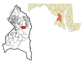
Prince George's County is a county located in the U.S. state of Maryland bordering the eastern portion of Washington, D.C. As of the 2020 U.S. census, the population was 967,201, making it the second-most populous county in Maryland, behind Montgomery County. The 2020 census counted an increase of nearly 104,000 in the previous ten years. Its county seat is Upper Marlboro. It is the largest and the second most affluent African American-majority county in the United States, with five of its communities identified in a 2015 top ten list.

<span class="mw-page-title-main">Brentwood, Maryland</span> Town in Prince Georges County, Maryland, US

Brentwood is a town in Prince George's County, Maryland, United States. Per the 2020 census, the population was 3,828. Brentwood is located within 1-mile (1.6 km) of Washington. The municipality of Brentwood is located just outside the northeast boundary of the District of Columbia and surrounded by the communities of Mount Rainier, Cottage City, North Brentwood, and the nearby Hyattsville. Along the Route 1 Corridor, Brentwood is part of the Gateway Arts District.

<span class="mw-page-title-main">Forestville, Maryland</span> CDP in Maryland

Forestville is an unincorporated area and census-designated place (CDP) in Prince George's County, Maryland, United States. Per the 2020 census, the population was 12,831. The community is a mixture of garden apartments, single-family homes, and shopping centers built mostly from the 1930s through 1970s, adjacent to the communities of District Heights, Suitland, Morningside, Westphalia and Camp Springs. Forestville is located close to the town of Upper Marlboro, where many Prince George's County Board Offices are located. Additionally, Forestville is located adjacent to the Joint Base Andrews/ Andrews Air Force Base. The neighborhood has a majority African-American population. It is convenient to the Capital Beltway (I-95/I-495), Maryland Route 4, including Penn Mar Shopping Center, and for employees of Andrews Air Force Base and the U.S. Census Bureau. Forestville is located within proximity to the Suitland Metro Station, served by WMATA's Green Line. A notable former resident was Steny Hoyer, now Democratic Leader of the United States House of Representatives.

<span class="mw-page-title-main">Glenn Dale, Maryland</span> CDP in Maryland

Glenn Dale is an unincorporated area and census-designated place (CDP) in Prince George's County, Maryland, United States. The population was 14,698 at the 2020 census. Glenn Dale is home to the Glenn Dale Hospital, an abandoned sanatorium, and the USDA Plant Introduction Station.

<span class="mw-page-title-main">Greater Upper Marlboro, Maryland</span> Unincorporated area in Maryland

Greater Upper Marlboro is an area of Prince George's County, Maryland that completely surrounds Upper Marlboro, the county seat. It was formerly a census-designated place (CDP), with a population of 18,720 at the 2000 census. However, the 2010 census divided the area into several smaller CDPs, including portions of Marlboro Meadows, Brock Hall, Marlboro Village, Queenland, and Croom.

<span class="mw-page-title-main">Kettering, Maryland</span> Census-designated place in Maryland, United States

Kettering is an unincorporated area and census-designated place in Prince George's County, Maryland, United States. At the 2020 United States Census, the population was 14,424,. Kettering is adjacent to Prince George's Community College, the upscale gated community of Woodmore, Six Flags America, Evangel Temple megachurch, and the community of Largo at the end of the Washington Metro Blue Line. Watkins Regional Park in Kettering offers a large playground, a colorful carousel, miniature golf, a miniature train ride, and various animals.

<span class="mw-page-title-main">Lake Arbor, Maryland</span> Census-designated place in Maryland, United States

Lake Arbor is an unincorporated area and census-designated place (CDP) in Prince George's County, Maryland, United States. The population was 14,541 at the 2020 census. It is one of the nation's most affluent African-American communities. The ZIP Codes encompassing the CDP area are 20721 and 20774.

<span class="mw-page-title-main">Mitchellville, Maryland</span> Census-designated place in Maryland

Mitchellville is an upper-class majority African-American unincorporated area and census-designated place (CDP) in Prince George's County, Maryland, United States. Per the 2020 census, the population was 11,136.

<span class="mw-page-title-main">Upper Marlboro, Maryland</span> Town in Maryland, United States

Upper Marlboro, officially the Town of Upper Marlboro, is the seat of Prince George's County, Maryland. As of the 2020 census, the population within the town limits was 652, although Greater Upper Marlboro, which covers a large area outside the town limits, is many times larger.

Seabrook is an unincorporated community and census-designated place (CDP) in Prince George's County, Maryland, United States, located approximately 12 miles (19 km) east of Washington, D.C.. Per the 2020 census, the population was 19,627. Prior to 2010, Seabrook was part of the Lanham-Seabrook census-designated place.

Landover is an unincorporated community and census-designated place in Prince George's County, Maryland, United States. As of the 2020 census, it had a population of 25,998.

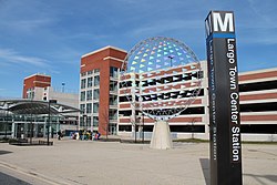
Largo High School is a public High School in Largo census-designated place, Prince George's County, Maryland, United States. Operated by Prince George's County Public Schools, it serves students of grades 9 to 12.

Queen Anne in Prince George's County, Maryland, United States, is a former port on the Patuxent River. It was delineated as a CDP for the 2010 census, at which time it had a population of 1,280. Per the 2020 census, the population was 1,405.

<span class="mw-page-title-main">Brock Hall, Maryland</span> Census-designated place in Maryland

Brock Hall is an unincorporated area and census-designated place in eastern Prince George's County, Maryland, United States, located south of Largo and Bowie, and north of Upper Marlboro. As of the 2020 census, the CDP had a population of 13,181.

<span class="mw-page-title-main">Marlboro Meadows, Maryland</span> Census-designated place in Maryland

Marlboro Meadows is an unincorporated community and census-designated place (CDP) in Prince George's County, Maryland, United States. Per the 2020 census, the population was 3,655. It was newly delineated for the 2010 census prior to which the area was part of the Greater Upper Marlboro census-designated place.

Marlboro Village is an unincorporated community and census-designated place (CDP) in Prince George's County, Maryland, United States. Per the 2020 census, the population was 9,221. It was newly delineated for the 2010 census prior to which the area was part of the Greater Upper Marlboro census-designated place.

Queensland is a census-designated place south of Upper Marlboro in Prince George's County, Maryland, United States. The population of the CDP was 2,191 at the 2020 census. It was formerly known as Queenland until 2014 when its name was changed to Queensland and a small portion of its geography was transferred to Upper Marlboro.

Summerfield is a census-designated place near Landover in Prince George's County, Maryland. As of the 2020 census, the population was 14,758. It is a suburb of Washington, D.C.

Westphalia is a census-designated place in southern Prince George's County, Maryland, United States. The population of the CDP was 11,770 at the 2020 census.

The Prince George's County Memorial Library System (PGCMLS) is the public library system of Prince George's County, Maryland, United States, in the Washington metropolitan area. Its headquarters are in the Largo-Kettering Branch in Largo.

References

  1. "ePodunk". www.epodunk.com. Archived from the original on 7 May 2018. Retrieved 6 May 2018.
  2. "2020 U.S. Gazetteer Files". United States Census Bureau. Retrieved April 26, 2022.
  3. U.S. Geological Survey Geographic Names Information System: Largo, Maryland
  4. "Largo CDP, Maryland". United States Census Bureau . Retrieved April 15, 2022.
  5. "Watkins Regional Park". Archived from the original on 2013-06-25. Retrieved 2013-05-01.
  6. "RootsWeb.com Home Page" (PDF). freepages.genealogy.rootsweb.ancestry.com. Archived from the original (PDF) on 9 October 2016. Retrieved 6 May 2018.
  7. 1 2 3 4 Hernández, Arelis R. (2015-07-22). "Baker wants to move government headquarters to Largo, lawmakers say". Washington Post . Retrieved 2018-09-11.
  8. "US Gazetteer files: 2010, 2000, and 1990". United States Census Bureau. 2011-02-12. Retrieved 2011-04-23.
  9. "Decennial Census of Population and Housing by Decades". US Census Bureau.
  10. 1 2 "P2 HISPANIC OR LATINO, AND NOT HISPANIC OR LATINO BY RACE – 2010: DEC Redistricting Data (PL 94-171) – Largo CDP, Maryland". United States Census Bureau .
  11. 1 2 "P2 HISPANIC OR LATINO, AND NOT HISPANIC OR LATINO BY RACE – 2020: DEC Redistricting Data (PL 94-171) – Largo CDP, Maryland". United States Census Bureau .
  12. "U.S. Census website". United States Census Bureau . Retrieved 2008-01-31.
  13. Spivack, Miranda S. (2010-09-14). "Rushern Baker wins Prince George's executive race". Washington Post . Retrieved 2018-09-11.
  14. "District 2 Station - Bowie." Prince George's County Police Department. Retrieved on September 9, 2018. "District 2 Station - Bowie 601 SW Crain Highway Bowie, MD 20715 ". Beat map. 2010 U.S. Census Bureau index map of Brock Hall CDP as well as the detail on Page 1.
  15. "2010 CENSUS - CENSUS BLOCK MAP (INDEX): Lake Arbor CDP, MD." U.S. Census Bureau. Retrieved on September 1, 2018. Pages: 1 and 2.
  16. "LARGO." U.S. Postal Service. Retrieved on September 11, 2018. "9801 APOLLO DR UPPER MARLBORO, MD 20774-9997" - See: "2010 CENSUS - CENSUS BLOCK MAP (INDEX): Lake Arbor CDP, MD." U.S. Census Bureau. Retrieved on September 1, 2018.
  17. "2010 CENSUS - CENSUS BLOCK MAP: Largo CDP, MD." U.S. Census Bureau. Retrieved on August 28, 2018.
  18. "NEIGHBORHOOD ELEMENTARY SCHOOLS AND BOUNDARIES SCHOOL YEAR 2018-2019." Prince George's County Public Schools. Retrieved on August 28, 2018.
  19. "NEIGHBORHOOD MIDDLE SCHOOLS AND BOUNDARIES SCHOOL YEAR 2018-2019." Prince George's County Public Schools. Retrieved on August 28, 2018.
  20. "NEIGHBORHOOD HIGH SCHOOLS AND BOUNDARIES SCHOOL YEAR 2018-2019." Prince George's County Public Schools. Retrieved on August 28, 2018.
  21. "Excellent Education Empowered by Christ".
  22. "Largo-Kettering Branch." Prince George's County Memorial Library System. Retrieved on August 29, 2018. "Largo-Kettering Branch 9601 Capital Lane Largo, MD 20774"
  23. "Prince George's County Memorial Library System grid.473433.4". GRID. 2018-08-27. Retrieved 2018-08-31.
  24. "Hyattsville." Prince George's County Memorial Library System. January 1, 2004. Retrieved on September 20, 2018. "Hyattsville Address: 6530 Adelphi Rd. Hyattsville, MD 20782 and "Administrative Offices : 6532 Adelphi Road, Hyattsville, MD 20782-209"
  25. "BOARD OF LIBRARY TRUSTEES MEETING June 9, 2015–7:30 p.m. Oxon Hill Branch." Prince George's County Public Library. Retrieved on September 20, 2018. p. 2/5.
  26. Barone, Michael; Ujifusa, Grant (1999). The Almanac of American Politics 2000. National Journal Group Inc. p. 753.
  27. Chris Richards (3 July 2018). "Here's why Q Da Fool is in a particularly good mood". The Washington Post .
  28. Samson, Pete (March 10, 2022). "Severance Star Tramell Tillman Talks Work/Life Balance". Mr Feelgood . Retrieved April 17, 2022. I grew up in Largo, Maryland, which is a suburb outside of Washington DC.