Dodge Park, Maryland

Last updated

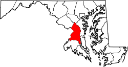
Dodge Park is an unincorporated area and former census-designated place (CDP) in Prince George's County, Maryland, United States; [1] it is currently within the Landover CDP.

Contents

The former CDPs of Landover, Dodge Park, Kentland, and Palmer Park, defined as such by the U.S. Census Bureau in the 1990 U.S. Census, [2] were consolidated into the Greater Landover CDP as of the 2000 U.S. Census. [3] This amalgamated area was renamed the Landover CDP as of the 2010 U.S. Census. [4]

Education

Prince George's County Public Schools operates area public schools. [2]

Dodge Park and William Paca elementary schools serve sections of the former 1990 CDP. [5] Kenmoor Middle School serves all of the former CDP [6] DuVal High School and Charles Herbert Flowers High School serve sections of the former CDP. [7]

Related Research Articles

Coral Hills, Maryland Census-designated place in Maryland

Coral Hills is an unincorporated area and census-designated place (CDP) in Prince George's County, Maryland, United States. As of the 2010 census, the CDP population was 9,895.

Forestville, Maryland CDP in Maryland

Forestville is an unincorporated area and census-designated place (CDP) in Prince George's County, Maryland, United States. The population was 12,353 at the 2010 census. The community is a mixture of garden apartments, single-family homes, and shopping centers built mostly from the 1930s through 1970s, adjacent to the communities of District Heights, Suitland, Morningside, Westphalia and Camp Springs. Forestville is located close to the town of Upper Marlboro, where many Prince George's County Board Offices are located. Additionally, Forestville is located adjacent to the Joint Base Andrews/ Andrews Air Force Base. The neighborhood has a majority African-American population. It is convenient to the Capital Beltway (I-95/I-495), Maryland Route 4, including Penn Mar Shopping Center, and for employees of Andrews Air Force Base and the U.S. Census Bureau. Forestville is located within proximity to the Suitland Metro Station, served by WMATA's Green Line. A notable former resident was Steny Hoyer, now Democratic Leader of the United States House of Representatives.

Glenarden, Maryland City in Maryland

Glenarden is a city in Prince George's County, Maryland, United States. The population was 6,000 at the 2010 census.

Glenn Dale, Maryland CDP in Maryland

Glenn Dale is an unincorporated area and census-designated place (CDP) in Prince George's County, Maryland, United States. The population was 13,466 at the 2010 census. Glenn Dale is home to the Glenn Dale Hospital, an abandoned sanatorium, and the USDA Plant Introduction Station.

Goddard, Maryland Unincorporated community in Maryland

Goddard is an unincorporated community and former census-designated place (CDP) in Prince George's County, Maryland, United States. It was named after the physicist Robert H. Goddard. The population was 5,554 in the 2000 census. The area was no longer a census-designated place as of the 2010 census.

Greater Landover, Maryland Former census-designated place in Maryland

Greater Landover was a census-designated place (CDP) in Prince George's County, Maryland, United States, during the 2000 census. The population was 22,900 at that time. As of 2007, the rough estimate given by the census was at 22,665. For the 2010 U.S. Census, the area was designated the Landover CDP.

Lake Arbor, Maryland Census-designated place in Maryland, United States

Lake Arbor is an unincorporated area and census-designated place (CDP) in Prince George's County, Maryland, United States. The population was 9,776 at the 2010 census. It is one of the nation's most affluent African-American communities. The ZIP Codes encompassing the CDP area are 20721 and 20774.

Largo, Maryland Census-designated place in Maryland

Largo, located within greater Upper Marlboro, Maryland, is an unincorporated area and census-designated place in Prince George's County, Maryland, United States. The population was 10,709 at the 2010 census.

Marlton, Maryland Census-designated place in Maryland

Marlton is an unincorporated area and census-designated place (CDP) in Prince George's County, Maryland, United States. The population was 9,301 at the 2010 census. The Marlton housing development, at first briefly called "Brandywine Country", grew up along U.S. Route 301 in the 1970s, and is part of the greater Upper Marlboro community. Originally made up of only single-family homes, more recently townhouses have been added.

Rosaryville, Maryland Census-designated place in Maryland

Rosaryville is an unincorporated area and census-designated place (CDP) in Prince George's County, Maryland, United States, located beside U.S. Route 301. The population was 10,697 at the 2010 census, including housing developments and rural open space. It was named for a local Roman Catholic church. Close to Rosaryville are the Marlton housing development, Maryland Veterans Cemetery, the Southern Maryland Farmers Market, and Rosaryville State Park.

South Laurel, Maryland Census-designated place in Maryland

South Laurel is an unincorporated area and census-designated place (CDP) in Prince George's County, Maryland, United States. The population was 26,112 at the 2010 census.

Springdale, Maryland Census-designated place in Maryland

Springdale is an unincorporated area and census-designated place (CDP) in Prince George's County, Maryland, United States. The population was 2,994 at the 2010 census.

Landover, Maryland Census-designated place in Maryland, US

Landover is an unincorporated community and census-designated place in Prince George's County, Maryland, United States. Landover is located very close to Washington, although it does not directly border Washington D.C. unlike its neighboring communities, Chapel Oaks and Fairmount Heights, which directly border Washington D.C. and go all the way up to/touch the Maryland/ D.C. line. As of the 2010 census it had a population of 23,078.

Kentland, Maryland Unincorporated community in Maryland

Kentland is an unincorporated community and former census-designated place in Prince George's County, Maryland, United States, located within the Landover census area. Kentland is served by the Landover Metro Station, which is located just north of the community, across Landover Road.

Palmer Park, Maryland Unincorporated community in Maryland

Palmer Park is an unincorporated community in Prince George's County, Maryland, United States, within the census-designated place of Landover. It was previously a CDP of its own until 2000.

Konterra, Maryland CDP in Maryland

Konterra is an unincorporated area and census-designated place (CDP) in Prince George's County, Maryland, United States. The population was 2,527 at the 2010 census.

Charles Herbert Flowers High School Public high school in Springdale, Maryland, United States

Charles Herbert Flowers High School is a comprehensive science and technology magnet school located in unincorporated Prince George's County, Maryland, United States, adjacent to the Springdale census-designated place and with a Springdale postal address. It is part of the Prince George's County School System. Its principal is Dr. Gorman Brown.

Fairmont Heights High School Public comprehensive secondary school in Landover, Maryland , United States

Fairmont Heights High School (est.1950) is an American public comprehensive secondary school located in the Landover, Maryland, United States, just outside Washington D.C. It is part of the Prince George's County Public Schools system. Two middle schools feed into Fairmont Heights. It is part of the School Board District 3.

Fairwood is an unincorporated area and census-designated place (CDP) in Prince George's County, Maryland, United States. The population was 5,031 at the 2010 census.

Summerfield, Maryland Census-designated place in Maryland

Summerfield is a census-designated place near Landover in Prince George's County, Maryland, United States. The population of the CDP was 10,898 at the 2010 census. It is a suburb of Washington

References

  1. "Dodge Park". Geographic Names Information System . United States Geological Survey . Retrieved September 24, 2018.
  2. 1 2 "1990 COUNTY BLOCK MAP" (index map) Prince George's County. U.S. Census Bureau. Retrieved on September 9, 2018. The CDPs of Landover, Dodge Park, Kentland, and Palmer Park are shown on pages 13, 14, 17, and 18.
  3. "CENSUS 2000 BLOCK MAP: GREATER LANDOVER CDP." U.S. Census Bureau. Retrieved on September 9, 2018.
  4. "2010 CENSUS - CENSUS BLOCK MAP: Landover CDP, MD." U.S. Census Bureau. Retrieved on September 1, 2018.
  5. "NEIGHBORHOOD ELEMENTARY SCHOOLS AND BOUNDARIES SCHOOL YEAR 2018-2019." Prince George's County Public Schools. Retrieved on September 1, 2018.
  6. "NEIGHBORHOOD MIDDLE SCHOOLS AND BOUNDARIES SCHOOL YEAR 2018-2019." Prince George's County Public Schools. Retrieved on September 1, 2018.
  7. "NEIGHBORHOOD HIGH SCHOOLS AND BOUNDARIES SCHOOL YEAR 2018-2019." Prince George's County Public Schools. Retrieved on September 1, 2018.

Coordinates: 38°55′39″N76°52′37″W / 38.92750°N 76.87694°W / 38.92750; -76.87694