Westphalia, Maryland

Last updated

Westphalia, Maryland
USA Maryland location map.svg
Red pog.svg
Westphalia, Maryland
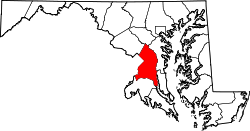
Location within the state of Maryland
Usa edcp location map.svg
Red pog.svg
Westphalia, Maryland
Westphalia, Maryland (the United States)
Coordinates: 38°50′24″N76°49′26″W / 38.84000°N 76.82389°W / 38.84000; -76.82389
CountryFlag of the United States.svg  United States
State Flag of Maryland.svg  Maryland
County Flag of Prince George's County, Maryland (1963-present).svg Prince George's
Area
[1]
  Total9.91 sq mi (25.68 km2)
  Land9.91 sq mi (25.66 km2)
  Water0.01 sq mi (0.02 km2)
Elevation
180 ft (50 m)
Population
 (2020)
  Total11,770
  Density1,188.05/sq mi (458.71/km2)
Time zone UTC−5 (Eastern (EST))
  Summer (DST) UTC−4 (EDT)
Area code(s) 301, 240
FIPS code 24-83290

Westphalia is a census-designated place in southern Prince George's County, Maryland, United States. The population of the CDP was 11,770 at the 2020 census. [2]

Contents

History

The U.S. Census Bureau first defined the Westphalia census-designated place for the 2010 U.S. Census. [3] In the 2020 U.S. Census, portions of Westphalia were given to the new Brown Station CDP. [3] [4] [5]

Geography

According to the U.S. Census Bureau, Westphalia has a total area of 13.3 square miles (34.4 km2), of which 0.03 square miles (0.07 km2), or 0.20%, is water. [6] The CDP is bordered to the west by the Capital Beltway (I-495/95) and to the south by Maryland Route 4. The CDP of Largo borders Westphalia to the north, Brock Hall is to the northeast, Marlboro Village is to the east, Queensland, Rosaryville and Melwood are to the south, Andrews Air Force Base is to the southwest, and Forestville is to the west.

Demographics

Historical population
CensusPop.Note
2010 7,266
2020 11,77062.0%
U.S. Decennial Census [7]
2010 [8] 2020 [9]

2020 census

Westphalia CDP, Maryland – Racial and Ethnic Composition
(NH = Non-Hispanic)
Note: the US Census treats Hispanic/Latino as an ethnic category. This table excludes Latinos from the racial categories and assigns them to a separate category. Hispanics/Latinos may be of any race.
Race / EthnicityPop 2010 [8] Pop 2020 [9] % 2010% 2020
White alone (NH)7135689.81%4.83%
Black or African American alone (NH)6,0119,26582.73%78.72%
Native American or Alaska Native alone (NH)23260.32%0.22%
Asian alone (NH)721980.99%1.68%
Pacific Islander alone (NH)030.00%0.03%
Some Other Race alone (NH)14710.19%0.60%
Mixed Race/Multi-Racial (NH)1724522.37%3.84%
Hispanic or Latino (any race)2611,1873.59%10.08%
Total7,26611,770100.00%100.00%

Planning issues

On February 6, 2007, the Prince George's County Council approved the Westphalia Sector Plan and Sectional Map Amendment. [10] This document established a planning concept for the Westphalia area and rezoned specified properties. [11] This concept is envisions a "high-density, transit- and pedestrian-oriented urban town center" surrounded by three village centers and multiple residential modules. Buildout is proposed to include 14,000 - 15,300 new residential units, 4.5 million square feet of commercial space, and 750,000 square feet of retail space. A 150-acre Central Park is proposed immediately north of the Town Center, approximately at the center of the Westphalia area. [11]

Education

Prince George's County Public Schools operates public schools serving the census-designated place. [12]

School zoning as of 2024 (with the 2020 Census map being used, [4] and compare with the 2010 Census map [3] ):

Elementary schools: [13]

Middle schools: [15]

High schools: [16]

Obama, [17] and Wise, [18] in the 2010 U.S. Census, were in the Westphalia CDP. [19] However, in the 2020 Census, they were moved to the Brown Station CDP. [5]

Related Research Articles

<span class="mw-page-title-main">Capitol Heights, Maryland</span> Town in Maryland

Capitol Heights is a town in Prince George's County, Maryland, United States, located on the border of both the Northeast & Southeast quadrants of Washington. Per the 2020 census, the population was 4,050. The town of Capitol Heights is officially bounded between Southern Avenue NE/SE to the north, Yost Place, and Eastern Avenue NE to the east, the Watts Branch Stream, Brooke Road, and Capitol Heights Boulevard to the south, and Marlboro Pike to the west. The zip code of Capitol Heights is 20743.

<span class="mw-page-title-main">District Heights, Maryland</span> City in Maryland

District Heights is an incorporated municipality in Prince George's County, Maryland, United States, located near Maryland Route 4. Per the 2020 census, the population was 5,959. For more information, see the separate articles on Forestville and Suitland.

<span class="mw-page-title-main">Forestville, Maryland</span> CDP in Maryland

Forestville is an unincorporated area and census-designated place (CDP) in Prince George's County, Maryland, United States. Per the 2020 census, the population was 12,831. The community is a mixture of garden apartments, single-family homes, and shopping centers built mostly from the 1930s through 1970s, adjacent to the communities of District Heights, Suitland, Morningside, Westphalia and Camp Springs.

<span class="mw-page-title-main">Greater Upper Marlboro, Maryland</span> Unincorporated area in Maryland

Greater Upper Marlboro is an area of Prince George's County, Maryland that completely surrounds Upper Marlboro, the county seat. It was formerly a census-designated place (CDP), with a population of 18,720 at the 2000 census. However, the 2010 census divided the area into several smaller CDPs, including portions of Marlboro Meadows, Brock Hall, Marlboro Village, Queenland, and Croom.

<span class="mw-page-title-main">Kettering, Maryland</span> Census-designated place in Maryland, United States

Kettering is an unincorporated area and census-designated place in Prince George's County, Maryland, United States. At the 2020 United States Census, the population was 14,424,. Kettering is adjacent to Prince George's Community College, the upscale gated community of Woodmore, Six Flags America, Evangel Temple megachurch, and the community of Largo at the end of the Washington Metro Blue Line. Watkins Regional Park in Kettering offers a large playground, a colorful carousel, miniature golf, a miniature train ride, and various animals.

<span class="mw-page-title-main">Largo, Maryland</span> Census-designated place in Maryland

Largo, located within Greater Upper Marlboro, Maryland, is an unincorporated area and census-designated place in Prince George's County, Maryland, United States. The population was 11,605 at the 2020 census.

<span class="mw-page-title-main">Marlton, Maryland</span> Census-designated place in Maryland

Marlton is an unincorporated area and census-designated place (CDP) in Prince George's County, Maryland, United States. The population was 9,802 at the 2020 census. The Marlton housing development, at first briefly called "Brandywine Country", grew up along U.S. Route 301 in the 1970s, and is part of the greater Upper Marlboro community. Originally made up of only single-family homes, more recently townhouses have been added.

<span class="mw-page-title-main">Rosaryville, Maryland</span> Census-designated place in Maryland, US

Rosaryville is an unincorporated area and census-designated place (CDP) in Prince George's County, Maryland, United States, located south of Cinton and Upper Marlboro beside U.S. Route 301. Per the 2020 census, the population was 11,548. including housing developments and rural open space. It was named for a local Roman Catholic church. Close to Rosaryville are the Marlton housing development, Maryland Veterans Cemetery, the Southern Maryland Farmers Market, and Rosaryville State Park.

<span class="mw-page-title-main">Upper Marlboro, Maryland</span> Town in Maryland, United States

Upper Marlboro, officially the Town of Upper Marlboro, is the seat of Prince George's County, Maryland. As of the 2020 census, the population within the town limits was 652, although Greater Upper Marlboro, which covers a large area outside the town limits, is many times larger.

Seabrook is an unincorporated community and census-designated place (CDP) in Prince George's County, Maryland, United States, located approximately 12 miles (19 km) east of Washington, D.C. Per the 2020 census, the population was 19,627. Prior to 2010, Seabrook was part of the Lanham-Seabrook census-designated place.

Queen Anne in Prince George's County, Maryland, United States, is a former port on the Patuxent River. It was delineated as a CDP for the 2010 census, at which time it had a population of 1,280. Per the 2020 census, the population was 1,405.

Frederick Douglass High School (FDHS), is an American public high school established in 1935 and located in the Croom census-designated place of unincorporated Prince George's County, Maryland, United States, with a mailing address of Upper Marlboro and near Upper Marlboro.

Dr. Henry A. Wise Jr. High School is a public high school in unincorporated Prince George's County, Maryland, United States, with an Upper Marlboro postal address. A part of the Prince George's County Public Schools (PGCPS), it opened in the fall of 2006.

Baden is an unincorporated area and census-designated place in southeastern Prince George's County, Maryland, United States. As of the 2020 census, the CDP had a population of 2,114.

<span class="mw-page-title-main">Brock Hall, Maryland</span> Census-designated place in Maryland

Brock Hall is an unincorporated area and census-designated place in eastern Prince George's County, Maryland, United States, located south of Largo and Bowie, and north of Upper Marlboro. As of the 2020 census, the CDP had a population of 13,181.

<span class="mw-page-title-main">Marlboro Meadows, Maryland</span> Census-designated place in Maryland

Marlboro Meadows is an unincorporated community and census-designated place (CDP) in Prince George's County, Maryland, United States. Per the 2020 census, the population was 3,655. It was newly delineated for the 2010 census prior to which the area was part of the Greater Upper Marlboro census-designated place.

Marlboro Village is an unincorporated community and census-designated place (CDP) in Prince George's County, Maryland, United States. Per the 2020 census, the population was 9,221.

Melwood is an unincorporated community and census-designated place (CDP) in Prince George's County, Maryland, United States. It was newly delineated for the 2010 census, at which time its population was 3,051. Per the 2020 census, the population was 3,977.

Queensland is a census-designated place south of Upper Marlboro in Prince George's County, Maryland, United States. The population of the CDP was 2,191 at the 2020 census. It was formerly known as Queenland until 2014 when its name was changed to Queensland and a small portion of its geography was transferred to Upper Marlboro.

Brown Station is an census designated place in Prince George's County, Maryland, United States. Per the 2020 Census, the population was 3,298.

References

  1. "2020 U.S. Gazetteer Files". United States Census Bureau. Retrieved April 26, 2022.
  2. "Westphalia CDP, Maryland". United States Census Bureau . Retrieved March 13, 2022.
  3. 1 2 3 "2010 CENSUS - CENSUS BLOCK MAP (INDEX): Westphalia CDP, MD." U.S. Census Bureau. Retrieved on August 27, 2018. Pages: 1, 2, 3, and 4.
  4. 1 2 3 "2020 CENSUS - CENSUS BLOCK MAP: Westphalia CDP, MD" (PDF). U.S. Census Bureau. p. 2 (PDF p. 3/4). Retrieved February 5, 2024. - Compare to the Arrowhead school address: "2300 Sansbury Road. Upper Marlboro, MD 20772" - Compare also to other school zone maps
  5. 1 2 "2020 CENSUS - CENSUS BLOCK MAP: Brown Station CDP, MD" (PDF). U.S. Census Bureau . Retrieved February 5, 2024. - Compare to the schools' addresses.
  6. "Geographic Identifiers: 2010 Demographic Profile Data (G001): Westphalia CDP, Maryland". United States Census Bureau . Retrieved December 16, 2011.
  7. "Decennial Census of Population and Housing by Decades". US Census Bureau.
  8. 1 2 "P2 HISPANIC OR LATINO, AND NOT HISPANIC OR LATINO BY RACE - 2010: DEC Redistricting Data (PL 94-171) - Westphalia CDP, Maryland". United States Census Bureau .
  9. 1 2 "P2 HISPANIC OR LATINO, AND NOT HISPANIC OR LATINO BY RACE - 2020: DEC Redistricting Data (PL 94-171) - Westphalia CDP, Maryland". United States Census Bureau .
  10. "Prince George's County Council Resolution CR-2-2007" (PDF). Retrieved March 16, 2012.
  11. 1 2 Prince George's County Planning Department (2007). Approved Westphalia Sector Plan and Sectional Map Amendment. Upper Marlboro, MD: The Maryland-National Capital Park and Planning Commission. p. 148.
  12. "2020 CENSUS - SCHOOL DISTRICT REFERENCE MAP: Prince George's County, MD" (PDF). U.S. Census Bureau . Retrieved February 5, 2024. - Text list
  13. "NEIGHBORHOOD ELEMENTARY SCHOOLS AND BOUNDARIES SCHOOL YEAR 2023-2024." Prince George's County Public Schools. Retrieved on February 5, 2024 - Compare to the CDP maps
  14. Dickson, Akeya (October 21, 2010). "Much hope at dedication of Barack Obama Elementary School in Upper Marlboro". Washington Post . p.  2.
  15. "NEIGHBORHOOD MIDDLE SCHOOLS AND BOUNDARIES SCHOOL YEAR 2023-2024." Prince George's County Public Schools. Retrieved on February 5, 2024 - Compare to the CDP maps
  16. "NEIGHBORHOOD HIGH SCHOOLS AND BOUNDARIES SCHOOL YEAR 2023-2024." Prince George's County Public Schools. Retrieved on February 5, 2024 - Compare to the CDP maps
  17. Home. Barack Obama Elementary School. Retrieved on August 28, 2018. "Barack Obama Elementary 12700 Brooke Lane Upper Marlboro, MD 20772"
  18. "Dr. Henry A. Wise Jr. High (2021–2022 school year)". National Center for Educational Statistics (NCES). Mailing Address: 12650 Brooke Ln Upper Marlboro, MD 20772
  19. "2010 CENSUS - CENSUS BLOCK MAP (INDEX): Westphalia CDP, MD" (PDF). U.S. Census Bureau. p.  4 . Retrieved February 5, 2024. - Compare to the schools' addresses.