Tuxedo, Maryland | |
---|---|
Coordinates: 38°55′3″N76°55′16″W / 38.91750°N 76.92111°W | |
Country | United States of America |
State | Maryland |
County | Prince George's |
Time zone | UTC-5 (Eastern (EST)) |
• Summer (DST) | UTC-4 (EDT) |
GNIS feature ID | 598187 |
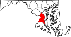
Tuxedo is an unincorporated community in Prince George's County, Maryland, United States. [1]
Scattered settlement in Tuxedo appeared along the Baltimore and Potomac Railroad (later the Pennsylvania Railroad) by 1886, according to historic maps. In 1894, a local developer created the area as a railroad suburb of DC and named it Tuxedo, advertising it as "Washington's Prettiest Suburb", with its own train station. Despite aggressive sales, the settlement slowly developed along three blocks adjacent to the rail line. By 1917, the community contained approximately 20 houses, one church, and one school. Tuxedo grew to include two additional blocks and a total of approximately 50 residences and a new school by 1942. [2] [3]
The community is bounded on the north by the Town of Cheverly, on the south and east by the John Hanson Highway, and on the west by the B&O Railroad line. All of the census and demographic data for Tuxedo residents are included with the information for the Town of Cheverly. [4]
Tuxedo has remained unincorporated, but shares services with the incorporated town of Cheverly, which was developed in the early 20th century. The second school constructed in Tuxedo was called the Cheverly-Tuxedo School and opened in 1923. This school and another facility in Cheverly remained in operation until 1991. Since that time, the Cheverly-Tuxedo School has functioned as a specialty education center. Another facility shared with Cheverly was the volunteer fire department. The original Tuxedo-Cheverly Fire Station was constructed in 1930, but in 1968 a new station was constructed at 5711 Tuxedo Road. Both stations were originally all volunteer, with assistance from Prince George's County career (paid) firefighters coming later to supplement the volunteers. By 1995 the volunteers had ceased operation and the Tuxedo-Cheverly Fire Company (officially called Company 22) became the very first fire station in Prince George's County to be staffed 24/7 by career firefighters. Unfortunately, the station was closed in 2010 with the county citing budget constraints and nearby station overlap. Most personnel and apparatus were transferred to the newly constructed Springdale Fire Station (Company 06) in nearby Springdale, Md. The previous Tuxedo-Cheverly Fire Station building was badly in need of repairs and was subsequently sold to a private buyer.
This building is now operated by the New Horizons Supported Services organization, which is dedicated to the personal and employment advancement of individuals with intellectual and developmental disabilities. Most of the land in and around Tuxedo has become industrial because of its proximity to the railroad line, the John Hanson Highway, and Baltimore–Washington Parkway. [2]
Prince George's County is located in the U.S. state of Maryland bordering the eastern portion of Washington, D.C. As of the 2020 U.S. census, the population was 967,201, making it the second-most populous county in Maryland, behind neighboring Montgomery County. The 2020 census counted an increase of nearly 104,000 in the previous ten years. Its county seat is Upper Marlboro. It is the largest and the second most affluent African American-majority county in the United States, with five of its communities identified in a 2015 top ten list.
Arbutus is an unincorporated community and a census-designated place in Baltimore County, Maryland, United States. The population was 20,483 at the 2010 census. The census area also contains the communities of Halethorpe and Relay, in which all three names were used during the 1960 census when the area had a population of 22,402.
Bladensburg is a town in Prince George's County, Maryland, United States. The population was 9,657 at the 2020 census. Areas in Bladensburg are located within ZIP code 20710. Bladensburg is 8.6 miles (13.8 km) from Washington, D.C.
Bowie is a city in Prince George's County, Maryland, United States. Per the 2020 census, the population was 58,329. Bowie has grown from a small railroad stop to the largest municipality in Prince George's County, and the fifth most populous city and third largest city by area in the U.S. state of Maryland. In 2014, CNN Money ranked Bowie 28th in its Best Places to Live list.
Brandywine is the name of an unincorporated area in Prince George's County, Maryland, United States, that refers both to a census-designated place (CDP) and a zip code area which is much larger (20613), whose areas overlap. The population of Brandywine at the 2020 U.S. Census was 10,550 for the CDP, and the population of ZIP code 20613 was 11,860 in 2010.
Cheverly is a town in Prince George's County, Maryland, United States, located very close to Washington, D.C., though not bordering it directly. The town was founded in 1918 and incorporated in 1931. Per the 2020 census, the population was 6,170. Cheverly borders the communities of Tuxedo, Chapel Oaks, Landover, Landover Hills, Villa Heights, and Bladensburg.
Laurel is a city in Maryland, United States, located midway between Washington, D.C. and Baltimore on the banks of the Patuxent River. While the city limits are entirely in northern Prince George's County, outlying developments extend into Anne Arundel, Montgomery and Howard counties. Founded as a mill town in the early 19th century, Laurel expanded local industry and was later able to become an early commuter town for Washington and Baltimore workers following the arrival of the Baltimore and Ohio Railroad in 1835. Largely residential today, the city maintains a historic district centered on its Main Street, highlighting its industrial past.
Riverdale Park, formerly known and often referred to as Riverdale, is a semi-urban town in Prince George's County, Maryland, United States, a suburb in the Washington, D.C., metropolitan area. The population was 6,955 as of the 2010 U.S. Census. The population as of 2019 is approximately 7,304, according to the US Census Bureau and other entities.
Seat Pleasant is an incorporated city in Prince George's County, Maryland, United States, located immediately east of Washington. Per the 2020 census, the population was 4,522. Two state highways pass through the community — Maryland routes 704 and 214. The Washington Metro's Blue and Silver Lines are nearby. The Washington Commanders' stadium is east of Seat Pleasant, near the Capital Beltway (I-95/495).
Seabrook is an unincorporated community and census-designated place (CDP) in Prince George's County, Maryland, United States, located approximately 12 miles (19 km) east of Washington, D.C.. Per the 2020 census, the population was 19,627. Prior to 2010, Seabrook was part of the Lanham-Seabrook census-designated place.
Landover is an unincorporated community and census-designated place in Prince George's County, Maryland, United States. As of the 2020 census, it had a population of 25,998.
Carmody Hills is an unincorporated community in Prince George's County in the U.S. state of Maryland. Because it is not formally incorporated, it has no official boundaries, but the United States Census Bureau has defined a census-designated place consisting of Carmody Hills and the adjacent community of Pepper Mill Village, together designated "Peppermill Village", for statistical purposes. Carmody Hills is located on the south side of Seat Pleasant Drive and east of Seat Pleasant.
The Baltimore–Washington Parkway is a limited-access highway in the U.S. state of Maryland, running southwest from Baltimore to Washington, D.C. The road begins at an interchange with U.S. Route 50 (US 50) near Cheverly in Prince George's County at the Washington, D.C. border, and continues northeast as a parkway maintained by the National Park Service (NPS) to MD 175 near Fort Meade, serving many federal institutions. This portion of the parkway is dedicated to Gladys Noon Spellman, a representative of Maryland's 5th congressional district, and has the unsigned Maryland Route 295 (MD 295) designation. Commercial vehicles, including trucks, are prohibited within this stretch. This section is administered by the NPS's Greenbelt Park unit. After leaving park service boundaries the highway is maintained by the state and signed with the MD 295 designation. This section of the parkway passes near Baltimore–Washington International Thurgood Marshall Airport. Upon entering Baltimore, the Baltimore Department of Transportation takes over maintenance of the road and it continues north to an interchange with Interstate 95 (I-95). Here, the Baltimore–Washington Parkway ends and MD 295 continues north unsigned on Russell Street, which carries the route north into downtown Baltimore. In downtown Baltimore, MD 295 follows Paca Street northbound and Greene Street southbound before ending at US 40.
Maryland Route 201 is a state highway in the U.S. state of Maryland. Known for most of its length as Kenilworth Avenue, the highway runs 9.40 miles (15.13 km) from the District of Columbia boundary in Tuxedo, where the highway continues south as District of Columbia Route 295, north to MD 212 in Beltsville. MD 201 is a four to six-lane divided highway that connects Washington, D.C., with the northern Prince George's County municipalities of Cheverly, Bladensburg, Edmonston, Riverdale Park, College Park, Berwyn Heights, and Greenbelt. The highway also provides part of the connections from Interstate 95 (I-95)/I-495 to a pair of Washington Metro stations. MD 201 was built as two separate highways in the late 1920s: MD 201 from Washington, D.C., to Bladensburg and MD 205 from Bladensburg to Greenbelt. These highways, some of which became MD 769, were replaced with a relocated Kenilworth Avenue in the mid 1950s, including the Kenilworth Interchange with U.S. Route 50 and the Baltimore–Washington Parkway in Tuxedo. MD 201 was extended north to Beltsville in the early 1960s. The Maryland State Highway Administration (MDSHA) plans to extend MD 201 north toward Laurel.
Sparks is an unincorporated community that is located in Baltimore County, Maryland, United States. It is situated approximately 20 miles (32 km) north of Baltimore and is considered to be a suburb of the City of Baltimore. The Gunpowder River runs through Sparks.
Maryland Route 410 (MD 410) is a state highway in the U.S. state of Maryland and known for most of its length as East–West Highway. The highway runs east to west for 13.92 miles (22.40 km) from MD 355 in Bethesda east to Pennsy Drive in Landover Hills. MD 410 serves as a major east–west commuter route through the inner northern suburbs of Washington, D.C., connecting the commercial districts of Bethesda, Silver Spring, and Hyattsville. In addition, the highway serves the industrial area of Landover Hills and the residential suburbs of Chevy Chase, Takoma Park, Chillum, Riverdale, and East Riverdale. The road also connects many of the arterial highways and freeways that head out of Washington. Additionally, it provides a highway connection to transit and commercial hubs centered around Washington Metro subway stations in Bethesda, Takoma Park, Hyattsville, Silver Spring, and New Carrollton–the latter two of which provide additional connections to MARC and Amtrak trains.
U.S. Route 301 (US 301) in the state of Maryland is a major highway that runs 122.85 miles (197.71 km) from the Governor Harry W. Nice Memorial Bridge over the Potomac River into Virginia northeast to Delaware. It passes through three of Maryland's four main regions: Southern Maryland, the Baltimore-Washington Metropolitan Area, and the Eastern Shore. US 301 serves mainly as a bypass of Baltimore and Washington, D.C. from Virginia to Delaware.
Maryland Route 202 is a state highway in the U.S. state of Maryland. The highway runs 13.92 miles (22.40 km) from MD 725 in Upper Marlboro north to MD 450 in Bladensburg. MD 202 connects the central Prince George's County communities of Bladensburg, Cheverly, Landover, and Largo with the county seat of Upper Marlboro. The state highway was constructed from Bladensburg to Largo in the mid- to late 1920s and from Largo to Upper Marlboro in the early 1930s. MD 202 was relocated through Landover in the early 1940s. The highway was expanded to a divided highway with several interchanges from Bladensburg through Landover and Largo from the early 1960s to the mid-1970s. In the 1990s, MD 202's divided highway segment was extended halfway to Upper Marlboro and expanded again through Largo, including the construction of several auxiliary routes to connect the highway with FedExField.
Maryland Route 769 is a collection of unsigned state highways in the U.S. state of Maryland. These three highways are sections of old alignment of MD 201 and the former MD 205 in Bladensburg. MD 769D and MD 769C form the old alignment of MD 201 between a dead end next to the Baltimore–Washington Parkway and MD 450. MD 769B forms part of the old alignment of MD 205 in Bladensburg and Edmonston. The portions of MD 201 and MD 205 that are now part of MD 769 were constructed in the mid- to late 1920s and widened in the early 1940s. Modern MD 201 was constructed in the early to mid-1950s; many of the bypassed sections later became portions of MD 769.
Maryland Route 459 is a state highway in the U.S. state of Maryland. Known for much of its length as Tuxedo Road, the state highway runs 1.25 miles (2.01 km) from U.S. Route 50 (US 50) in Cheverly north to MD 201 in Tuxedo. MD 459 serves an industrial area in Cheverly and Tuxedo and connects the town to the Cheverly station of the Washington Metro. The state highway was constructed in the early 1930s. MD 459 originally followed Cheverly Avenue through the middle of Cheverly, but the state highway was rolled back to the US 50 interchange in the early 1970s.