Carmody Hills | |
---|---|
Coordinates: 38°53′47″N76°53′42″W / 38.89639°N 76.89500°W Coordinates: 38°53′47″N76°53′42″W / 38.89639°N 76.89500°W | |
Country | |
State | |
County | |
Time zone | UTC-5 (Eastern (EST)) |
• Summer (DST) | UTC-4 (EDT) |
GNIS feature ID | 597183 |
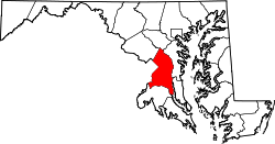
Carmody Hills is an unincorporated community in Prince George's County in the U.S. state of Maryland. [1] Because it is not formally incorporated, it has no official boundaries, but the United States Census Bureau has defined a census-designated place consisting of Carmody Hills and the adjacent community of Pepper Mill Village, together designated "Peppermill Village", for statistical purposes. (At the 2000 census the area was delineated as "Carmody Hills-Pepper Mill Village". [2] ) Carmody Hills is located on the south side of Seat Pleasant Drive and east of Seat Pleasant.
In law, an unincorporated area is a region of land that is not governed by a local municipal corporation; similarly an unincorporated community is a settlement that is not governed by its own local municipal corporation, but rather is administered as part of larger administrative divisions, such as a township, parish, borough, county, city, canton, state, province or country. Occasionally, municipalities dissolve or disincorporate, which may happen if they become fiscally insolvent, and services become the responsibility of a higher administration. Widespread unincorporated communities and areas are a distinguishing feature of the United States and Canada. In most other countries of the world, there are either no unincorporated areas at all, or these are very rare; typically remote, outlying, sparsely populated or uninhabited areas.
Prince George's County is located in the U.S. state of Maryland, bordering the eastern portion of Washington, D.C. As of the 2010 U.S. Census, the population was 863,420, making it the second-most populous county in Maryland, behind Montgomery County. Its county seat is Upper Marlboro. It is one of the richest African American-majority counties in the United States, with five of its communities identified in a 2015 top ten list.
In the United States, a state is a constituent political entity, of which there are currently 50. Bound together in a political union, each state holds governmental jurisdiction over a separate and defined geographic territory and shares its sovereignty with the federal government. Due to this shared sovereignty, Americans are citizens both of the federal republic and of the state in which they reside. State citizenship and residency are flexible, and no government approval is required to move between states, except for persons restricted by certain types of court orders.
Carmody Hills, platted in the 1930s, is one of several subdivisions constructed in the early to mid 20th century around the Town of Seat Pleasant. Suburban development in this area of Prince George’s County began in the late 19th century and continued to grow throughout the 20th century due to its proximity to Washington and access to the city via railroads, streetcar lines, and road networks. The early 20th-century communities were fostered by the Chesapeake Beach Railway (1898) and the Washington, Baltimore and Annapolis Electric Railroad (1908). As the popular mode of transportation shifted from streetcar line to the automobile in the 1930s and 1940s, highways gave suburban residents access to the city. The George Palmer Highway (present-day Martin Luther King, Jr. Highway) was constructed on the right-of-way of the Washington, Baltimore and Annapolis Electric Railroad in the early 1940s. [3] [4] [5]
Seat Pleasant is an incorporated city in Prince George's County, Maryland, United States, immediately east of Washington D.C. The population was 4,542 at the 2010 census. Two state highways run through it — Maryland Route 704 and Maryland Route 214. The Washington Metro's Blue and Silver Lines are nearby. The Washington Redskins stadium is east of Seat Pleasant, near the Capital Beltway (I-95/495).
The Chesapeake Beach Railway (CBR), now defunct, was an American railroad of southern Maryland and Washington, DC built in the 19th century. The CBR ran 27.629 miles from Washington, D.C. on tracks formerly owned by the Southern Maryland Railroad and then on its own single track through Maryland farm country to a resort at Chesapeake Beach. It was built by Otto Mears, a Colorado railroad builder, who planned a shoreline resort with railroad service from Washington and Baltimore. It served Washington and Chesapeake Beach for almost 35 years, but the Great Depression and the rise of the automobile marked the end of the CBR. The last train left the station on April 15, 1935. Parts of the right-of-way are now used for roads and a future rail trail.
Maryland Route 704 is a state highway in the U.S. state of Maryland. Known as Martin Luther King Jr. Highway, the highway runs 6.53 miles (10.51 km) from Eastern Avenue at the District of Columbia boundary in Seat Pleasant east to MD 450 in Lanham. MD 704 is a four- to six-lane divided highway that connects the northern Prince George's County communities of Seat Pleasant, Landover, Glenarden, and Lanham. The highway was constructed along the right of way of the abandoned Washington, Baltimore and Annapolis Electric Railway (WB&A) in the early 1940s. In the late 1950s and early 1960s, MD 704 served as a temporary routing of U.S. Route 50 while the U.S. Highway's freeway was under construction from Washington to Lanham. The route was expanded to a divided highway between Seat Pleasant and US 50 in the late 1960s and early 1970s. MD 704 was completed as a divided highway when the portion east of US 50 was expanded in the late 1990s.
The first development of the Carmody Hills subdivision began in the early 1930s. House construction and road development continued from the 1930s through the 1970s. By 1942, the community was well established with approximately 130 houses on a grid pattern of nine north-south streets and three east-west streets. In the immediate post-World War II period, vacant lots within the established residential blocks were developed. Between 1957 and 1965, the community expanded one block to the south and several blocks to the east. Also constructed within that time period was the Carmody Hills School. An evaluation of housing conditions in Carmody Hills in the late 1960s found approximately one-third of the houses in need of enhancement. Code enforcement, as well as street paving and drainage, encouraged the construction of new houses in the 1970s in areas of the community previously inaccessible. [3]
Beltsville is a census-designated place (CDP) in northern Prince George's County, Maryland, United States. The community was named for Truman Belt, a local landowner. The population was 16,772 at the 2010 census. Beltsville includes the unincorporated community of Vansville.
Bladensburg is a town in Prince George's County, Maryland, United States. The population was 9,148 at the 2010 census. Areas in Bladensburg have the ZIP code 20710. Bladensburg is 8.6 miles (13.8 km) from central Washington, D.C.
Camp Springs is an unincorporated area and census-designated place (CDP) in Prince George's County, Maryland, United States. The population was 19,096 at the 2010 census. Camp Springs is not an official post office designation; the area is divided between the surrounding mailing addresses of Temple Hills, Fort Washington, Clinton, and Suitland. It includes the unincorporated area of Andrews Manor, Maryland.
Cheverly is a town in Prince George's County, Maryland, United States, located within very close proximity to Washington, D.C., though not bordering it directly. The town was founded in 1918, and it was incorporated in 1931. Cheverly had 6,173 residents as of the 2010 Census. Cheverly borders the adjacent communities of Tuxedo, Chapel Oaks, Landover, Landover Hills, Villa Heights, and Bladensburg.
Fairmount Heights is a town in Prince George's County, Maryland, United States. The population was 1,494 at the 2010 census. The town was formally incorporated in 1935, making the town the second oldest African-American-majority municipality in Prince George's County. The town is composed of six subdivisions: Fairmount Heights (1900), Waterford (1907), Mount Weissner (1909), North Fairmount Heights (1910), West Fairmount Heights (1911) and Sylvan Vista (1923).
Seabrook is an unincorporated community and census-designated place (CDP) in Prince George's County, Maryland, about 12 miles (19 km) east of Washington, D.C. As of the 2010 census, the population of the CDP was 17,287. Prior to 2010, Seabrook was part of the Lanham-Seabrook census-designated place.
Landover is an unincorporated community and census-designated place in Prince George's County, Maryland, United States. Landover is located within very close proximity to Washington D.C. although it does not directly border Washington D.C. unlike its neighboring communities, Chapel Oaks and Fairmount Heights, which directly border Washington D.C. and go all the way up to/ touch the Maryland/ D.C. line. As of the 2010 census it had a population of 23,078.
Peppermill Village is an unincorporated community near Maryland Route 214 in Prince George's County, Maryland. The Washington Redskins football stadium, Metrorail's Blue Line, and Hampton Mall shopping center are very near by. Because it is not formally incorporated, it has no official boundaries, but the United States Census Bureau has defined a census-designated place (CDP) consisting of Peppermill Village and the adjacent community of Carmody Hills, for statistical purposes.
The Baltimore–Washington Parkway is a highway in the U.S. state of Maryland, running southwest from Baltimore to Washington, D.C. The road begins at an interchange with U.S. Route 50 (US 50) near Cheverly in Prince George's County at the D.C. border, and continues northeast as a parkway maintained by the National Park Service (NPS) to MD 175 near Fort Meade, serving many federal institutions. This portion of the parkway is dedicated to Gladys Noon Spellman, a representative of Maryland's 5th congressional district, and has the unsigned Maryland Route 295 (MD 295) designation. Commercial vehicles, including trucks, are prohibited within this stretch. This section is administered by the NPS's Greenbelt Park unit. After leaving park service boundaries the highway is maintained by the state and signed with the MD 295 designation. This section of the parkway passes near Baltimore–Washington International Thurgood Marshall Airport. Upon entering Baltimore, the Baltimore Department of Transportation takes over maintenance of the road and it continues north to an interchange with Interstate 95 (I-95). Here, the Baltimore–Washington Parkway ends and MD 295 continues north unsigned on Russell Street, which carries the route north into downtown Baltimore. In downtown Baltimore, MD 295 follows Paca Street northbound and Greene Street southbound before ending at US 40.
Maryland Route 450 is a state highway in the U.S. state of Maryland. The state highway runs 30.19 miles (48.59 km) from U.S. Route 1 Alternate in Bladensburg east to US 50, US 301, and MD 2 near Arnold. MD 450 forms a local complement to US 50 from near Washington through Annapolis. In Prince George's County, the highway is a four- to six-lane divided highway that serves Bladensburg, Landover Hills, New Carrollton, Lanham, and Bowie. In Anne Arundel County, MD 450 connects Crofton with Parole and Annapolis with the portion of the county east of the Severn River. The highway serves as one of the main streets of Annapolis, including the state capital's historic core, and is the primary vehicular access to the U.S. Naval Academy.
U.S. Route 1 (US 1) is the easternmost and longest of the major north–south routes of the older 1920s era United States Numbered Highway System, running from Key West, Florida to Fort Kent, Maine. In the U.S. state of Maryland, an 80.86-mile (130.13 km) segment of the route runs through central Maryland between Mount Rainier and Rising Sun.
Maryland Route 214 is a state highway in the U.S. state of Maryland. Known for most of its length as Central Avenue, the highway runs 24.97 miles (40.19 km) from Southern Avenue and East Capitol Street at the District of Columbia boundary in Capitol Heights east to Beverley Beach. MD 214 connects the central Prince George's County suburbs of Capitol Heights, Seat Pleasant, Largo, and Bowie with the southern Anne Arundel County communities of Davidsonville and Edgewater and several beach villages along the Chesapeake Bay. The highway connects Interstate 95 and I-495 to FedExField, Six Flags America, and several stations of the Washington Metro's Blue and Silver lines, which the route parallels between Capitol Heights and Largo.
Avondale is an unincorporated community in Prince George's County Maryland, United States. It is contained between Eastern Avenue NE to the south, Queens Chapel Road (MD-500) to the east, and the Northwest Branch Anacostia River to the north and west.
Tuxedo is an unincorporated community in Prince George's County, Maryland, United States.
Green Meadows is an unincorporated community in Prince George's County, Maryland, United States. For statistical purposes, it is part of the Chillum census-designated place (CDP).
Andrews Manor is an unincorporated community in Prince George's County, Maryland, United States. For statistical purposes, it is part of the Camp Springs census-designated place (CDP).