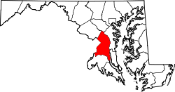
Melwood | |
|---|---|
| Coordinates: 38°48′07″N76°50′30″W / 38.80194°N 76.84167°W | |
| Country | |
| State | |
| County | |
| Area | |
• Total | 2.83 sq mi (7.34 km2) |
| • Land | 2.83 sq mi (7.33 km2) |
| • Water | 0.0039 sq mi (0.01 km2) |
| Population (2020) | |
• Total | 3,977 |
| • Density | 1,405.8/sq mi (542.78/km2) |
| Time zone | UTC−5 (Eastern (EST)) |
| • Summer (DST) | UTC−4 (EDT) |
| FIPS code | 24-51940 |
Melwood is an unincorporated community and census-designated place (CDP) in Prince George's County, Maryland, United States. It was newly delineated for the 2010 census, at which time its population was 3,051. [2] Per the 2020 census, the population was 3,977. [3]
According to the U.S. Census Bureau, Melwood has a total area of 2.82 square miles (7.3 km2), all land. [4] The CDP is located directly to the east of Andrews Air Force Base.
| Census | Pop. | Note | %± |
|---|---|---|---|
| 2010 | 3,051 | — | |
| 2020 | 3,977 | 30.4% | |
| U.S. Decennial Census [5] 2010 [6] 2020 [7] | |||
Melwood first appeared as a census designated place in the 2010 U.S. census [6] formed from part of Rosaryville CDP and additional area. [6]
| Race / Ethnicity (NH = Non-Hispanic) | Pop 2010 [8] | Pop 2020 [7] | % 2010 | % 2020 |
|---|---|---|---|---|
| White alone (NH) | 741 | 407 | 24.29% | 10.23% |
| Black or African American alone (NH) | 1,961 | 2,576 | 64.27% | 64.77% |
| Native American or Alaska Native alone (NH) | 20 | 16 | 0.66% | 0.40% |
| Asian alone (NH) | 45 | 55 | 1.47% | 1.38% |
| Native Hawaiian or Pacific Islander alone (NH) | 0 | 2 | 0.00% | 0.05% |
| Other race alone (NH) | 5 | 33 | 0.16% | 0.83% |
| Mixed race or Multiracial (NH) | 74 | 131 | 2.43% | 3.29% |
| Hispanic or Latino (any race) | 205 | 757 | 6.72% | 19.03% |
| Total | 3,051 | 3,977 | 100.00% | 100.00% |
Melwood residents are assigned to schools in Prince George's County Public Schools. [9] The zoned schools are Melwood Elementary School, [10] James Madison Middle School, [11] and Dr. Henry A. Wise Jr. High School. [12]