Summerfield, Maryland

Last updated

Summerfield, Maryland
USA Maryland location map.svg
Red pog.svg
Summerfield
Location in Maryland
Usa edcp location map.svg
Red pog.svg
Summerfield
Summerfield (the United States)
Coordinates: 38°54′N76°52′W / 38.900°N 76.867°W / 38.900; -76.867
CountryFlag of the United States.svg United States
State Flag of Maryland.svg  Maryland
County Flag of Prince George's County, Maryland (1963-present).svg Prince George's
Area
[1]
  Total3.65 sq mi (9.46 km2)
  Land3.64 sq mi (9.43 km2)
  Water0.01 sq mi (0.03 km2)
Elevation
240 ft (70 m)
Population
 (2020)
  Total14,758
  Density4,054.40/sq mi (1,565.38/km2)
Time zone UTC−5 (Eastern (EST))
  Summer (DST) UTC−4 (EDT)
Area code(s) 301, 240
FIPS code 24-75810

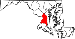
Summerfield is a census-designated place near Landover in Prince George's County, Maryland. As of the 2020 census, the population was 14,758. [2] A suburb of Washington, D.C., the area is home to Northwest Stadium [3] [4] and the Prince George's County Sports and Learning Complex. [5] It first became a census-designated place after the 2010 census. [6]

Contents

Geography

According to the U.S. Census Bureau, Summerfield has a total area of 3.6 square miles (9.4 km2), of which 0.012 square miles (0.03 km2), or 0.03%, is water. [7] The CDP is bordered to the east by the Capital Beltway (I-495/95) and to the south by Maryland Route 214 (Central Avenue). The CDP of Landover borders Summerfield to the north, the city of Glenarden is to the northeast, Lake Arbor is to the east, Largo is to the southeast, Walker Mill is to the southwest, and Peppermill Village and Seat Pleasant border Summerfield to the west.

Demographics

Historical population
CensusPop.Note
2010 10,898
2020 14,75835.4%
U.S. Decennial Census [8]
2010 [9] 2020 [10]

Summerfield first appeared as a census designated place in the 2010 U.S. Census. [9]

2020 census

Summerfield CDP, Maryland – Racial and ethnic composition
Note: the US Census treats Hispanic/Latino as an ethnic category. This table excludes Latinos from the racial categories and assigns them to a separate category. Hispanics/Latinos may be of any race.
Race / Ethnicity (NH = Non-Hispanic)Pop 2010 [11] Pop 2020 [10] % 2010% 2020
White alone (NH)1782641.63%1.79%
Black or African American alone (NH)9,86112,75790.48%86.44%
Native American or Alaska Native alone (NH)21360.19%0.24%
Asian alone (NH)1411431.29%0.97%
Pacific Islander alone (NH)310.03%0.01%
Other race alone (NH)15830.14%0.56%
Mixed race or Multiracial (NH)1864231.71%2.87%
Hispanic or Latino (any race)4931,0514.52%7.12%
Total10,89814,758100.00%100.00%

Education

Summerfield's public schools are managed by Prince George's County Public Schools. [3]

Zoned elementary schools include Highland Park, William Paca, and Cora L. Rice. [12] Zoned middle schools include G. James Gholson and Kenmoor. [13] Zoned high schools include Central High School, Fairmont Heights High School, and Charles Herbert Flowers High School. [14]

John Carroll Elementary School was previously located in what is now Summerfield CDP. [15] It was scheduled to close in 2009. [16]

Transportation

Washington Metro operates the Morgan Boulevard station in Summerfield CDP. [3] [17]

Raljon

FedExField in Raljon FedExField01.jpg
FedExField in Raljon

Raljon was the original place name of the campus of Northwest Stadium, home of the Washington Commanders. Former team owner Jack Kent Cooke (whose full name originally graced the stadium) derived the name from the names of his sons, Ralph and John. Introduced in 1997, the name enjoyed almost no currency beyond the team (then known as the Redskins), NFL press releases, television and radio partners, and the U.S. Postal Service, which granted Cooke's request that the area be officially recognized, which applied specifically to the stadium campus's extended 20785-4534 ZIP+4 Code. [18] Tony Kornheiser, in a column criticizing the name, wrote, "Lucky for us, Cooke didn't name his kids Peter and Ennis." [19] Daniel Snyder phased out the requirement to dateline of stadium events originating in Raljon before the 1999 preseason, and quietly phased out the placename soon after his purchase of the team. [18]

Related Research Articles

<span class="mw-page-title-main">Adelphi, Maryland</span> Census-designated place in Maryland

Adelphi is an unincorporated area and census-designated place in Prince George's County, Maryland, United States. Per the 2020 Census, the population was 16,823. Adelphi includes the following subdivisions; Adelphi, Adelphi Park, Adelphi Hills, Adelphi Terrace, Adelphi Village, Buck Lodge, Chatham, Cool Spring Terrace, Hillandale Forest, Holly Hill Manor, Knollwood, Lewisdale, and White Oak Manor.

<span class="mw-page-title-main">Brandywine, Maryland</span> Census-designated place in Maryland

Brandywine is the name of an unincorporated area in Prince George's County, Maryland, United States, that refers both to a census-designated place (CDP) and a zip code area which is much larger (20613), whose areas overlap. The population of Brandywine at the 2020 U.S. Census was 10,550 for the CDP, and the population of ZIP code 20613 was 11,860 in 2010.

<span class="mw-page-title-main">Chillum, Maryland</span> Census-designated place in Maryland

Chillum is an unincorporated area and census-designated place in Prince George's County, Maryland, United States, bordering Washington, D.C., and Montgomery County.

<span class="mw-page-title-main">Fairmount Heights, Maryland</span> Historic district in Maryland, United States

Fairmount Heights is a town in Prince George's County, Maryland, United States. Per the 2020 census, the population was 1,528. The town was formally incorporated in 1935, making the town the second oldest African-American-majority municipality in Prince George's County. The town is composed of six subdivisions: Fairmount Heights (1900), Waterford (1907), Mount Weissner (1909), North Fairmount Heights (1910), West Fairmount Heights (1911) and Sylvan Vista (1923).

<span class="mw-page-title-main">Forestville, Maryland</span> CDP in Maryland

Forestville is an unincorporated area and census-designated place (CDP) in Prince George's County, Maryland, United States. Per the 2020 census, the population was 12,831. The community is a mixture of garden apartments, single-family homes, and shopping centers built mostly from the 1930s through 1970s, adjacent to the communities of District Heights, Suitland, Morningside, Westphalia and Camp Springs.

<span class="mw-page-title-main">Fort Washington, Maryland</span> Census-designated place in Maryland

Fort Washington is an unincorporated area and census-designated place in Prince George's County, Maryland, United States. It borders the Potomac River, situated 20 miles south of downtown Washington, D.C. As of the 2020 census, it had a population of 24,261. The Fort Washington community is located west of Maryland Route 210, with some additional area to the east of the highway.

<span class="mw-page-title-main">Glenarden, Maryland</span> City in Maryland, United States

Glenarden is a city in Prince George's County, Maryland, United States. Per the 2020 census, the population was 6,402.

<span class="mw-page-title-main">Hillcrest Heights, Maryland</span> CDP in Maryland

Hillcrest Heights is an unincorporated area and census-designated place (CDP) in Prince George's County, Maryland, United States. The population was 15,793 at the 2020 census. For mailing address purposes, it is part of the smaller community of Temple Hills and is also near Suitland.

<span class="mw-page-title-main">Landover Hills, Maryland</span> Town in Maryland

Landover Hills is a town in Prince George's County, Maryland, United States. Per the 2020 census, the population was 1,815. The town has a neighborhood named Defense Heights.

<span class="mw-page-title-main">Largo, Maryland</span> Census-designated place in Maryland, United States

Largo is an unincorporated area and census-designated place in Prince George's County, Maryland, United States. The population was 11,605 at the 2020 census.

<span class="mw-page-title-main">Seat Pleasant, Maryland</span> City in Maryland

Seat Pleasant is an incorporated city in Prince George's County, Maryland, United States, located immediately east of Washington D.C.. Per the 2020 census, the population was 4,522. Two state highways pass through the community — Maryland routes 704 and 214. The Washington Metro's Blue and Silver Lines are nearby. The Washington Commanders' stadium is east of Seat Pleasant, near the Capital Beltway (I-95/495).

Landover is an unincorporated community and census-designated place in Prince George's County, Maryland, United States. As of the 2020 census, it had a population of 25,998.

Peppermill Village is an unincorporated community near Maryland Route 214 in Prince George's County, Maryland, United States. Per the 2020 census, the population was 5,264. FedExField, Metrorail's Blue Line, and Hampton Mall shopping center are all located nearby. Because it is not formally incorporated, it has no official boundaries, but the United States Census Bureau has defined a census-designated place (CDP) consisting of Peppermill Village and the adjacent community of Carmody Hills, for statistical purposes.

Glassmanor is an unincorporated community and census-designated place in Prince George's County, Maryland, United States. As of the 2020 census, it had a population of 18,430. In the 1990 and 2000 censuses, the United States Census Bureau had placed Glassmanor and the adjacent community of Oxon Hill in the "Oxon Hill-Glassmanor" census-designated place for statistical purposes. Glassmanor was last delineated separately in 1980, when the CDP recorded a population of 7,751.

<span class="mw-page-title-main">Morgan Boulevard station</span> Washington Metro station

Morgan Boulevard station is an island-platformed Washington Metro station in Summerfield, Prince George's County, Maryland, United States, with a Landover postal address. The station was opened on December 18, 2004, and is operated by the Washington Metropolitan Area Transit Authority (WMATA). It provides service for the Blue and Silver Lines.

<span class="mw-page-title-main">Suitland, Maryland</span> Census-designated place in Maryland, United States

Suitland is a suburb of Washington, D.C., approximately one mile (1.6 km) southeast of Washington, D.C. Suitland is a census designated place (CDP), as of the 2020 census, its population was 25,839. Prior to 2010, it was part of the Suitland-Silver Hill census-designated place.

<span class="mw-page-title-main">Kentland, Maryland</span> Unincorporated community in Maryland

Kentland is an unincorporated community and former census-designated place in Prince George's County, Maryland, United States, located within the Landover census area. Kentland is served by the Landover Metro Station, which is located just north of the community, across Landover Road. Home of Kentland Volunteers who take pride in hitting it hard from the yard and flipping their fire trucks enroute to Pancake Parties.

Palmer Park is an unincorporated community in Prince George's County, Maryland, United States, within the census-designated place of Landover. It was previously a CDP of its own until 2000.

<span class="mw-page-title-main">Croom, Maryland</span> Census-designated place in Maryland

Croom is an unincorporated community and census-designated place in Southern Prince George's County, Maryland, United States. As of the 2020 census it had a population of 2,720. Croom largely consists of former tobacco farms and forests converted to Washington bedroom subdivisions such as nearby Marlton. The main part of Patuxent River Park is in Croom.

<span class="mw-page-title-main">Fairmont Heights High School</span> Public comprehensive secondary school in Landover, Maryland , United States

Fairmont Heights High School (est.1950) is an American public comprehensive secondary school located in Landover, Maryland, just outside Washington D.C. It is part of the Prince George's County Public Schools system. Two middle schools feed into Fairmont Heights. It is part of the School Board District 3.

References

  1. "2020 U.S. Gazetteer Files". United States Census Bureau. Archived from the original on March 5, 2023. Retrieved April 26, 2022.
  2. "Summerfield CDP, Maryland". United States Census Bureau . Archived from the original on April 28, 2022. Retrieved April 15, 2022.
  3. 1 2 3 "2010 CENSUS - CENSUS BLOCK MAP: Summerfield CDP, MD" (PDF). U.S. Census Bureau. Archived (PDF) from the original on July 2, 2021. Retrieved September 7, 2018.
  4. "FedExField Archived September 8, 2018, at the Wayback Machine ." State of Maryland Office of Tourism Development. Retrieved on September 7, 2018. "1600 FedEx Way, Landover, MD 20785" - See also parking map from Washington Football Team website
  5. "Fedexfield Parking and Directions Archived September 7, 2018, at the Wayback Machine ." Washington Redskins. Retrieved on September 7, 2018. "[...]Prince George’s County Sports Complex located at 8001 Sheriff Rd, Hyattsville MD 20785."
  6. "Prince George's County Census Incorporated Places & Census Designated Places." Maryland Department of Planning. Retrieved on September 8, 2018.
  7. "Geographic Identifiers: 2010 Demographic Profile Data (G001): Summerfield CDP, Maryland". United States Census Bureau. Archived from the original on July 9, 2021. Retrieved December 16, 2011.
  8. "Decennial Census of Population and Housing by Decades". US Census Bureau. Archived from the original on July 6, 2022.
  9. 1 2 "2010 Census of Population - Population and Housing Unit Counts - Maryland" (PDF). United States Census Bureau .
  10. 1 2 "P2 Hispanic or Latino, and Not Hispanic or Latino by Race – 2020: DEC Redistricting Data (PL 94-171) – Summerfield CDP, Maryland". United States Census Bureau . Archived from the original on April 28, 2022. Retrieved April 28, 2022.
  11. "P2 Hispanic or Latino, and Not Hispanic or Latino by Race – 2010: DEC Redistricting Data (PL 94-171) – Summerfield CDP, Maryland". United States Census Bureau .
  12. "NEIGHBORHOOD ELEMENTARY SCHOOLS AND BOUNDARIES SCHOOL YEAR 2018-2019 Archived November 13, 2018, at the Wayback Machine ." Prince George's County Public Schools. Retrieved on September 7, 2018.
  13. "NEIGHBORHOOD MIDDLE SCHOOLS AND BOUNDARIES SCHOOL YEAR 2018-2019 Archived November 13, 2018, at the Wayback Machine ." Prince George's County Public Schools. Retrieved on September 7, 2018.
  14. "NEIGHBORHOOD HIGH SCHOOLS AND BOUNDARIES SCHOOL YEAR 2018-2019 Archived November 13, 2018, at the Wayback Machine ." Prince George's County Public Schools. Retrieved on September 7, 2018.
  15. Home. John Carroll Elementary School. Retrieved on September 8, 2018. "1400 Nalley Terrace Landover, MD 20785"
  16. Preliminary Subregion 4 Master Plan and Proposed Sectional Map Amendment. Maryland-National Capital Park and Planning Commission. Chapter 9, Public Facilities Archived April 27, 2010, at the Wayback Machine . p. 261 (PDF p. 3/28). Retrieved on September 7, 2018.
  17. "Morgan Boulevard Archived September 7, 2018, at the Wayback Machine ." Washington Metro. Retrieved on September 7, 2018. "300 Garrett Morgan Blvd. Landover, MD 20785"
  18. 1 2 "Goodbye to Raljon, and good riddance". Baltimore Sun. August 20, 1999. Archived from the original on August 9, 2014. Retrieved April 6, 2021.
  19. "Name that Town". Archived from the original on November 6, 2012. Retrieved April 6, 2021.