Cheltenham, Maryland

Last updated

Cheltenham
Cheltenham United Methodist Church Cemetery.jpg
Cheltenham United Methodist Church Cemetery
USA Maryland location map.svg
Red pog.svg
Cheltenham
Location in Maryland
Usa edcp location map.svg
Red pog.svg
Cheltenham
Cheltenham (the United States)
Coordinates: 38°44′8″N76°49′35″W / 38.73556°N 76.82639°W / 38.73556; -76.82639
Country Flag of the United States.svg United States
State Flag of Maryland.svg Maryland
County Flag of Prince George's County, Maryland (1963-present).svg Prince George's
Elevation
190 ft (60 m)
Time zone UTC-5 (Eastern (EST))
  Summer (DST) UTC-4 (EDT)
ZIP code
20623 [1]
Area codes 240 and 301
GNIS feature ID597222

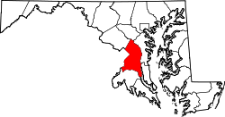
Cheltenham is an unincorporated community in Prince George's County, in southern Maryland, United States, adjacent to U.S. Highway 301. It is named after Cheltenham, Gloucestershire, England.

Contents

History

The Cheltenham Youth Detention Center, [2] a juvenile correctional facility, was founded in the 1870s as a "House of Reformation for Colored Children" by Baltimore merchant, banker, and philanthropist Enoch Pratt on his former farm property. [3] Cheltenham is also home to the Southern Maryland Regional Farmers Market, [4] and the Cheltenham State Veterans Cemetery, [5] along with many scenic farms and woods.

Geography

Nearby is the Marlton housing development. [6]

References

  1. "Cheltenham ZIP Code". zipdatamaps.com. 2022. Retrieved November 18, 2022.
  2. "Cheltenham Youth Detention Center". Maryland Department of Juvenile Services.
  3. Barbic, Kari. "Enoch Pratt". Philanthropy Roundtable . Retrieved January 26, 2014.
  4. "Southern Maryland Regional Farmers Market". Archived from the original on June 5, 2023. Retrieved August 20, 2024.
  5. "Cemetery and Memorial Program". Maryland Department of Veterans Affairs. June 24, 2016.
  6. U.S. Geological Survey Geographic Names Information System: Cheltenham, Maryland