Aquasco, Maryland

Last updated
Aquasco, Maryland
2020-06-19 11 16 28 View south along Maryland State Route 381 (Aquasco Road) at Maryland State Route 382 (Croom Road) in Aquasco, Prince George's County, Maryland.jpg
View along Aquasco Road at Croom Road in Aquasco, MD
USA Maryland location map.svg
Red pog.svg
Aquasco
Location within the state of Maryland
Usa edcp location map.svg
Red pog.svg
Aquasco
Aquasco (the United States)
Coordinates: 38°35′6″N76°43′30″W / 38.58500°N 76.72500°W / 38.58500; -76.72500 Coordinates: 38°35′6″N76°43′30″W / 38.58500°N 76.72500°W / 38.58500; -76.72500
CountryFlag of the United States.svg  United States
State Flag of Maryland.svg  Maryland
County Flag of Prince George's County, Maryland (1963-present).svg Prince George's
Area
[1]
  Total22.11 sq mi (57.27 km2)
  Land19.78 sq mi (51.23 km2)
  Water2.33 sq mi (6.04 km2)
Population
 (2020)
  Total913
  Density46.16/sq mi (17.82/km2)
Time zone UTC−5 (Eastern (EST))
  Summer (DST) UTC−4 (EDT)
FIPS code 24-01925
GNIS feature ID597013

Aquasco is an unincorporated area and census-designated place in southeastern Prince George's County, Maryland, United States, surrounding the town of Eagle Harbor and bordering Charles County. [2] As of the 2020 census, the CDP had a population of 913. [3] Aquasco was home to the Aquasco Speedway.

Contents

Geography

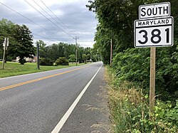
Aquasco occupies the southeastern corner of Prince George's County and is centered on the intersection of Maryland Route 381, Aquasco Road, and Maryland Route 233, Dr. Bowen Road. The Patuxent River forms the eastern boundary of the community. As of the 2010 census, the CDP had a total area of 22.1 square miles (57.3 km2), of which 19.8 square miles (51.3 km2) was land and 2.3 square miles (6.0 km2), or 10.55%, was water, consisting primarily of the Patuxent River.

The Aquasco CDP contains the Chalk Point Generating Station and surrounds the tiny incorporated town of Eagle Harbor.

Demographics

Historical population
CensusPop.Note
2010 981
2020 913−6.9%
U.S. Decennial Census [4]
2010 [5] 2020 [6]

2020 census

Aquasco CDP, Maryland - Demographic Profile
(NH = Non-Hispanic)
Note: the US Census treats Hispanic/Latino as an ethnic category. This table excludes Latinos from the racial categories and assigns them to a separate category. Hispanics/Latinos may be of any race.
Race / EthnicityPop 2010 [5] Pop 2020 [6] % 2010% 2020
White alone (NH)52546053.52%50.38%
Black or African American alone (NH)42235643.02%38.99%
Native American or Alaska Native alone (NH)560.51%0.66%
Asian alone (NH)220.20%0.22%
Pacific Islander alone (NH)000.00%0.00%
Some Other Race alone (NH)010.00%0.11%
Mixed Race/Multi-Racial (NH)12431.22%4.71%
Hispanic or Latino (any race)15451.53%4.93%
Total981913100.00%100.00%

History

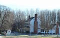
Aquasco is named for a nearby tract first surveyed and patented in 1650. The name is derived from the Native American name Aquascake. Located between Swanson's Creek and the Patuxent River, the community developed as an agricultural center for the production of tobacco. The main roads connecting the widely scattered tobacco plantations were established in the 18th century and, in the early 19th century, the village of Woodville began to form. It was named after the Wood family, early settlers of Aquasco. By mid-century, the village had a grist mill, several small stores, a tavern, blacksmith, school, post office, and Methodist and Episcopal churches. [7]

Because of the number of plantations, the slave population was relatively high in this section of Prince George's County. The Freedmen's Bureau established a school at Woodville in 1867. The school later became home to John Wesley Methodist Episcopal Church. African Americans also worshiped at St. Mary's Episcopal Church, established in 1848 as a mission church of St. Paul's Parish Church, which later became St. Phillip's Episcopal Church. [7]

Historic sites

The following is a list of historic sites in Aquasco identified by the Maryland-National Capital Park and Planning Commission: [7] [8]

Site NameImageLocationM-NCPPC Inventory NumberComment
1 Adams-Bowen House 16002 Dr. Bowen Rd. 87B-036-19
2 P.A. Bowen Farmstead 15701 Dr. Bowen Rd. 87B-036-20
3 William R. Barker House 22600 Aquasco Rd. 87B-036-14
4 Green Hill 19404 Aquasco Rd. 87A-011
5 Grimes House 22609 Aquasco Rd. 87B-036-16
6 John Wesley Methodist Episcopal Church Site and Cemetery 22919 Christ Church Road87B-33Historic church demolished.
7 St. Mary's Episcopal Church 22200 Saint Mary's Church Rd.87B-036-37
8 St. Mary's Rectory Saint Mary's Rectory Aquasco MD Oct 13.jpg 16305 Saint Mary's Church Rd.87B-036-08Listed on the National Register of Historic Places, September 10, 1987
9 St. Phillip's Episcopal Church Site and Cemetery 16100 St. Phillip's Church Road87B-36-12Historic church destroyed by fire in 1976.
10 Sunnyside Sunnyside Aquasco Dec 08.JPG 16005 Dr. Bowen Rd. 87B-036-21Listed on the National Register of Historic Places, May 29, 1987
11 H.B.B. Trueman House 20218 Aquasco Rd. 87A-022
12 J.E. Turner House 16410 St. Mary’s Church Road87B-036-05
13 Villa DeSales Villa Desales Dec 08.JPG 22410 Aquasco Rd. 87B-036-13Listed on the National Register of Historic Places, July 14, 1988
14 Wilson-Rawlings Farmstead 17109 Milltown Landing Road87A-019
15 Wood House 22606 Aquasco Rd. 87B-036-15
16 Woodville School 21500 Aquasco Road87B-34

Government

Prince George's County Police Department District 5 Station in Clinton CDP serves the community. [9]

The U.S. Postal Service operates the Aquasco Post Office. [10]

Education

Aquasco residents are assigned to schools in Prince George's County Public Schools. [11]

Residential areas of the CDP area are zoned to Baden Elementary School, [12] Gwynn Park Middle School, [13] and Gwynn Park High School. [14]

Notable person

Related Research Articles

<span class="mw-page-title-main">Beltsville, Maryland</span> CDP in Maryland

Beltsville is a census-designated place (CDP) in northern Prince George's County, Maryland, United States. The community was named for Truman Belt, a local landowner. The 2020 census counted 20,133 residents. Beltsville includes the unincorporated community of Vansville.

<span class="mw-page-title-main">Brandywine, Maryland</span> Census-designated place in Maryland

Brandywine is the name of an unincorporated area in Prince George's County, Maryland, United States, that refers both to a census-designated place (CDP) and a zip code area which is much larger (20613), whose areas overlap. The population of Brandywine at the 2020 U.S. Census was 10,550 for the CDP, and the population of ZIP code 20613 was 11,860 in 2010.

<span class="mw-page-title-main">Clinton, Maryland</span> Census-designated place in Maryland, United States

Clinton is an unincorporated census-designated place (CDP) in Prince George's County, Maryland, United States. Clinton was formerly known as Surrattsville until after the time of the Civil War. The population of Clinton was 38,760 at the 2020 census. Clinton is historically known for its role in the American Civil War concerning the Abraham Lincoln assassination. Clinton is adjacent to Camp Springs, Rosaryville, Melwood, and Andrews Air Force Base.

<span class="mw-page-title-main">Eagle Harbor, Maryland</span> Town in Maryland, United States

Eagle Harbor is an incorporated town in the far southeast corner of Prince George's County, Maryland, United States, and near the rural community of Aquasco that is known as a historic African American community founded in 1925. Per the 2020 census, the population was 67. The Chalk Point Generating Station, owned by NRG Energy, which was sold to Mirant by the Potomac Electric Power Company (PEPCO) in 2000, is located adjacent to the town.

<span class="mw-page-title-main">Forestville, Maryland</span> CDP in Maryland

Forestville is an unincorporated area and census-designated place (CDP) in Prince George's County, Maryland, United States. Per the 2020 census, the population was 12,831. The community is a mixture of garden apartments, single-family homes, and shopping centers built mostly from the 1930s through 1970s, adjacent to the communities of District Heights, Suitland, Morningside, Westphalia and Camp Springs. Forestville is located close to the town of Upper Marlboro, where many Prince George's County Board Offices are located. Additionally, Forestville is located adjacent to the Joint Base Andrews/ Andrews Air Force Base. The neighborhood has a majority African-American population. It is convenient to the Capital Beltway (I-95/I-495), Maryland Route 4, including Penn Mar Shopping Center, and for employees of Andrews Air Force Base and the U.S. Census Bureau. Forestville is located within proximity to the Suitland Metro Station, served by WMATA's Green Line. A notable former resident was Steny Hoyer, now Democratic Leader of the United States House of Representatives.

<span class="mw-page-title-main">Glenn Dale, Maryland</span> CDP in Maryland

Glenn Dale is an unincorporated area and census-designated place (CDP) in Prince George's County, Maryland, United States. The population was 14,698 at the 2020 census. Glenn Dale is home to the Glenn Dale Hospital, an abandoned sanatorium, and the USDA Plant Introduction Station.

<span class="mw-page-title-main">Marlton, Maryland</span> Census-designated place in Maryland

Marlton is an unincorporated area and census-designated place (CDP) in Prince George's County, Maryland, United States. The population was 9,802 at the 2020 census. The Marlton housing development, at first briefly called "Brandywine Country", grew up along U.S. Route 301 in the 1970s, and is part of the greater Upper Marlboro community. Originally made up of only single-family homes, more recently townhouses have been added.

<span class="mw-page-title-main">Rosaryville, Maryland</span> Census-designated place in Maryland

Rosaryville is an unincorporated area and census-designated place (CDP) in Prince George's County, Maryland, United States, located south of Cinton and Upper Marlboro beside U.S. Route 301. Per the 2020 census, the population was 11,548. including housing developments and rural open space. It was named for a local Roman Catholic church. Close to Rosaryville are the Marlton housing development, Maryland Veterans Cemetery, the Southern Maryland Farmers Market, and Rosaryville State Park.

Lanham is an unincorporated community and census-designated place in Prince George's County, Maryland. As of the 2020 United States Census it had a population of 11,282. The New Carrollton station as well as an Amtrak station are across the Capital Beltway in New Carrollton, Maryland. Doctors Community Hospital is located in Lanham.

Peppermill Village is an unincorporated community near Maryland Route 214 in Prince George's County, Maryland, United States. Per the 2020 census, the population was 5,264. FedExField, Metrorail's Blue Line, and Hampton Mall shopping center are all located nearby. Because it is not formally incorporated, it has no official boundaries, but the United States Census Bureau has defined a census-designated place (CDP) consisting of Peppermill Village and the adjacent community of Carmody Hills, for statistical purposes.

Queen Anne in Prince George's County, Maryland, United States, is a former port on the Patuxent River. It was delineated as a CDP for the 2010 census, at which time it had a population of 1,280. Per the 2020 census, the population was 1,405.

Gwynn Park High School (GPHS) is in Brandywine census-designated place, Prince George's County, Maryland, United States, a suburban area near Washington DC.

<span class="mw-page-title-main">Croom, Maryland</span> Census-designated place in Maryland

Croom is an unincorporated community and census-designated place in Southern Prince George's County, Maryland, United States. As of the 2020 census it had a population of 2,720. Croom largely consists of former tobacco farms and forests converted to Washington bedroom subdivisions such as nearby Marlton. The main part of Patuxent River Park is in Croom.

Baden is an unincorporated area and census-designated place in southeastern Prince George's County, Maryland, United States. As of the 2020 census, the CDP had a population of 2,114.

<span class="mw-page-title-main">Brock Hall, Maryland</span> Census-designated place in Maryland

Brock Hall is an unincorporated area and census-designated place in eastern Prince George's County, Maryland, United States, located south of Largo and Bowie, and north of Upper Marlboro. As of the 2020 census, the CDP had a population of 13,181.

Cedarville is an unincorporated community and census-designated place in southern Prince George's County, Maryland, United States. As of the 2020 census the population was 639.

<span class="mw-page-title-main">Marlboro Meadows, Maryland</span> Census-designated place in Maryland

Marlboro Meadows is an unincorporated community and census-designated place (CDP) in Prince George's County, Maryland, United States. Per the 2020 census, the population was 3,655. It was newly delineated for the 2010 census prior to which the area was part of the Greater Upper Marlboro census-designated place.

Marlboro Village is an unincorporated community and census-designated place (CDP) in Prince George's County, Maryland, United States. Per the 2020 census, the population was 9,221. It was newly delineated for the 2010 census prior to which the area was part of the Greater Upper Marlboro census-designated place.

Queensland is a census-designated place south of Upper Marlboro in Prince George's County, Maryland, United States. The population of the CDP was 2,191 at the 2020 census. It was formerly known as Queenland until 2014 when its name was changed to Queensland and a small portion of its geography was transferred to Upper Marlboro.

Summerfield is a census-designated place near Landover in Prince George's County, Maryland. As of the 2020 census, the population was 14,758. It is a suburb of Washington, D.C.

References

  1. "2020 U.S. Gazetteer Files". United States Census Bureau. Retrieved April 26, 2022.
  2. U.S. Geological Survey Geographic Names Information System: Aquasco, Maryland
  3. "Aquasco CDP, Maryland". United States Census Bureau . Retrieved March 13, 2022.
  4. "Decennial Census of Population and Housing by Decades". US Census Bureau.
  5. 1 2 "P2 HISPANIC OR LATINO, AND NOT HISPANIC OR LATINO BY RACE - 2010: DEC Redistricting Data (PL 94-171) - Aquasco CDP, Maryland". United States Census Bureau .
  6. 1 2 "P2 HISPANIC OR LATINO, AND NOT HISPANIC OR LATINO BY RACE - 2020: DEC Redistricting Data (PL 94-171) - Aquasco CDP, Maryland". United States Census Bureau .
  7. 1 2 3 M-NCPPC African-American Heritage Survey, October 1996: Properties Within or Closely Associated With Historic Communities (Prince George's County, Maryland), 1996 [ permanent dead link ].
  8. M-NCPPC Illustrated Inventory of Historic Sites (Prince George's County, Maryland), 2006.
  9. "District 5 Station - Clinton." Prince George's County Police Department. Retrieved on September 9, 2018. " 6707 Groveton Drive Clinton, MD 20735". Beat map. See 2010 U.S. Census index map of Clinton CDP: area with police station is on the edge of page 6 with surroundings on page 5.
  10. "AQUASCO." U.S. Postal Service. Retrieved on September 11, 2018. "22503 AQUASCO RD AQUASCO, MD 20608-9998"
  11. "2010 CENSUS - CENSUS BLOCK MAP (INDEX): Aquasco CDP, MD." U.S. Census Bureau. Retrieved on September 2, 2018. Pages: 1, 2, 3, 4, and 5.
  12. "NEIGHBORHOOD ELEMENTARY SCHOOLS AND BOUNDARIES SCHOOL YEAR 2018-2019." Prince George's County Public Schools. Retrieved on September 2, 2018.
  13. "NEIGHBORHOOD MIDDLE SCHOOLS AND BOUNDARIES SCHOOL YEAR 2018-2019." Prince George's County Public Schools. Retrieved on September 2, 2018.
  14. "NEIGHBORHOOD HIGH SCHOOLS AND BOUNDARIES SCHOOL YEAR 2018-2019." Prince George's County Public Schools. Retrieved on September 2, 2018.