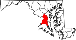
Cedar Heights, Maryland

Last updated

Cedar Heights
USA Maryland location map.svg
Red pog.svg
Cedar Heights
Location within the state of Maryland
Usa edcp location map.svg
Red pog.svg
Cedar Heights
Cedar Heights (the United States)
Coordinates: 38°54′9″N76°54′29″W / 38.90250°N 76.90806°W / 38.90250; -76.90806
Country Flag of the United States.svg  United States of America
State Flag of Maryland.svg  Maryland
County Flag of Prince George's County, Maryland (1963-present).svg Prince George's
Area
[1]
  Total0.22 sq mi (0.56 km2)
  Land0.22 sq mi (0.56 km2)
  Water0.00 sq mi (0.00 km2)
Population
 (2020)
  Total1,597
  Density7,393.52/sq mi (2,854.76/km2)
Time zone UTC-5 (Eastern (EST))
  Summer (DST) UTC-4 (EDT)
FIPS code 24-14550
GNIS feature ID597202

Cedar Heights is an census designated place in Prince George's County, Maryland, United States. [2] [3] Per the 2020 Census, the population was 1,597. [4]

Contents

Demographics

Historical population
CensusPop.Note
2020 1,597
U.S. Decennial Census [5]
2020 [6]

2020 census

Cedar Heights CDP, Maryland – Racial and ethnic composition
Note: the US Census treats Hispanic/Latino as an ethnic category. This table excludes Latinos from the racial categories and assigns them to a separate category. Hispanics/Latinos may be of any race.
Race / Ethnicity (NH = Non-Hispanic)Pop 2020 [6] % 2020
White alone (NH)171.06%
Black or African American alone (NH)1,31082.03%
Native American or Alaska Native alone (NH)10.06%
Asian alone (NH)120.75%
Pacific Islander alone (NH)00.00%
Other race alone (NH)50.31%
Mixed race or Multiracial (NH)211.31%
Hispanic or Latino (any race)23114.46%
Total1,597100.00%

Notable people

See also

Related Research Articles

<span class="mw-page-title-main">Marlow Heights, Maryland</span> Census-designated place in Maryland, United States

Marlow Heights is an unincorporated area and census-designated place (CDP) in Prince George's County, Maryland, United States. The population was 6,169 at the 2020 census. The Marlow Heights Shopping Center first opened in 1957, adjacent to the large community of Hillcrest Heights. It was joined ten years later, in 1967, by the two-level Iverson Mall, the Washington metropolitan area's first enclosed mall.

<span class="mw-page-title-main">Falcon Heights, Texas</span> CDP in Texas, United States

Falcon Heights is a census-designated place (CDP) in Starr County, Texas, United States. The population was 18 at the 2020 census, down from 53 at the 2010 census.

Peppermill Village is an unincorporated community near Maryland Route 214 in Prince George's County, Maryland, United States. Per the 2020 census, the population was 5,264. FedExField, Metrorail's Blue Line, and Hampton Mall shopping center are all located nearby. Because it is not formally incorporated, it has no official boundaries, but the United States Census Bureau has defined a census-designated place (CDP) consisting of Peppermill Village and the adjacent community of Carmody Hills, for statistical purposes.

Glassmanor is an unincorporated community and census-designated place in Prince George's County, Maryland, United States. As of the 2020 census, it had a population of 18,430. In the 1990 and 2000 censuses, the United States Census Bureau had placed Glassmanor and the adjacent community of Oxon Hill in the "Oxon Hill-Glassmanor" census-designated place for statistical purposes. Glassmanor was last delineated separately in 1980, when the CDP recorded a population of 7,751.

Silver Hill is an unincorporated community and census-designated place (CDP) in Prince George's County, Maryland, United States, approximately 1 mile (1.6 km) southeast of Washington, D.C. Per the 2020 census, the population was 6,381. Prior to 2010, Silver Hill was part of the Suitland-Silver Hill census-designated place.

<span class="mw-page-title-main">Croom, Maryland</span> Census-designated place in Maryland

Croom is an unincorporated community and census-designated place in Southern Prince George's County, Maryland, United States. As of the 2020 census it had a population of 2,720. Croom largely consists of former tobacco farms and forests converted to Washington bedroom subdivisions such as nearby Marlton. The main part of Patuxent River Park is in Croom.

Cedarville is an unincorporated community and census-designated place in southern Prince George's County, Maryland, United States. As of the 2020 census the population was 639.

Fairwood is an unincorporated area and census-designated place (CDP) in Prince George's County, Maryland, United States. The population was 7,983 at the 2020 census.

<span class="mw-page-title-main">Marlboro Meadows, Maryland</span> Census-designated place in Maryland

Marlboro Meadows is an unincorporated community and census-designated place (CDP) in Prince George's County, Maryland, United States. Per the 2020 census, the population was 3,655. It was newly delineated for the 2010 census prior to which the area was part of the Greater Upper Marlboro census-designated place.

Marlboro Village is an unincorporated community and census-designated place (CDP) in Prince George's County, Maryland, United States. Per the 2020 census, the population was 9,221.

Melwood is an unincorporated community and census-designated place (CDP) in Prince George's County, Maryland, United States. It was newly delineated for the 2010 census, at which time its population was 3,051. Per the 2020 census, the population was 3,977.

Queensland is a census-designated place south of Upper Marlboro in Prince George's County, Maryland, United States. The population of the CDP was 2,191 at the 2020 census. It was formerly known as Queenland until 2014 when its name was changed to Queensland and a small portion of its geography was transferred to Upper Marlboro.

Summerfield is a census-designated place near Landover in Prince George's County, Maryland. As of the 2020 census, the population was 14,758. A suburb of Washington, D.C., the area is home to Northwest Stadium and the Prince George's County Sports and Learning Complex. It first became a census-designated place after the 2010 census.

Westphalia is a census-designated place in southern Prince George's County, Maryland, United States. The population of the CDP was 11,770 at the 2020 census.

Alto Bonito Heights is an unincorporated community and census-designated place (CDP) in Starr County, Texas, United States. It is a new CDP, formed from part of the old La Victoria CDP prior to the 2010 census, with a population of 342.

Falconaire is a census-designated place (CDP) in Starr County, Texas, United States. It is a new CDP, formed from part of the Falcon Heights CDP prior to the 2010 census, with a population of 132.

H. Cuellar Estates is a census-designated place (CDP) in Starr County, Texas, United States. It is a new CDP, formed from part of the Falcon Heights CDP prior to the 2010 census. In the 2020 census, it had a population of 11, down from 20 in the 2010 census.

Indio is a census-designated place (CDP) in Starr County, Texas, United States. It is a new CDP, formed from part of the Falcon Heights CDP prior to the 2010 census, with a population of 50.

Lago Vista is a census-designated place (CDP) in Starr County, Texas, United States. It is a new CDP, formed from part of the Falcon Heights CDP prior to the 2010 census. The CDP had a population of 133 in the 2020 census, up from 115 in the 2010 census.

Airport Heights is an unincorporated community and census-designated place (CDP) in Starr County, Texas, United States. This was a new CDP for the 2010 census, with a population of 161.

References

  1. "2020 U.S. Gazetteer Files". United States Census Bureau. Retrieved April 26, 2022.
  2. U.S. Geological Survey Geographic Names Information System: Cedar Heights, Maryland
  3. Rowlands, DW (January 20, 2021). "A first look at our region's new Census-Designated Places". "GGWash". Washington, DC. Retrieved February 26, 2021.
  4. "Cedar Heights CDP, Maryland". United States Census Bureau . Retrieved March 13, 2022.
  5. "Decennial Census of Population and Housing by Decades". US Census Bureau.
  6. 1 2 "P2 Hispanic or Latino, and Not Hispanic or Latino by Race – 2020: DEC Redistricting Data (PL 94-171) – Cedar Heights CDP, Maryland". United States Census Bureau .
  7. Williams, Earl P. Jr. (October 2012). "Did Francis Hopkinson Design Two Flags?" (PDF). NAVA News (216): 7–9. Archived (PDF) from the original on March 6, 2016.