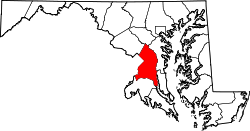
Muirkirk, Maryland

Last updated

Muirkirk
USA Maryland location map.svg
Red pog.svg
Muirkirk
Location within the state of Maryland
Usa edcp location map.svg
Red pog.svg
Muirkirk
Muirkirk (the United States)
Coordinates: 39°03′42″N76°53′07″W / 39.06167°N 76.88528°W / 39.06167; -76.88528
Country Flag of the United States.svg  United States of America
State Flag of Maryland.svg  Maryland
County Flag of Prince George's County, Maryland (1963-present).svg Prince George's
Time zone UTC-5 (Eastern (EST))
  Summer (DST) UTC-4 (EDT)
GNIS feature ID597797

Muirkirk is an unincorporated community in northern Prince George's County, Maryland, United States, located between Baltimore and Washington in the central part of the state. [1]

Contents

It is located along U.S. Route 1 between Beltsville and Laurel. It has a stop on the MARC commuter rail (on the Camden line), and hosts a dinosaur park.

Many Muirkirk residents work for government agencies such as NASA's Goddard Space Flight Center, the Food and Drug Administration and the headquarters of the Washington Suburban Sanitary Commission. [2]

History

Muirkirk was the historic location of Muirkirk Furnace, from which the area takes its name. The ironworks were established before the American Civil War. After the conflict began, the US government hired a manager from the North, Charles Coffin, to ensure the works were kept under federal control.

Located along Old Muirkirk Road, near Muirkirk station and just east of the former furnace, [3] is the historic African-American community of Rossville , originally composed mostly of families of men who labored at the ironworks. It has existed for more than 100 years. In 1868 after the Civil War, six black men purchased property for a church and cemetery, forming the Queens Chapel Methodist Episcopal Church in the rural enclave colloquially referred to as "Swamp Poodle." Part of the property was already in use as a burial ground. They intended to use the church building, originally a small log structure, as a school for their children. This was the start of a postwar cohesive black community in which freedmen established a church independent of white supervision. [4] The Queen's Chapel church was rebuilt in the 1950s. [3]

Around 1885, the estate of landowner Mark Duvall, who owned considerable property in the Vansville area, provided for the sale of 28.5 acres (115,000 m2) just east of Queen's Chapel. The twelve lots made available were quickly settled by African Americans, many of whom worked at nearby Muirkirk Furnace. Augustus Ross, after whom the community was named, built one of the first houses.

The largest lot was purchased by Rebecca Lodge #6, Benevolent Sons and Daughters of Abraham, a black fraternal organization whose members established the historic Abraham Hall. The lodge hall functioned for years as the community school for black children, as the state had segregated facilities. In 1922 the black community raised matching funds and gained white school board members' approval to build a Rosenwald School to improve the educational facilities for black children. Historically black schools were underfunded. [5] This former school was more recently used as an American Legion post. [3]

Charles H. Stanley of Laurel sold 25 acres (100,000 m2) of land to blacks in Rossville, as documented with the Maryland Historical Trust. [6]

Historic sites

The following is a list of historic sites in Rossville, near Muirkirk, identified by the Maryland-National Capital Park and Planning Commission: [5] [7]

Site NameImageLocationM-NCPPC Inventory NumberComment
1 Abraham Hall Abraham Hall Dec 08.JPG 7612 Old Muirkirk Rd.62-023-07Located at Rossville. Listed on the National Register of Historic Places, 2005-03-14
2 Thomas Matthews House 7700 Old Muirkirk Road62-23-17Located at Rossville.
3 Muirkirk School 7813 Muirkirk Road62-23-20Located at Rossville.
4 Queen's Chapel Methodist Episcopal Church Site and Cemetery 7410 Old Muirkirk Road62-23-21Located at Rossville.

Education

Prince George's County Public Schools operates public schools serving Muirkirk.

During the era of legally-required racial segregation of schools, black students from Muirkirk attended Lakeland High School in College Park in the period 1928–1950; [8] Fairmont Heights High School, then near Fairmount Heights, replaced Lakeland High and served black students only from 1950 to 1964; around 1964, legally-required racial segregation of schools ended. [9]

Related Research Articles

<span class="mw-page-title-main">Prince George's County, Maryland</span> County in Maryland, United States

Prince George's County is a county located in the U.S. state of Maryland bordering the eastern portion of Washington, D.C. As of the 2020 U.S. census, the population was 967,201, making it the second-most populous county in Maryland, behind neighboring Montgomery County. The 2020 census counted an increase of nearly 104,000 in the previous ten years. Its county seat is Upper Marlboro. It is the largest and the second most affluent African American-majority county in the United States, with five of its communities identified in a 2015 top ten list. The county is part of the Capital region of the state, though portions of the county are considered to be in Southern Maryland.

<span class="mw-page-title-main">College Park, Maryland</span> City in Maryland, United States

College Park is a city in Prince George's County, Maryland, United States, located approximately four miles (6.4 km) from the northeast border of Washington, D.C. Its population was 34,740 at the 2020 United States census. It is the home of the University of Maryland, College Park.

<span class="mw-page-title-main">Beltsville, Maryland</span> CDP in Maryland, United States

Beltsville is a census-designated place (CDP) in northern Prince George's County, Maryland, United States. The community was named for Truman Belt, a local landowner. The 2020 census counted 20,133 residents. Beltsville includes the unincorporated community of Vansville.

<span class="mw-page-title-main">Bowie, Maryland</span> City in Maryland, United States

Bowie is a city in Prince George's County, Maryland, United States. Per the 2020 census, the population was 58,329. Bowie has grown from a small railroad stop to the largest municipality in Prince George's County, and the fifth most populous city and third largest city by area in the U.S. state of Maryland. In 2014, CNN Money ranked Bowie 28th in its Best Places to Live list.

<span class="mw-page-title-main">Brandywine, Maryland</span> Census-designated place in Maryland

Brandywine is the name of an unincorporated area in Prince George's County, Maryland, United States, that refers both to a census-designated place (CDP) and a zip code area which is much larger (20613), whose areas overlap. The population of Brandywine at the 2020 U.S. Census was 10,550 for the CDP, and the population of ZIP code 20613 was 11,860 in 2010.

<span class="mw-page-title-main">Cheverly, Maryland</span> Town in Prince Georges County, Maryland, US

Cheverly is a town in Prince George's County, Maryland, United States, located very close to Washington, D.C., though not bordering it directly. The town was founded in 1918 and incorporated in 1931. Per the 2020 census, the population was 6,170. Cheverly borders the communities of Tuxedo, Chapel Oaks, Landover, Landover Hills, Villa Heights, and Bladensburg.

<span class="mw-page-title-main">Fairmount Heights, Maryland</span> Historic district in Maryland, United States

Fairmount Heights is a town in Prince George's County, Maryland, United States. Per the 2020 census, the population was 1,528. The town was formally incorporated in 1935, making the town the second oldest African-American-majority municipality in Prince George's County. The town is composed of six subdivisions: Fairmount Heights (1900), Waterford (1907), Mount Weissner (1909), North Fairmount Heights (1910), West Fairmount Heights (1911) and Sylvan Vista (1923).

<span class="mw-page-title-main">Hyattsville, Maryland</span> City in Maryland, United States

Hyattsville is a city in Prince George's County, Maryland, United States. It is an urban suburb of Washington, D.C. The population was 21,187 at the 2020 United States census.

<span class="mw-page-title-main">Laurel, Maryland</span> City in Maryland, United States

Laurel is a city in Maryland, United States, located midway between Washington, D.C. and Baltimore on the banks of the Patuxent River, in northern Prince George's County. Founded as a mill town in the early 19th century, Laurel expanded local industry and was later able to become an early commuter town for Washington and Baltimore workers following the arrival of the Baltimore and Ohio Railroad in 1835. Largely residential today, the city maintains a historic district centered on its Main Street, highlighting its industrial past.

<span class="mw-page-title-main">Mount Rainier, Maryland</span> City in Maryland, United States

Mount Rainier is a city in Prince George's County, Maryland, United States, bordering Washington D.C. The population was 8,333 at the 2020 census. Mount Rainier is contained between the Northwest Branch Anacostia River, Cedar Lane Alley, and 34th Street to the north, 37th Street and 37th Place to the northeast, Upshur Street and Queens Chapel Road to the west, the CSX Capital Subdivision train tracks to the east, and Eastern Avenue NE to the south. Mount Rainier got its start as a streetcar suburb, when tracks were laid for the 82 Streetcar Line. According to local tradition, surveyors from the Pacific Northwest named the town, giving the streets names such as Shasta and Cascade. Historic U.S. 1 runs through the center of the town and serves as the main street and central business district.

<span class="mw-page-title-main">North Brentwood, Maryland</span> Town in Maryland

North Brentwood is a town in Prince George's County, Maryland, United States. The population was 593 at the 2020 census. The municipality of North Brentwood is located north of Washington and is surrounded by the communities of Brentwood, Hyattsville, and Cottage City, and the nearby Mount Rainier. The Town of North Brentwood was incorporated in 1924, and was the first African-American-majority municipality in Maryland.

<span class="mw-page-title-main">Prince George's County Public Schools</span> Public school district in Prince Georges County, Maryland

Prince George's County Public Schools (PGCPS) is a public school district that serves Prince George's County, Maryland. During the 2023-2024 academic year, the district enrolls around 133,000 students and operates over 200 schools. PGCPS is the second-largest school district in Maryland, the third-largest district in the Washington-Baltimore metropolitan area, the 18th-largest in the United States, and the nation's largest school district with a majority-black student population.

<span class="mw-page-title-main">Charles E. Coffin</span> American politician (1841–1912)

Charles Edward Coffin, was an American industrialist and Republican politician who moved to Maryland during the American Civil War to operate ironworks near the national capital, and later served in both houses of the Maryland legislature as well as the United States House of Representatives.

<span class="mw-page-title-main">Abraham Hall</span> United States historic place

Abraham Hall, constructed in 1889, is located on the northeast side of Old Muirkirk Road in the center of the historic African American community of Rossville, a section of Prince George's County, Maryland near Beltsville.

<span class="mw-page-title-main">Aquasco, Maryland</span> Census-designated place in Maryland

Aquasco is an unincorporated area and census-designated place in southeastern Prince George's County, Maryland, United States, surrounding the town of Eagle Harbor and bordering Charles County. As of the 2020 census, the CDP had a population of 913. Aquasco was home to the Aquasco Speedway.

<span class="mw-page-title-main">Fairmont Heights High School</span> Public comprehensive secondary school in Landover, Maryland , United States

Fairmont Heights High School (est.1950) is an American public comprehensive secondary school located in Landover, Maryland, just outside Washington D.C. It is part of the Prince George's County Public Schools system. Two middle schools feed into Fairmont Heights. It is part of the School Board District 3.

Frederick Douglass High School (FDHS), is an American public high school established in 1935 and located in the Croom census-designated place of unincorporated Prince George's County, Maryland, United States, with a mailing address of Upper Marlboro and near Upper Marlboro.

<span class="mw-page-title-main">Dinosaur Park (Prince George's County, Maryland)</span> Park in Maryland, U.S. near which dinosaur fossils have been found

Dinosaur Park is a park located in the 13200 block of Mid-Atlantic Boulevard, near Laurel and Muirkirk, Maryland, and operated by the Prince George's County Department of Parks and Recreation. The park features a fenced area where visitors can join paleontologists and volunteers in searching for early Cretaceous fossils. The park also has an interpretive garden with plants and information signs. The park is in the approximate location of discoveries of Astrodon teeth and bones as early as the 19th century.

<span class="mw-page-title-main">Fairmount Heights Historic District</span> Historic district in Maryland, United States

The Fairmount Heights Historic District encompasses an area of 144 acres (58 ha) in the historic heart of Fairmount Heights, Maryland. The area is notable as one of the first planned African-American communities in the Washington, D.C., area. Predominantly residential in character, most of its housing stock was built between 1900 and 1960, although there has also been recent development. The district includes the original town hall. and the first public school for African-Americans in the county. There are also five churches and a community center, all important centers of political activism during the period of segregation.

Lakeland High School was a high school for black children located in the Lakeland community of Prince George's County, Maryland, United States, now a part of College Park. It was the second high school for black children in the county. It ceased being used for educational purposes in 1983. As of 2012, the building was being used as a church.

References

  1. U.S. Geological Survey Geographic Names Information System: Muirkirk, Maryland
  2. Glaros, Tony (July 14, 2006). ""Long Memories in Land of the Freed"". The Washington Post . Retrieved October 28, 2024.
  3. 1 2 3 Chidester, Robert C. (c. 2003). "VI: Western Shore". A Historic Context for the Archaeology of Industrial Labor in the State of Maryland (Report). University of Maryland College Park Department of Anthropology Center for Heritage Resource Studies. Retrieved December 20, 2015.
  4. "Queen's Chapel and Burial Grounds", Determination of Eligibility, Maryland Historical Trust, 13 Sep 2002, MNCPPC, accessed 17 Mar 2010
  5. 1 2 M-NCPPC African-American Heritage Survey, October 1996: Properties Within or Closely Associated With Historic Communities (Prince George's County, Maryland), 1996 [ permanent dead link ].
  6. Leonard, Kevin (November 17, 2016). "Who was Laurel's Charles Stanley?". History Matters. Baltimore Sun. Retrieved January 28, 2017.
  7. M-NCPPC Illustrated Inventory of Historic Sites (Prince George's County, Maryland), 2006 Archived 2008-07-25 at the Wayback Machine .
  8. African-American Historic and Cultural Resources in Prince George's County, Maryland . Maryland-National Capital Park and Planning Commission, February 2012. p. 63 (document page 67). Retrieved on September 6, 2018.
  9. "Fairmont Heights High School History". Fairmont Heights High School. September 4, 2018. Archived from the original on October 4, 2005. Retrieved September 4, 2018.