Kettering, Maryland

Last updated

Kettering, Maryland
Prince George's County Maryland Incorporated and Unincorporated areas Kettering Highlighted.svg
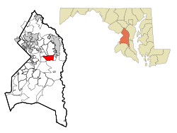
Location of Kettering, Maryland
Coordinates: 38°53′42″N76°47′47″W / 38.89500°N 76.79639°W / 38.89500; -76.79639
Country Flag of the United States.svg United States
State Flag of Maryland.svg  Maryland
County Flag of Prince George's County, Maryland.svg Prince George's
Area
[1]
  Total5.51 sq mi (14.28 km2)
  Land5.49 sq mi (14.23 km2)
  Water0.02 sq mi (0.05 km2)
Elevation
138 ft (42 m)
Population
 (2020)
  Total14,424
  Density2,625.89/sq mi (1,013.79/km2)
Time zone UTC−5 (Eastern (EST))
  Summer (DST) UTC−4 (EDT)
ZIP codes
20774-20775
Area code(s) 301, 240
FIPS code 24-43900
GNIS feature ID1714445

Kettering is an unincorporated area and census-designated place in Prince George's County, Maryland, United States. [2] At the 2020 United States Census, the population was 14,424,. [3] Kettering is adjacent to Prince George's Community College, the upscale gated community of Woodmore, Six Flags America, Evangel Temple megachurch, and the community of Largo at the end of the Washington Metro Blue Line. Watkins Regional Park in Kettering offers a large playground, a colorful carousel, miniature golf, a miniature train ride, and various animals.

Contents

Etymology

The name Kettering was chosen by a suburban housing developer in the 1960s when development began.

Geography

Kettering is located at 38°53′42″N76°47′47″W / 38.895012°N 76.796471°W / 38.895012; -76.796471 . [4]

According to the United States Census Bureau, the CDP has a total area of 5.5 square miles (14 km2), all land.

Demographics

Historical population
CensusPop.Note
2000 11,008
2010 12,79016.2%
2020 14,42412.8%
U.S. Decennial Census [5]
2010 [6] 2020 [7]

2020 census

Kettering CDP, Maryland – Racial and ethnic composition
Note: the US Census treats Hispanic/Latino as an ethnic category. This table excludes Latinos from the racial categories and assigns them to a separate category. Hispanics/Latinos may be of any race.
Race / Ethnicity (NH = Non-Hispanic)Pop 2010 [6] Pop 2020 [7] % 2010% 2020
White alone (NH)3683082.88%2.14%
Black or African American alone (NH)11,67512,97691.28%89.96%
Native American or Alaska Native alone (NH)15110.12%0.08%
Asian alone (NH)2412071.88%1.44%
Pacific Islander alone (NH)510.04%0.01%
Some Other Race alone (NH)27590.21%0.41%
Mixed Race or Multi-Racial (NH)2204001.72%2.77%
Hispanic or Latino (any race)2394621.87%3.20%
Total12,79014,424100.00%100.00%

2000 Census

As of the census [8] of 2000, there were 11,008 people, 3,814 households, and 2,955 families residing in the CDP. The population density was 2,016.5 inhabitants per square mile (778.6/km2). There were 3,958 housing units at an average density of 725.0 per square mile (279.9/km2). The racial makeup of the CDP was 5.78% White, 90.62% African American, 0.19% Native American, 1.24% Asian, 0.47% from other races, and 1.71% from two or more races. Hispanic or Latino of any race were 0.95% of the population.

There were 3,814 households, out of which 36.3% had children under the age of 18 living with them, 50.0% were married couples living together, 23.3% had a female householder with no husband present, and 22.5% were non-families. 18.4% of all households were made up of individuals, and 1.7% had someone living alone who was 65 years of age or older. The average household size was 2.86 and the average family size was 3.24.

In the CDP, the population was spread out, with 26.6% under the age of 18, 7.1% from 18 to 24, 30.6% from 25 to 44, 29.1% from 45 to 64, and 6.6% who were 65 years of age or older. The median age was 37 years. For every 100 females, there were 81.3 males. For every 100 females age 18 and over, there were 75.8 males.

The median income for a household in the CDP was $78,735, and the median income for a family was $82,777. Males had a median income of $47,059 versus $45,243 for females. The per capita income for the CDP was $30,398. About 0.8% of families and 1.9% of the population were below the poverty line, including 1.9% of those under age 18 and 2.0% of those age 65 or over. By the end of 2020, the CDP ranks # 6 among top 10 richest black communities in US, with an average family income of $107,008. [9]

Kettering was majority white for much of its history. While majority white in the 1970 census, Kettering was 49% white by 1980 and only 17% white by 1990. The white population quickly declined as the community became majority African-American. [10]

Government and infrastructure

Prince George's County Police Department District 2 Station in Brock Hall CDP, with a Bowie postal address, serves the community. [11]

The U.S. Postal Service operates the Kettering Post Office in Kettering CDP. [12] [13]

Education

Kettering is a part of the Prince George's County Public Schools. [13]

Kettering, Perrywood, and Lake Arbor elementary schools serve sections of the Kettering CDP. [14] Almost all of the CDP is zoned to Kettering Middle School, with a portion zoned to Ernest Everett Just Middle School. [15] Most of the CDP is zoned to Largo High School while a portion is zoned to Dr. Henry A. Wise Jr. High School. [16]

Kettering is served by the Largo-Kettering Branch of the Prince George's County Memorial Library System in Largo. [17]

Related Research Articles

<span class="mw-page-title-main">Camp Springs, Maryland</span> Census-designated place in Maryland

Camp Springs is an unincorporated area and census-designated place (CDP) in Prince George's County, Maryland, United States. The population was 22,734 at the 2020 census. Camp Springs is not an official post office designation; the area is divided among the surrounding mailing addresses of Temple Hills, Fort Washington, Clinton, and Suitland.

<span class="mw-page-title-main">Coral Hills, Maryland</span> Census-designated place in Maryland

Coral Hills is an unincorporated area and census-designated place (CDP) in Prince George's County, Maryland, United States. As of the 2020 census, the population was 9,997.

<span class="mw-page-title-main">East Riverdale, Maryland</span> Census-designated place in Maryland, United States

East Riverdale is an unincorporated area and census-designated place (CDP) in Prince George's County, Maryland, United States. The population was 18,459 at the 2020 census.

<span class="mw-page-title-main">Forestville, Maryland</span> CDP in Maryland

Forestville is an unincorporated area and census-designated place (CDP) in Prince George's County, Maryland, United States. Per the 2020 census, the population was 12,831. The community is a mixture of garden apartments, single-family homes, and shopping centers built mostly from the 1930s through 1970s, adjacent to the communities of District Heights, Suitland, Morningside, Westphalia and Camp Springs.

<span class="mw-page-title-main">Friendly, Maryland</span> Census-designated place in Maryland

Friendly is an unincorporated area and census-designated place (CDP) in Prince George's County, Maryland, United States, with an African-American majority population, located a few miles south of Washington, D.C. The population was 9,937 at the 2020 census.

<span class="mw-page-title-main">Glenn Dale, Maryland</span> CDP in Maryland

Glenn Dale is an unincorporated area and census-designated place (CDP) in Prince George's County, Maryland, United States. The population was 14,698 at the 2020 census. Glenn Dale is home to the Glenn Dale Hospital, an abandoned sanatorium, and the USDA Plant Introduction Station.

<span class="mw-page-title-main">Greater Upper Marlboro, Maryland</span> Unincorporated area in Maryland

Greater Upper Marlboro is an area of Prince George's County, Maryland, United States, that completely surrounds Upper Marlboro, the county seat. It was formerly a census-designated place (CDP), with a population of 18,720 at the 2000 census. However, the 2010 census divided the area into several smaller CDPs, including portions of Marlboro Meadows, Brock Hall, Marlboro Village, Queenland, and Croom.

<span class="mw-page-title-main">Hillcrest Heights, Maryland</span> CDP in Maryland

Hillcrest Heights is an unincorporated area and census-designated place (CDP) in Prince George's County, Maryland, United States. The population was 15,793 at the 2020 census. For mailing address purposes, it is part of the smaller community of Temple Hills and is also near Suitland.

<span class="mw-page-title-main">Lake Arbor, Maryland</span> Census-designated place in Maryland, United States

Lake Arbor is an unincorporated area and census-designated place (CDP) in Prince George's County, Maryland, United States. The population was 14,541 at the 2020 census. It is one of the nation's most affluent African-American communities. The ZIP Codes encompassing the CDP area are 20721 and 20774.

<span class="mw-page-title-main">Largo, Maryland</span> Census-designated place in Maryland, United States

Largo, located within Greater Upper Marlboro, Maryland, is an unincorporated area and census-designated place in Prince George's County, Maryland, United States. The population was 11,605 at the 2020 census.

<span class="mw-page-title-main">Marlow Heights, Maryland</span> Census-designated place in Maryland, United States

Marlow Heights is an unincorporated area and census-designated place (CDP) in Prince George's County, Maryland, United States. The population was 6,169 at the 2020 census. The Marlow Heights Shopping Center first opened in 1957, adjacent to the large community of Hillcrest Heights. It was joined ten years later, in 1967, by the two-level Iverson Mall, the Washington metropolitan area's first enclosed mall.

<span class="mw-page-title-main">Marlton, Maryland</span> Census-designated place in Maryland

Marlton is an unincorporated area and census-designated place (CDP) in Prince George's County, Maryland, United States. The population was 9,802 at the 2020 census. The Marlton housing development, at first briefly called "Brandywine Country", grew up along U.S. Route 301 in the 1970s, and is part of the greater Upper Marlboro community. Originally made up of only single-family homes, more recently townhouses have been added.

<span class="mw-page-title-main">Mitchellville, Maryland</span> Census-designated place in Maryland

Mitchellville is an upper-class majority African-American unincorporated area and census-designated place (CDP) in Prince George's County, Maryland, United States. Per the 2020 census, the population was 11,136.

<span class="mw-page-title-main">Rosaryville, Maryland</span> Census-designated place in Maryland, US

Rosaryville is an unincorporated area and census-designated place (CDP) in Prince George's County, Maryland, United States, located south of Cinton and Upper Marlboro beside U.S. Route 301. Per the 2020 census, the population was 11,548. including housing developments and rural open space. It was named for a local Roman Catholic church. Close to Rosaryville are the Marlton housing development, Maryland Veterans Cemetery, the Southern Maryland Farmers Market, and Rosaryville State Park.

<span class="mw-page-title-main">South Laurel, Maryland</span> Census-designated place in Maryland

South Laurel is an unincorporated area and census-designated place (CDP) in Prince George's County, Maryland, United States. Per the 2020 census, the population was 29,602.

<span class="mw-page-title-main">Springdale, Maryland</span> Census-designated place in Maryland

Springdale is an unincorporated area and census-designated place (CDP) in Prince George's County, Maryland, United States. Per the 2020 census, the population was 5,301.

<span class="mw-page-title-main">Woodlawn, Prince George's County, Maryland</span> Census-designated place in Maryland

Woodlawn is an unincorporated area and census-designated place (CDP) in Prince George's County, Maryland, United States. As of the 2020 census it had a population of 7,541.

<span class="mw-page-title-main">Woodmore, Maryland</span> Census-designated place in Maryland

Woodmore is an unincorporated area and census-designated place in Prince George's County, Maryland, United States. Per the 2020 census, the population was 4,513. The CDP is located within the boundaries of Route 193 to the west, Church Road to the east, Route 214 to the south and Route 50 to the north. Woodmore Road runs east and west through the center. It contains a large gated community and country club, developments of Woodmore Meadows, and Woodmore South on the south side, as well as various other custom built homes and farmland.

<span class="mw-page-title-main">Hillandale, Maryland</span> Census-designated place in Maryland, United States

Hillandale is an unincorporated area and census-designated place located in Montgomery and Prince George's counties, Maryland, United States. As of the 2020 census, it had a population of 5,774. Hillandale is contained between the Prince George's / Montgomery County line to the east, the Anacostia River to the west, McCeney Avenue to the north, and D.C.'s Capital Beltway to the south. It borders the communities of Adelphi, Avenel, White Oak and Beltsville.

<span class="mw-page-title-main">Brock Hall, Maryland</span> Census-designated place in Maryland

Brock Hall is an unincorporated area and census-designated place in eastern Prince George's County, Maryland, United States, located south of Largo and Bowie, and north of Upper Marlboro. As of the 2020 census, the CDP had a population of 13,181.

References

  1. "2020 U.S. Gazetteer Files". United States Census Bureau. Retrieved April 26, 2022.
  2. U.S. Geological Survey Geographic Names Information System: Kettering, Maryland
  3. "Kettering CDP, Maryland". United States Census Bureau . Retrieved April 15, 2022.
  4. "US Gazetteer files: 2010, 2000, and 1990". United States Census Bureau. February 12, 2011. Retrieved April 23, 2011.
  5. "Decennial Census of Population and Housing by Decades". US Census Bureau.
  6. 1 2 "P2 Hispanic or Latino, and Not Hispanic or Latino by Race – 2010: DEC Redistricting Data (PL 94-171) – Kettering CDP, Maryland". United States Census Bureau .
  7. 1 2 "P2 Hispanic or Latino, and Not Hispanic or Latino by Race – 2020: DEC Redistricting Data (PL 94-171) – Kettering CDP, Maryland". United States Census Bureau .
  8. "U.S. Census website". United States Census Bureau . Retrieved January 31, 2008.
  9. "10 Richest Black Communities in America" . Retrieved November 12, 2020.
  10. "The Dispersion Decade". The Washington Times. Retrieved December 25, 2020.
  11. "District 2 Station - Bowie." Prince George's County Police Department. Retrieved on September 9, 2018. "District 2 Station - Bowie 601 SW Crain Highway Bowie, MD 20715 ". Beat map. 2010 U.S. Census Bureau index map of Brock Hall CDP as well as the detail on Page 1.
  12. "KETTERING." U.S. Postal Service. Retrieved on September 11, 2018. "68 WATKINS PARK DR UPPER MARLBORO, MD 20774-9996"
  13. 1 2 "2010 CENSUS - CENSUS BLOCK MAP (INDEX): Kettering CDP, MD." U.S. Census Bureau. Retrieved on August 28, 2018. Pages: 1 and 2.
  14. "NEIGHBORHOOD ELEMENTARY SCHOOLS AND BOUNDARIES SCHOOL YEAR 2018-2019." Prince George's County Public Schools. Retrieved on August 28, 2018.
  15. "NEIGHBORHOOD MIDDLE SCHOOLS AND BOUNDARIES SCHOOL YEAR 2018-2019." Prince George's County Public Schools. Retrieved on August 28, 2018.
  16. "NEIGHBORHOOD HIGH SCHOOLS AND BOUNDARIES SCHOOL YEAR 2018-2019." Prince George's County Public Schools. Retrieved on August 28, 2018.
  17. "Largo-Kettering Branch." Prince George's County Memorial Library System. Retrieved on August 29, 2018. "Largo-Kettering Branch 9601 Capital Lane Largo, MD 20774"