
The Ore Mountains lie along the Czech–German border, separating the historical regions of Bohemia in the Czech Republic and Saxony in Germany. The highest peaks are the Klínovec in the Czech Republic at 1,244 metres (4,081 ft) above sea level and the Fichtelberg in Germany at 1,215 metres (3,986 ft).

The Rammelsberg is a mountain, 635 metres (2,083 ft) high, on the northern edge of the Harz range, south of the historic town of Goslar in the North German state of Lower Saxony. The mountain is the location of an important silver, copper, and lead mine. When it closed in 1988, it had been the only mine still working continuously for over 1,000 years. Because of its long history of mining and testimony to the advancement and exchange of technology over many centuries, the visitor mine of Rammelsberg was inscribed as a UNESCO World Heritage Site in 1992.

Freiberg is a university and former mining town in Saxony, Germany, with around 41,000 inhabitants. The city lies in the foreland of the Ore Mountains, in the Saxon urbanization axis, which runs along the northern edge of the Elster and Ore Mountains, stretching from Plauen in the southwest via Zwickau, Chemnitz and Freiberg to Dresden in the northeast. It sits on the Freiberger Mulde, a tributary of the Mulde River. It is a Große Kreisstadt, and the administrative seat of Landkreis Mittelsachsen. Freiberg is connected to Dresden by the S3 line of the Dresden S-Bahn.

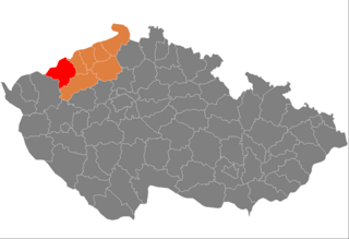
Karlovy Vary District is a district in the Karlovy Vary Region of the Czech Republic. Its capital is the city of Karlovy Vary.

Abertamy is a town in Karlovy Vary District in the Karlovy Vary Region of the Czech Republic. It has about 800 inhabitants. It is known as a winter sports centre. The town is historically associated with silver and tin mining and is located in the Ore Mountain Mining Region, which is a UNESCO World Heritage Site.
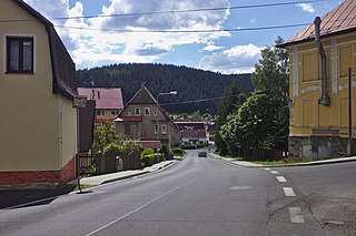
Pernink is a municipality and village in Karlovy Vary District in the Karlovy Vary Region of the Czech Republic. It has about 600 inhabitants.

The 140-kilometre-long Silver Road is the first and longest holiday route in the German Free State of Saxony. Against the background of the importance of mining in the history of Saxony, the road links those sights and tourist attractions of the Ore Mountains and its foreland that relate to the centuries-old mining and smelting industries of the region.

Krupka is a town in Teplice District in the Ústí nad Labem Region of the Czech Republic. It has about 13,000 inhabitants. The town is located in the Ore Mountain Mining Region, a UNESCO World Heritage Site, and during the late Middle Ages it was one of the world-leading producers of tin and silver. The centre of Krupka is well preserved and is protected by law as an urban monument zone.

Teplice District is a district in the Ústí nad Labem Region of the Czech Republic. Its capital is the city of Teplice.
Chomutov District is a district in the Ústí nad Labem Region of the Czech Republic. Its capital is the city of Chomutov.

Boží Dar is a town in Karlovy Vary District in the Karlovy Vary Region of the Czech Republic. It has about 300 inhabitants. Situated in the Ore Mountains at 1,028 m (3,373 ft) above sea level, it is considered the highest town in the Czech Republic. The town is part of the Abertamy – Boží Dar Mining Landscape, which is a UNESCO World Heritage Site as part of Ore Mountain Mining Region.

Horní Blatná is a town in Karlovy Vary District in the Karlovy Vary Region of the Czech Republic. It has about 400 inhabitants. The town is historically associated with tin mining and is located in the Ore Mountain Mining Region, which is a UNESCO World Heritage Site. The historic town centre is well preserved and is protected by law as an urban monument zone.
Mittelsachsen is a district (Kreis) in the Free State of Saxony, Germany.

The Ore Mountains/Vogtland Nature Park extends across the upper slopes of the Vogtland and Ore Mountains in southeastern Germany along its international border with Czech Republic. It is the longest nature park in Germany with a total length of 120 km. Its management organisation is the Zweckverband Naturpark Erzgebirge/Vogtland. It includes the following conservation areas:
Berggeschrey or Berggeschrei was a German term for the rapid spread of news on the discovery of rich ore deposits that led to the rapid establishment of a mining region, as in the silver rush in the early days of silver ore mining in the Ore Mountains. It is similar in some respects to the gold rush in North America.
The Revierwasserlaufanstalt Freiberg or RWA Freiberg, was a historical water management system that delivered driving water to the Freiberg mines in the time of the German Electorate and later Kingdom of Saxony. Today the system is used to supply drinking and industrial water and is operated by the Saxony State Reservoir Office.
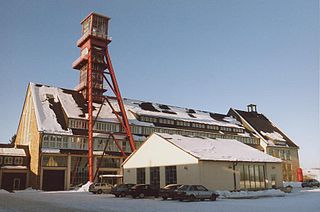
The Ore Mountain Mining Region is an industrial heritage landscape, over 800 years old, in the border region of the Ore Mountains between the German state of Saxony and North Bohemia in the Czech Republic. It is characterised by a plethora of historic, largely original, monuments to technology, as well as numerous individual monuments and collections related to the historic mining industry of the region. On 6 July 2019, the Erzgebirge/Krušnohoří Mining Region was inscribed as a UNESCO World Heritage Site, because of its exceptional testimony to the advancement of mining technology over the past 800 years.
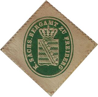
The Saxon Mining Office is the executive authority for mining rights in the German state of Saxony. It is also responsible for all non-metallic mineral resources on the terrain of the former East Germany.

The Neugrabenflöße, was a roughly 18 km long Kunstgraben dating to the 17th century. It enabled the rafting of timber for the mining and smelting industries in the Ore Mountains of eastern Germany. It ran from the River Flöha near Fleyh (Fláje) to the Freiberger Mulde near Clausnitz in the Ore Mountains.
