
Witney is a market town on the River Windrush in West Oxfordshire in the county of Oxfordshire, England. It is 12 miles (19 km) west of Oxford. The place-name "Witney" is derived from the Old English for "Witta's island". The earliest known record of it is as Wyttannige in a Saxon charter of 969. The Domesday Book of 1086 records it as Witenie.

The Cotswold Line is an 86+1⁄2-mile (139.2 km) railway line between Oxford and Hereford in England.

Oxford railway station is a mainline railway station, one of two serving the city of Oxford, England. It is about 0.5 miles (800 m) west of the city centre, north-west of Frideswide Square and the eastern end of Botley Road. It is on the line for trains between London Paddington and Hereford via Worcester Shrub Hill. It is a starting point for fast and local trains to London Paddington and London Marylebone, and for local trains to Reading, Worcester, and Banbury. It is also on the north/south Cross Country Route from Manchester Piccadilly and Newcastle via Birmingham New Street and Reading to Southampton Central and Bournemouth. The station is managed by Great Western Railway, and also served by CrossCountry and Chiltern Railways trains. Immediately to the north is Sheepwash Channel Railway Bridge over the Sheepwash Channel.
Swansea city centre in Swansea, Wales, contains the main shopping, leisure and nightlife district in Swansea. The city centre covers much of the Castle ward including the area around Oxford Street, Castle Square, and the Quadrant Shopping Centre; Alexandra Road, High Street, Wind Street and the Castle; Parc Tawe; and the Maritime Quarter extending down to the seafront.

Osney or Osney Island is a riverside community in the west of the city of Oxford, England. In modern times the name is applied to a community also known as Osney Town astride Botley Road, just west of the city's main railway station, on an island surrounded by the River Thames, Osney Ditch and another backwater connecting the Thames to Osney Ditch.
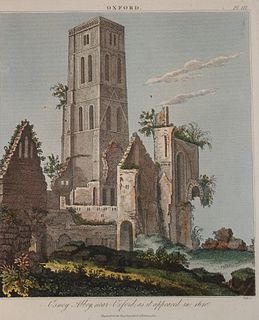
Osney Abbey or Oseney Abbey, later Osney Cathedral, was a house of Augustinian canons at Osney in Oxfordshire. The site is south of the modern Botley Road, down Mill Street by Osney Cemetery, next to the railway line just south of Oxford station. It was founded as a priory in 1129, becoming an abbey around 1154. It was dissolved in 1539 but was created a cathedral, the last abbot Robert King becoming the first Bishop of Oxford. The see was transferred to the new foundation of Christ Church in 1545 and the building fell into ruin. It was one of the four renowned monastic houses of medieval Oxford, along with St Frideswide's Priory, Rewley and Godstow.

George Street is a street in central Oxford, England. It is a shopping street running east–west.

Abingdon Road is the main arterial road to the south of the city of Oxford, England. The road passes through the suburbs of Grandpont and New Hinksey. It is named after the town of Abingdon to the south.
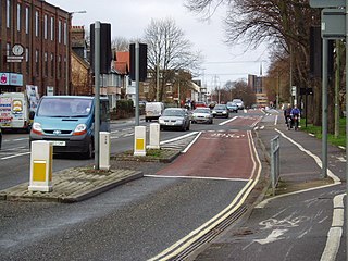
Botley Road is the main road into the centre of Oxford, England from the west. It stretches between Botley, on the Oxford Ring Road (A34) to the west of the city, and Frideswide Square at the junction with Oxford railway station, close to central Oxford.

Oxford Rewley Road railway station was a railway station serving the city of Oxford, England, located immediately to the north of what is now Frideswide Square on the site of the Saïd Business School, to the west of Rewley Road. It was the terminus of the Buckinghamshire Railway, which was worked, and later absorbed, by the London and North Western Railway (L&NWR). In 1923 it became part of the London, Midland and Scottish Railway (LMS), "Varsity Line" service from Cambridge via Bletchley and had features of significance in construction history.
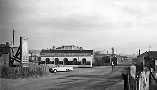
Banbury Merton Street was the first railway station to serve the Oxfordshire market town of Banbury in England. It opened in 1850 as the northern terminus of the Buckinghamshire Railway providing connections to Bletchley and Oxford and closing for passengers in 1961 and goods in 1966.

Oxpens Road is a road in central Oxford, England, linking west and south Oxford. It is named after the marshy area of Oxpens, next to one of the branches of the River Thames in Oxford. It forms part of the A420 road.

Hythe Bridge Street is in the west of central Oxford, England, forming part of the A4144 road.
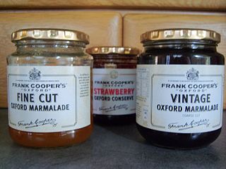
Frank Cooper's is a UK brand of marmalades and jams owned by Hain Daniels. Frank Cooper's is known primarily for its "Oxford" Marmalade and holds a Royal Warrant.

Park End Street is a street in central Oxford, England, to the west of the centre of the city, close to the railway station at its western end.
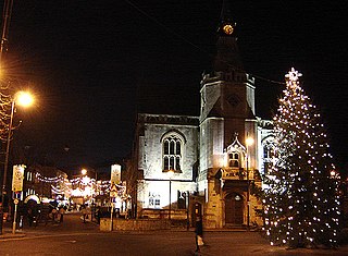
Banbury is a circa 1,500-year-old market town and civil parish on the River Cherwell in the Cherwell District of Oxfordshire, England. It is 64 miles (103 km) northwest of London, 38 miles (61 km) southeast of Birmingham, 27 miles (43 km) south of Coventry and 21 miles (34 km) north northwest of the county town of Oxford.
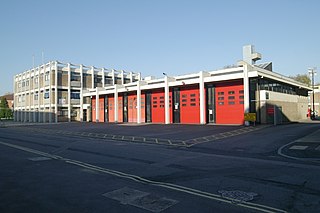
Rewley Road is in the west of central Oxford, England. It is located in St Thomas's parish.

Sheepwash Channel connects the River Thames to the west and the Castle Mill Stream next to the Oxford Canal to the east, in west Oxford, England. To the north are Cripley Meadow and Fiddler's Island. To the south are Osney Island and the Botley Road.
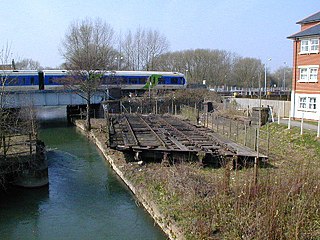
Rewley Road Swing Bridge is a disused railway swing bridge over Sheepwash Channel in west Oxford, England. To the north are Cripley Meadow and Fiddler's Island and to the south are Osney Island and the Botley Road.


