Hythe Bridge Street

Last updated

View east along Hythe Bridge Street with Beaver House on the left. Hythe Bridge Street - geograph.org.uk - 1403539.jpg
View east along Hythe Bridge Street with Beaver House on the left.
Location map United Kingdom Oxford.svg
Red pog.svg
Location of Hythe Bridge Street in Oxford

Hythe Bridge Street is in the west of central Oxford, England, forming part of the A4144 road. [1] [2]

Contents

History

There has been a road here since at least 1233. [2] Previous names include Hide Brigge, Hithe Brigge, and Rewley Lane. It used to form part of the road between Oxford and Witney to the west.

The name "Hythe" is derived from the "hithe" (wharf) that used to be located by the bridge on Hythe Bridge Street. [2] "Hithe" is a Saxon word that means a landing place.

Location

The street links Frideswide Square and then Botley Road (A420) to the east (at the junction with Hollybush Row, which continues becoming Oxpens Road) and Worcester Street (also the A4144) at the western end leading north, at the junction with George Street. Parallel to Hythe Bridge Street to the south is Park End Street.

To the north at the eastern end of the street is Worcester College, one of the colleges of Oxford University. To the north at the western end is Beaver House, which until May 2011 contained the head office of Blackwell's Booksellers, the leading academic bookseller in Oxford, also with further shops countrywide. Carfax Tutorial Establishment is at 39–42 Hythe Bridge Street. The Bridge is a night club at No. 6–9. There are also a number of restaurants and other shops in the street. It forms a part of the main arterial route into central Oxford from the west and as such is normally very busy with traffic.

View of Hythe Bridge on Hythe Bridge Street HytheBridge.jpg
View of Hythe Bridge on Hythe Bridge Street

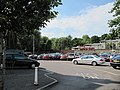
Hythe Bridge, a flat late 19th century cast iron bridge on Hythe Bridge Street constructed in 1861, spans the Castle Mill Stream, a backwater of the River Thames. Just to the northeast is the southern end of the Oxford Canal. This used to continue south of Hythe Bridge Street to a basin that is now filled in to form a car park. [3]

Buildings

The Cistercian house Rewley Abbey, founded in 1280, was located north of Hythe Bridge Street on the banks of one of the branches of the River Thames. Virtually all the original buildings have disappeared, but there is still a 15th-century doorway in a wall on the west side of the Oxford Canal, within a housing development. [4]

Beaver House was erected in 1971–72, designed by the Oxford Architects Partnership. [5] [6] It is clad in reeded concrete with a glass curtain wall facing Hythe Bridge Street. It was built to serve as the headquarters for Blackwell's Library Bookselling and Periodicals Divisions.

The Gloucester Green area beyond the eastern end of Hythe Bridge Street was redeveloped in 1987–90, with buildings clad in red brick, with patterns in different colours. [7] Three domed turrets can be seen along Hythe Bridge Street, which have been described as "Disney-like". [7]

The architectural partnership of Maguire and Murray designed the Linbury Building in Worcester College, completed in 1991. [8] Its pyramid-roofed turrets can be seen over a stone wall on the north side of Hythe Bridge Street at the eastern end.

Related Research Articles

Nuffield College, Oxford College of the University of Oxford

Nuffield College is one of the constituent colleges of the University of Oxford in England. It is a graduate college and specialises in the social sciences, particularly economics, politics and sociology. Nuffield is one of Oxford's newer colleges, having been founded in 1937, as well as one of the smallest, with around 90 postgraduate students and 60 academic fellows. It was also the first Oxford college to accept both men and women, having been coeducational since its foundation.

River Colne, Hertfordshire River in south England

The Colne is a river and a tributary of the River Thames in England. Just over half its course is in south Hertfordshire. Downstream, it forms the boundary between the South Bucks district of Buckinghamshire and the London Borough of Hillingdon. The confluence with the River Thames is on the Staines reach at Staines-upon-Thames.

Cotswold Line Railway line between Oxford and Hereford

The Cotswold Line is an 86+12-mile (139.2 km) railway line between Oxford and Hereford in England.

Osney Human settlement in England

Osney or Osney Island is a riverside community in the west of the city of Oxford, England. In modern times the name is applied to a community also known as Osney Town astride Botley Road, just west of the city's main railway station, on an island surrounded by the River Thames, Osney Ditch and another backwater connecting the Thames to Osney Ditch.

St Aldates, Oxford

St Aldate's is a street in central Oxford, England, named after Saint Aldate, but formerly known as Fish Street.

George Street, Oxford Street in central Oxford, England

George Street is a street in central Oxford, England. It is a shopping street running east–west.

Oxford Rewley Road railway station

Oxford Rewley Road railway station was a railway station serving the city of Oxford, England, located immediately to the north of what is now Frideswide Square on the site of the Saïd Business School, to the west of Rewley Road. It was the terminus of the Buckinghamshire Railway, which was worked, and later absorbed, by the London and North Western Railway (L&NWR). In 1923 it became part of the London, Midland and Scottish Railway (LMS), "Varsity Line" service from Cambridge via Bletchley and had features of significance in construction history.

Oxpens Road

Oxpens Road is a road in central Oxford, England, linking west and south Oxford. It is named after the marshy area of Oxpens, next to one of the branches of the River Thames in Oxford. It forms part of the A420 road.

Hythe Bridge

Hythe Bridge is a Victorian flat cast iron beamed bridge on Hythe Bridge Street in the west of central Oxford, England. It spans the Castle Mill Stream, a backwater of the River Thames. Hythe Bridge forms part of the main arterial route west of Oxford. It lies on the A4144, which continues west as the Botley Road (A420).

Castle Mill Stream Stream in Oxfordshire, England

Castle Mill Stream is a backwater of the River Thames in the west of Oxford, England. It is 5.5 km long.

Worcester Street Street in west central Oxford, England

Worcester Street is a street in west central Oxford, England.

Park End Street Street in central Oxford, England

Park End Street is a street in central Oxford, England, to the west of the centre of the city, close to the railway station at its western end.

Waterways, Oxford Human settlement in England

The Waterways is housing estate in North Oxford, England. The Oxford Canal runs through the centre of the estate and it is bounded on the east by the Cherwell Valley railway line. To the west beyond the railway line are Port Meadow and the River Thames. The estate begins in the south as a continuation of Frenchay Road, part of Victorian North Oxford, and as Elizabeth Jennings Way connects with the Woodstock Road (A4144) at the northern end of the estate.

Daniel Harris was an English builder, prison governor, civil engineer, and architect prominent in Oxford.

<span class="mw-page-title-main">Frideswide Square</span>

Frideswide Square is a square to the west of central Oxford, England. The square is named after the patron saint of Oxford, St Frideswide.

New Road, Oxford Street in west central Oxford, England

New Road is a street in west central Oxford, England. It links Park End Street and Worcester Street to the west with Queen Street and Castle Street to the east. To the south is Oxford Castle and the former Oxford Prison, now a Malmaison hotel. To the north is Nuffield College, a graduate college of Oxford University. At the eastern end on the south side is New County Hall, the headquarters of Oxfordshire County Council.

Rewley Road

Rewley Road is in the west of central Oxford, England. It is located in St Thomas's parish.

Sheepwash Channel

Sheepwash Channel connects the River Thames to the west and the Castle Mill Stream next to the Oxford Canal to the east, in west Oxford, England. To the north are Cripley Meadow and Fiddler's Island. To the south are Osney Island and the Botley Road.

Isis Lock

Isis Lock is a lock connecting the Oxford Canal and the Castle Mill Stream, a backwater of the River Thames in Oxford, England.

<span class="mw-page-title-main">Rewley Road Swing Bridge</span> Bridge in Oxford, England

Rewley Road Swing Bridge is a disused railway swing bridge over Sheepwash Channel in west Oxford, England. To the north are Cripley Meadow and Fiddler's Island and to the south are Osney Island and the Botley Road.

References

  1. Hythe Bridge Street, The Oxford Guide.
  2. 1 2 3 Hibbert, Christopher, ed. (1988). "Hythe Bridge Street". The Encyclopaedia of Oxford . Macmillan. p. 190. ISBN   0-333-39917-X.
  3. Hythe Bridge Street Oxford Parking, Parkopedia, UK.
  4. Tyack, p. 21.
  5. Tyack, p. 331.
  6. Sherwood, Jennifer; Pevsner, Nikolaus (1974). The Buildings of England: Oxfordshire. Penguin Books. p. 324. ISBN   0-14-071045-0.
  7. 1 2 Tyack, p. 335.
  8. Tyack, p. 340.

Bibliography

Coordinates: 51°45′12″N1°15′56″W / 51.7534°N 1.2655°W / 51.7534; -1.2655