Oxpens Road

Last updated • 2 min readFrom Wikipedia, The Free Encyclopedia

Oxpens Road
Looking towards Oxpens - geograph.org.uk - 1410528.jpg
View northwest along Oxpens Road
Length0.3 mi (0.48 km)
Postal codeOX1 1
Coordinates 51°44′59″N1°15′58″W / 51.74972°N 1.26611°W / 51.74972; -1.26611
northwest endHollybush Row
southeast endThames Street

Oxpens Road is a road in central Oxford, England, linking west and south Oxford. [1] It is named after the marshy area of Oxpens, [2] next to one of the branches of the River Thames in Oxford. It forms part of the A420 road.

Contents

Locale

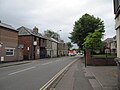
To the northwest, Oxpens Road becomes Hollybush Row, meeting at Frideswide Square, forming the major junction of the Botley Road, Park End Street and Hythe Bridge Street near the Saïd Business School and Oxford railway station (to the west of the city centre). To the southeast it becomes Thames Street, just north of the River Thames, and meets the junction with the south end of St Aldates near Christ Church Meadow (to the south of the city centre). It forms part of an inner ring road for the southwest part of the centre of Oxford.

Halfway along is the Oxford Ice Rink, a distinctive 1984 building by Nicholas Grimshaw, [2] which is the home of the Oxford City Stars ice hockey team. One of the campuses of the City of Oxford College is located here on the north side. The road crosses the southern end of the Castle Mill Stream just before it reaches the River Thames.

Oxpens Road also provides access to major car parks for the centre of Oxford, including the Westgate Shopping Centre. A redeveloped and greatly expanded shopping centre opened in 2017, but there have been concerns over the imposing and largely windowless wall at the southwest of the redevelopment on Oxpens Road by conservationists, including the Oxford Civic Society. [3]

History

Before 1850, Oxpens Road was known as Nun's Walk. This area used to be the location of a gasworks by the river. [4]

The locality was one of the poorer quarters of central Oxford. In the 1950s and 1960s there was large-scale clearance of the area, known as The Oxpens. Many residents were moved to Blackbird Leys, an estate consisting largely of council housing on the outskirts of southeast Oxford and close to Morris Motors Limited in Cowley, which provided employment. The area around Oxpens was almost entirely redeveloped during the second half of the 20th century.

Close to Oxpens Road on St Thomas Street was the Morrells Brewery (aka The Lion Brewery), near the Castle Mill Stream, which closed in 1998. [5]

See also

Next crossing upstream Castle Mill Stream Next crossing downstream
Swan Bridge Oxpens Road
Grid reference SP509058
none

Related Research Articles

<span class="mw-page-title-main">Oxford</span> City and district in Oxfordshire, England

Oxford is a cathedral city and non-metropolitan district in Oxfordshire, England, of which it is the county town. Founded in the 8th century, it was granted city status in 1542. The city is located at the confluence of the rivers Thames and Cherwell. It had a population of 163,257 in 2022. It is 56 miles (90 km) north-west of London, 64 miles (103 km) south-east of Birmingham and 61 miles (98 km) north-east of Bristol. The city is home to the University of Oxford, the oldest university in the English-speaking world; it has buildings in every style of English architecture since late Anglo-Saxon. Oxford's industries include motor manufacturing, education, publishing, science, and information technologies.

<span class="mw-page-title-main">Hunslet</span> Suburb of Leeds, West Yorkshire, England

Hunslet is an inner-city suburb in south Leeds, West Yorkshire, England. It is 1 mile (1.6 km) southeast of the city centre and has an industrial past.

<span class="mw-page-title-main">Cardiff city centre</span> Central Business District in Wales

Cardiff city centre is the city centre and central business district of Cardiff, Wales. The area is tightly bound by the River Taff to the west, the Civic Centre to the north and railway lines and two railway stations – Central and Queen Street – to the south and east respectively. Cardiff became a city in 1905.

<span class="mw-page-title-main">Botley, Oxfordshire</span> Human settlement in England

Botley is a village in the civil parish of Botley and North Hinksey, in the Vale of White Horse district, in the county of Oxfordshire, England, just west of the Oxford city boundary. Historically part of Berkshire, it stands on the Seacourt Stream, a stream running off the River Thames. The intersection of the A34 and A420 is to the village's north.

<span class="mw-page-title-main">Jericho, Oxford</span> Human settlement in England

Jericho is a historic suburb of the English city of Oxford. It consists of the streets bounded by the Oxford Canal, Worcester College, Walton Street and Walton Well Road. Located outside the old city wall, it was originally a place for travellers to rest if they had reached the city after the gates had closed. The name Jericho may have been adopted to signify this 'remote place' outside the wall. As of February 2021, the population of the Jericho and Osney wards was 6,995.

<span class="mw-page-title-main">A420 road</span> Road in England

The A420 is a road between Bristol and Oxford in England. Between Swindon and Oxford it is a primary route.

<span class="mw-page-title-main">Osney</span> Human settlement in England

Osney or Osney Island is a riverside community in the west of the city of Oxford, England. In modern times the name is applied to a community also known as Osney Town astride Botley Road, just west of the city's main railway station, on an island surrounded by the River Thames, Osney Ditch and another backwater connecting the Thames to Osney Ditch.

<span class="mw-page-title-main">St Aldate's, Oxford</span> Street in central Oxford, England

St Aldate's is a street in central Oxford, England, named after Saint Aldate, but formerly known as Fish Street.

<span class="mw-page-title-main">Westgate Oxford</span> Shopping mall in Oxford, England

Westgate Oxford is a major shopping centre in Oxford city centre, England, that was extensively remodelled and extended between 2016 and 2017.

<span class="mw-page-title-main">St Clement's, Oxford</span> District in Oxford, England

St Clement's is a district in Oxford, England, on the east bank of the River Cherwell. "St Clement's" is usually taken to describe a small triangular area from The Plain bounded by the River Cherwell to the North, Cowley Road to the South, and the foot of Headington Hill to the East. It also refers to the ecclesiastical parish of St Clement's which includes some neighbouring areas and is used in the names of local City and County electoral districts.

<span class="mw-page-title-main">The Plain, Oxford</span>

The Plain is an important junction, now a roundabout constructed in 1950, just east of Magdalen Bridge in Oxford, England. To the east and southeast are St Clement's, Cowley Road and Iffley Road which leads to the Liddell Buildings of Christ Church on the other side of the Christ Church Meadow. Magdalen College School is to the south. Cowley Place, also to the south, leads to St Hilda's College, the most easterly college of the University of Oxford.

<span class="mw-page-title-main">Winchester Road, Oxford</span> Road in North Oxford, England

Winchester Road is a road in North Oxford, England. It runs north–south between and roughly parallel with Woodstock Road to the west and Banbury Road to the east. It is in a desirable area with high house prices.

<span class="mw-page-title-main">St. Ebbes</span> District of central Oxford, England

St Ebbes is a district of central Oxford, England, southwest of Carfax. St Ebbes Street runs south from the western end of Queen Street.

<span class="mw-page-title-main">Hythe Bridge Street</span> Street in central Oxford, England

Hythe Bridge Street is in the west of central Oxford, England, forming part of the A4144 road.

<span class="mw-page-title-main">Castle Mill Stream</span> Stream in Oxfordshire, England

Castle Mill Stream is a backwater of the River Thames in the west of Oxford, England. It is 5.5 km long.

<span class="mw-page-title-main">Park End Street</span> Street in central Oxford, England

Park End Street is a street in central Oxford, England, to the west of the centre of the city, close to the railway station at its western end.

<span class="mw-page-title-main">Pullens Lane</span> Road in Headington, east Oxford, England

Pullens Lane is in Headington, east Oxford, England. It is located at the top of Headington Hill, leading north off Headington Road to Jack Straw's Lane and Harberton Mead. The cul-de-sac Pullens Field leads off west from Pullens Lane.

<span class="mw-page-title-main">Walton Well Road</span> Road in Oxford, England

Walton Well Road is a road, about 400 metres long, near the centre of Oxford, England. It provides a link from central Oxford to Port Meadow.

<span class="mw-page-title-main">Frideswide Square</span> Square in Oxford, England

Frideswide Square is a square to the west of central Oxford, England. The square is named after the patron saint of Oxford, St Frideswide.

<span class="mw-page-title-main">Morrell's Brewing Company</span> Brewery in Oxford, England

Morrell's Brewing Company, also known as the Lion Brewery, was the only major brewery in Oxford, England. It operated between 1782 and 1998.

References

  1. Sherwood, Jennifer; Pevsner, Nikolaus (1974). The Buildings of England: Oxfordshire. Penguin Books. pp. 303, 328. ISBN   0-14-071045-0.
  2. 1 2 3 Tyack, Geoffrey (1998). Oxford: An architectural guide. Oxford University Press. pp. 334–335. ISBN   0-14-071045-0.
  3. Ffrench, Andy (25 May 2017). "Concerns over centre's 'stark' wall – Part of design for Westgate is critised [sic]". Oxford Times . p. 7.
  4. "Oxford – Berkshire: 006/03, Ordnance Survey 1:2,500 —Epoch 1". www.british-history.ac.uk. UK: British History Online. 1878. Retrieved 28 December 2012.
  5. "Morrells Brewery up for Sale". www.thisisoxfordshire.co.uk. UK: Newsquest Media Group. 9 July 1998. Archived from the original on 1 December 2008. Retrieved 28 December 2012.