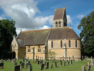
Marston is a village in the civil parish of Old Marston about 2 miles (3 km) northeast of the centre of Oxford, England. It was absorbed within the city boundaries in 1991. It is commonly called Old Marston to distinguish it from the suburb of New Marston that developed between St. Clement's and the village in the 19th and 20th centuries. The A40 Northern Bypass, part of the Oxford Ring Road forms a long north-west boundary of the village and parish and a limb, namely a distributary, of the Cherwell forms the western boundary.

Eynsham is an English village and civil parish in Oxfordshire, about 5 miles (8 km) north-west of Oxford and east of Witney. The 2011 Census recorded a parish population of 4,648. It was estimated at 5,087 in 2020.

Sir Arthur William Blomfield was an English architect. He became president of the Architectural Association in 1861; a Fellow of the Royal Institute of British Architects in 1867 and vice-president of the RIBA in 1886. He was educated at Trinity College, Cambridge, where he studied Architecture.

Headington is an eastern suburb of Oxford, in the county of Oxfordshire, England. It is at the top of Headington Hill overlooking the city in the Thames valley below, and bordering Marston to the north-west, Cowley to the south, and Barton and Risinghurst to the east. The life of the large residential area is centred upon London Road, the main road between London and Oxford.
Grandpont is a mainly residential area in south Oxford. It is west of Abingdon Road, and consists mainly of narrow streets that run at right angles to the main road, with terraced late-Victorian and Edwardian houses.

Summertown in North Oxford is a suburb of Oxford, England. Summertown is a one-mile square residential area, north of St Giles, the boulevard leading out of Oxford's city centre. Summertown is home to several independent schools and the city's most expensive houses. On both sides of Banbury Road are Summertown's popular shops. There is also a smaller street of shops and restaurants, South Parade, that links Banbury Road and Woodstock Road. Summertown is home to much of Oxford's broadcast media. BBC Radio Oxford and the BBC Television's Oxford studios are on Banbury Road. Start-ups also have an increasing presence on the parade, such as Brainomix and Passle. The studios for JACK FM, Glide FM, and Six TV Oxford are on Woodstock Road.

St Clement's is a district in Oxford, England, on the east bank of the River Cherwell. "St Clement's" is usually taken to describe a small triangular area from The Plain bounded by the Cherwell in the West, Cowley Road in the East. to the foot of Headington Hill in the South. It also refers to the ecclesiastical parish of St Clement's which includes some neighbouring areas and is used in the names of local City and County electoral districts.

Goring Heath is a hamlet and civil parish in the Chiltern Hills in South Oxfordshire. The civil parish includes the villages of Whitchurch Hill and Crays Pond and some small hamlets. Goring Heath is centred 3 miles (4.8 km) southeast of Goring-on-Thames and about 4 miles (6.4 km) northwest of Reading, Berkshire. In 1724 Henry Alnutt, a lawyer of the Middle Temple in London, established a set of almshouses at Goring Heath. They form three sides of a courtyard, flanking a chapel of the same date. In the 1880s a school was built beside the almshouses in what was intended to be the same architectural style. A post office was added in 1900.
New Hinksey is a suburb in the south of the city of Oxford.

St. Giles' Church is a church in North Oxford, England. It is at the northern end of the wide thoroughfare of St Giles', at the point where it meets Woodstock Road and Banbury Road. It stands between where Little Clarendon Street joins Woodstock Road and Keble Road joins Banbury Road.
St Ebbes is a district of central Oxford, England, southwest of Carfax. St Ebbes Street runs south from the western end of Queen Street.

Stanton Harcourt is a village and civil parish in Oxfordshire about 4 miles (6.4 km) southeast of Witney and about 6 miles (10 km) west of Oxford. The parish includes the hamlet of Sutton, 1⁄2 mile (800 m) north of the village. The 2011 Census recorded the parish's population as 960.

Cassington is a village and civil parish in Oxfordshire about 5 miles (8 km) northwest of Oxford. The village lies on gravel strata about 1⁄2 mile (800 m) from the confluence of the River Evenlode with the River Thames. The parish includes the hamlet of Worton northeast of the village and the site of the former hamlet of Somerford to the south. Somerford seems to have been abandoned early in the 14th century. Cassington is formed of two parts, "upper" and "lower", each with its own village green. The 2011 Census recorded the parish's population as 750.
Freeland is a village and civil parish about 4 miles (6.4 km) northeast of Witney in Oxfordshire. The 2021 Census recorded the parish population as 1,490.

Church Hanborough is a village in Hanborough civil parish about 5 miles (8 km) northeast of Witney in Oxfordshire.
Henry Jones Underwood (1804–1852) was an English architect who spent most of his career in Oxford. He was the brother of the architects Charles Underwood and George Allen Underwood.
Clapton Crabb Rolfe was an English Gothic Revival architect whose practice was based in Oxford.

Wilcote is a hamlet about 3+1⁄2 miles (5.6 km) north of Witney in Oxfordshire, England.

New Road is a street in west central Oxford, England. It links Park End Street and Worcester Street to the west with Queen Street and Castle Street to the east. To the south is Oxford Castle and the former Oxford Prison, now a Malmaison hotel. To the north is Nuffield College, a graduate college of Oxford University. At the eastern end on the south side is New County Hall, the headquarters of Oxfordshire County Council.
Thomas Lawrence Dale, FRIBA, FSA was an English architect. Until the First World War he concentrated on designing houses for private clients. From the 1930s Dale was the Oxford Diocesan Surveyor and was most noted for designing, restoring, and furnishing Church of England parish churches.