Fruitdale, Indiana

Last updated

Fruitdale, Indiana
Map of Indiana highlighting Brown County.svg
Brown County's location in Indiana
Location map of Brown County, Indiana.svg
Red pog.svg
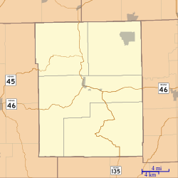
Fruitdale
Location in Brown County
Coordinates: 39°19′19″N86°15′28″W / 39.32194°N 86.25778°W / 39.32194; -86.25778
Country United States
State Indiana
County Brown
Township Jackson
Elevation
[1]
843 ft (257 m)
Time zone UTC-5 (Eastern (EST))
  Summer (DST) UTC-4 (EDT)
ZIP code
46160
Area codes 812 & 930
FIPS code 18-26080 [2]
GNIS feature ID434882 [1]

Fruitdale is an unincorporated community in Jackson Township, Brown County, in the U.S. state of Indiana. [1]

History

A post office was established at Fruitdale in 1909, and remained in operation until 1937. [3] The community was likely named from fruit orchards nearby. [4]

References

  1. 1 2 3 U.S. Geological Survey Geographic Names Information System: Fruitdale, Indiana
  2. "U.S. Census website". United States Census Bureau . Retrieved January 31, 2008.
  3. "Brown County". Jim Forte Postal History. Archived from the original on September 3, 2014. Retrieved August 28, 2014.
  4. Baker, Ronald L. (October 1995). From Needmore to Prosperity: Hoosier Place Names in Folklore and History . Indiana University Press. p.  140. ISBN   978-0-253-32866-3. ...it is generally believed that it comes from the location of the village, in the fruit belt.