Hamblen Township | |
|---|---|
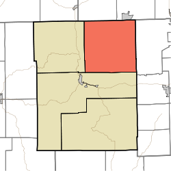 Location of Hamblen Township in Brown County | |
| Coordinates: 39°16′58″N86°09′34″W / 39.28278°N 86.15944°W | |
| Country | United States |
| State | Indiana |
| County | Brown |
| Government | |
| • Type | Indiana township |
| Area | |
• Total | 64.92 sq mi (168.1 km2) |
| • Land | 63.97 sq mi (165.7 km2) |
| • Water | 0.95 sq mi (2.5 km2) |
| Elevation | 840 ft (256 m) |
| Population (2020) | |
• Total | 4,470 |
| • Density | 69.9/sq mi (27.0/km2) |
| Time zone | UTC-5 (Eastern (EST)) |
| • Summer (DST) | UTC-4 (EDT) |
| Area codes | 812 & 930 |
| FIPS code | 18-30528 [2] |
| GNIS feature ID | 453363 |
Hamblen Township is one of four townships in Brown County, Indiana. [3] As of the 2020 census, its population was 4,470 (up from 4,336 at 2010 [4] ) and it contained 2,641 housing units. [5]
Contents
| Census | Pop. | Note | %± |
|---|---|---|---|
| 1890 | 1,959 | — | |
| 1900 | 1,923 | −1.8% | |
| 1910 | 1,524 | −20.7% | |
| 1920 | 1,331 | −12.7% | |
| 1930 | 932 | −30.0% | |
| 1940 | 1,184 | 27.0% | |
| 1950 | 1,228 | 3.7% | |
| 1960 | 1,398 | 13.8% | |
| 1970 | 2,007 | 43.6% | |
| 1980 | 3,365 | 67.7% | |
| 1990 | 4,032 | 19.8% | |
| 2000 | 4,591 | 13.9% | |
| 2010 | 4,336 | −5.6% | |
| 2020 | 4,470 | 3.1% | |
| Source: US Decennial Census [6] | |||
