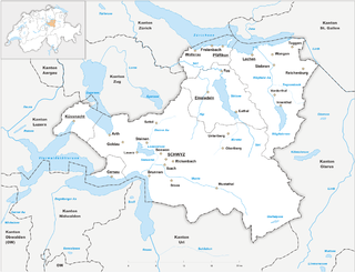
The canton of Schwyz is a canton in central Switzerland between the Alps in the south, Lake Lucerne to the west and Lake Zürich in the north, centered on and named after the town of Schwyz.

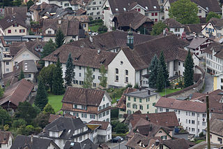
The town of Schwyz is the capital of the canton of Schwyz in Switzerland.

Einsiedeln is a municipality and district in the canton of Schwyz in Switzerland known for its monastery, the Benedictine Einsiedeln Abbey, established in the 10th century.

Pfäffikon is the principal town of the Municipality of Freienbach in the canton of Schwyz (SZ) in Switzerland. Together with Wollerau, Pfäffikon is considered the principal town of the district (Bezirk) of Höfe and the center of the region of Ausserschwyz. The former farm town is known today as cultural, economic and service center with its main focus on hedge funds. With 7,200 residents Pfäffikon is the third biggest town of the canton after Küssnacht and Einsiedeln.

Pragel Pass is a high mountain pass in the Swiss Alps between the cantons of Schwyz and Glarus between Muotathal and Netstal. The pass itself is located in the canton of Schwyz.
The Frank was the currency of the Swiss canton of Schwyz between 1798 and 1850. It was subdivided into 10 Batzen, each of 10 Rappen or 20 Angster. It was worth 1⁄4th the French silver écu or 6.67 g fine silver.

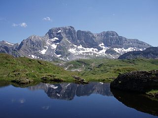
The Bös Fulen is a mountain in the Schwyz Alps, located on the border between the cantons of Schwyz and Glarus. It overlooks the valleys of Muotathal (Schwyz) and Linthal. It is the highest summit of the canton of Schwyz. Politically, it is split between the municipalities of Muotathal (Schwyz) and Glarus. Braunwald is the nearest locality.

The Ortstock is a mountain in the Schwyzer Alps, located at an elevation of 2,717 m (8,914 ft) on the border between the cantons of Schwyz and Glarus. It overlooks Braunwald and Linthal on its east side, while the west side overlooks the high valley of Glattalp.
The Schijen is a mountain of the Glarus Alps in Switzerland, located west of the Ortstock. The summit is the tripoint between the cantons of Schwyz, Uri and Glarus. The Schijen lies on the range that lies between the Glattalp and the Urner Boden.

The Wildspitz is the highest summit of the Rossberg, a mountain of the Schwyzer Alps, located on the border between the Swiss cantons of Zug and Schwyz. Reaching a height of 1,580 metres above sea level, it is the highest summit in the canton of Zug.

Arth-Goldau railway station is a railway station in the Swiss canton of Schwyz and municipality of Arth. The station is located in the centre of the village of Goldau, which forms part of Arth.

The Wasserbergfirst is a mountain of the Schwyz Alps, located south of Muotathal in the canton of Schwyz. It lies on the range between the Hürital and the Bisistal, north of the Schächentaler Windgällen.

The Chaiserstock is a mountain of the Schwyzer Alps, located on the border between the Swiss cantons of Schwyz and Uri. It lies on the range between Muotathal and Unterschächen, east of Lake Lucerne.

The Rossstock is a mountain of the Schwyzer Alps, located on the border between the Swiss cantons of Schwyz and Uri. It lies on the range between Muotathal and Unterschächen, east of Lake Lucerne.
The Hoch Fulen is a mountain of the Glarus Alps, located east of Erstfeld in the Uri. It lies in the group north-west of the Gross Windgällen, between the Reuss valley and the Schächental.

The Brünnelistock is a mountain of the Schwyzer Alps, located on the border between the cantons of Schwyz and Glarus. It lies north of the Mutteristock, on the range between the Wägitalersee and the Obersee.

The Eggstock is a mountain of the Schwyzer Alps, located on the border between the Swiss canton of Schwyz and canton of Glarus, north of Braunwald. It lies on the range east of the Bös Fulen, between the valley of Bösbächi and the cirque of Braunwald and is composed of three summits: the Hinterer Eggstock, the Mittlerer Eggstock and the Vorderer Eggstock.

The Schiberg is a mountain of the Schwyz Alps, located on the border between the Swiss cantons of Schwyz and Glarus. It overlooks the Wägitalersee on its west side.

The Schwyz Alps are a mountain range in Switzerland. They form part of the North-Eastern Swiss Alps and are bordered by the Glarus Alps to the east, the Appenzell Alps to the north-east, the Emmental Alps in the west, and the Uri Alps to the south-west. The Klausen Pass is the highest point between the Schwyz Alps and the Glarus Alps.


