
The Matterhorn is a mountain of the Alps, straddling the main watershed and border between Switzerland and Italy. It is a large, near-symmetric pyramidal peak in the extended Monte Rosa area of the Pennine Alps, whose summit is 4,478 metres (14,692 ft) high, making it one of the highest summits in the Alps and Europe. The four steep faces, rising above the surrounding glaciers, face the four compass points and are split by the Hörnli, Furggen, Leone/Lion, and Zmutt ridges. The mountain overlooks the Swiss town of Zermatt, in the canton of Valais, to the northeast; and the Italian town of Breuil-Cervinia in the Aosta Valley to the south. Just east of the Matterhorn is Theodul Pass, the main passage between the two valleys on its north and south sides, which has been a trade route since the Roman Era.

Breuil-Cervinia is a frazione of the comune of Valtournenche, and is considered one of the most renowned winter and summer tourist resorts in the Alps.

The Grenzgipfel is a peak of Monte Rosa Massif, located on the border between Italy and Switzerland.

Mont Brulé is a mountain of the Pennine Alps, located on the Swiss-Italian border, east of the Col Collon. On its northern side it overlooks the upper Arolla Glacier.
The Sonnighorn is a mountain of the Pennine Alps, located on the Swiss-Italian border. The closest locality is Saas Almagell on the west side.

The Portjengrat is a mountain of the Pennine Alps, located on the border between Switzerland and Italy. It lies south of the Weissmies and the Zwischbergen Pass, where the international border diverges away from the main Alpine watershed. The summit of the Portjengrat has an elevation of 3,654 metres above sea level and is the tripoint between the valleys of Saas, Divedro and Antrona. It is the culminating point of the Antrona valley.

The Corno Campascio is a mountain of the Bernina Range (Alps), located on the border between Italy and Switzerland. It lies between the Val Malenco and the Val Poschiavo. The closest locality is Poschiavo on the east side.

Piz Terza is a mountain in the Sesvenna Range of the Alps, located on the border between Italy and Switzerland.
The Sulzfluh is a mountain in the Rätikon range of the Alps, located on the border between Austria and Switzerland. The closest locality is St. Antönien, on the southern side.

Piz Sesvenna is the highest mountain in the Sesvenna Range of the Alps. It lies between the Swiss canton of Graubünden and the Italian region of South Tyrol. The summit is located within Switzerland, very close to the Italian border and main watershed.
The Camoscellahorn is a mountain of the Pennine Alps, located on the Swiss-Italian border. The closest locality is Gondo in the Swiss Val Divedro.
The Punta Valgrande is a mountain of the Lepontine Alps, located on the border between Switzerland and Italy. The west side belongs to the Swiss canton of Valais and the east side belongs to the Italian region of Piedmont.

The Magerrain is a mountain of the Glarus Alps, located on the border between the cantons of Glarus and St. Gallen in Eastern Switzerland. Reaching an elevation of 2,524 metres above sea level, the Magerrain is the highest summit of the range north of the Walabützer Furggle and the Risitenpass.

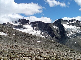
Gobba di Rollin is a mountain of the Pennine Alps, straddling the border between Switzerland and Italy. It is located south of the Breithorn and it is largely covered by ice, the summit area being particularly flat. On the north side is the Breithorn Plateau of the Theodul Glacier, on the east side is the Verraz Glacier and on the south is the Glacier d'Aventine.

Theodul Pass, elevation 3,295 metres (10,810 ft), is a high mountain pass across the eastern Pennine Alps, connecting Zermatt in the Swiss canton of Valais and Breuil-Cervinia in the Italian region of Aosta Valley. Theodul Pass is the lowest and the easiest pass between the valleys of Zermatt and Valtournanche.

Refuge Jean-Antoine Carrel is a refuge in the Alps at an altitude of 3,830m in Aosta Valley, Italy. It is located on the south-west ridge of the Matterhorn, near the Swiss border.
Isentällispitz is a mountain of the Silvretta Alps, located on the border between Austria and Switzerland. The closest locality is Klosters on the Swiss side.
Testa Grigia is a rocky prominence above the Theodul Pass, located on the border between Italy and Switzerland (Valais). It overlooks the Plateau Rosa section of the Theodul Glacier on its east side.
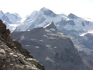
The Furggen is a mountain of the Pennine Alps, located on the border between Italy and Switzerland (Valais). It is the culminating point of the ridge named Furgggrat stretching from the Furggjoch to the Theodul Pass, and is located halfway between the Matterhorn and Testa Grigia.
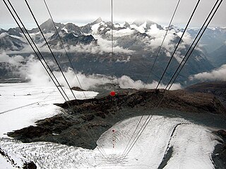
The Theodul Glacier is a glacier of the Alps, located south of Zermatt in the canton of Valais. It lies on the Swiss side of the Pennine Alps, although its upper basin touches the Italian region of the Aosta Valley. The glacier descends from the west side of the Breithorn and splits into two diverging branches above Gandegg: the Upper Theodul Glacier, spilling on a high plateau near Trockener Steg, together with the Furgg Glacier, and the Lower Theodul Glacier, reaching a height of about 2,500 metres (8,202 ft) above the Gorner Glacier. Both branches are part of the Rhone basin, through the rivers Gornera, Mattervispa, and Vispa. Slightly above the glacier splitting is the Theodul Pass, crossing the border between Switzerland and Italy, and connecting Zermatt to Breuil-Cervinia. On the west, the Theodul Glacier is overlooked by the Matterhorn.

