
Wayanad is a district in the north-east of the Indian state of Kerala, with administrative headquarters at the municipality of Kalpetta. It is the only plateau in Kerala. The Wayanad Plateau forms a continuation of the Mysore Plateau, the southern portion of the Deccan Plateau. It is set high in the Western Ghats with altitudes ranging from 700 to 2,100 meters. Vellari Mala, a 2,240 m (7,349 ft) high peak situated on the trijunction of Wayanad, Malappuram, and Kozhikode districts, is the highest point in Wayanad district. The district was formed on 1 November 1980 as the 12th district in Kerala, by carving out areas from Kozhikode and Kannur districts. An area of 885.92 km2 in the district is forested. Wayanad has three municipal towns—Kalpetta, Mananthavady and Sulthan Bathery. There are many indigenous tribes in this area. The Kabini River, a tributary of the Kaveri River, originates at Wayanad. Wayanad district, along with the Chaliyar valley in the neighbouring Nilambur in Malappuram district, is known for natural gold fields, which are also seen in other parts of the Nilgiri Biosphere Reserve. The Chaliyar river, which is the fourth longest river of Kerala, originates on the Wayanad plateau. The historically important Edakkal Caves are located in Wayanad district.

Palakkad is one of the 14 districts in the Indian state of Kerala. It was carved out of the southeastern region of the former Malabar District on 1 January 1957. It is located at the central region of Kerala and is the second largest district in the state after Idukki. The city of Palakkad is the district headquarters. Palakkad is bordered on the northwest by the Malappuram district, on the southwest by the Thrissur district, on the northeast by Nilgiris district, and on the east by Coimbatore district of Tamil Nadu. The district is nicknamed "The granary of Kerala". Palakkad is the gateway to Kerala due to the presence of the Palakkad Gap, in the Western Ghats. The 2,383 m high Anginda peak, which is situated in the border of Palakkad district, Nilgiris district, and Malappuram district, in Silent Valley National Park, is the highest point of elevation in Palakkad district. Palakkad city is about 347 kilometres (216 mi) northeast of the state capital, Thiruvananthapuram.
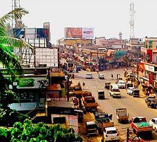
Sultan Bathery is a town and municipality in the Wayanad district of Kerala, India, near its borders with Tamil Nadu and Karnataka. Once known as a strategic location in the Malabar region, Sultan Bathery is the headquarters of the Sultan Bathery taluk.
Kottakkal is a major municipal town in Malappuram district in Kerala, southern India having 32 wards. it is a part of Malappuram metropolitan area and a growing city in Kerala. The town is best known for the Arya Vaidya Sala, one of the top Ayurvedic health centres of the world. Kottakkal is also a major growing commercial, educational, and healthcare hub in South Malabar. The town lies on Mumbai–Kanyakumari National Highway 66.
The economy of Kerala is the 9th largest in India, with an annual gross state product (GSP) of ₹9.78 lakh crore in 2020–2021. Per-capita GSP of Kerala during the same period is ₹257,711 (US$3,100), the sixth largest in India. In 2019–20, the tertiary sector contributed around 63% of the state's GSVA, compared to 28% by secondary sector, and 8% by primary sector.
Kuthuparamba or Koothuparamba is a town and a municipality in the Kannur district, state of Kerala, India. It is about 24 km south-east of Kannur and 14 km east of Thalassery.

Peravoor is a town and Grama Panchayat in Kannur district of Kerala state in India. It is located 50 km (31 mi) east of Kannur and 40 km (25 mi) north east of Thalassery. And Iritty, the nearest municipality is 14 km (8.7 mi) north of Peravoor. Peravoor is situated in the Western Ghats mountain range.

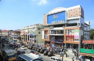
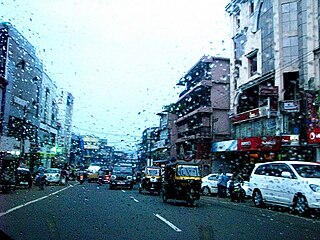
Palakkad, also known as Palghat, historically known as Palakkattussery, is a city and municipality in the Indian state of Kerala. It is the administrative headquarters of Palakkad District. Palakkad is the most densely populated municipality and the fourth-most densely populated city in the state. It was established before Indian independence under British rule and known by the name Palghat. Palakkad is famous for the ancient Palakkad Fort, which is in the heart of the city and was captured and rebuilt by Hyder Ali in 1766 which later fell into the hands of Zamorin in 1784. The city is about 347 kilometres (216 mi) northeast of the state capital, Thiruvananthapuram.

Kulathuvayal is a place near Perambra in Kozhikode district of Kerala state, India. Administratively, Kulathuvayal comes under the Chakkittapara panchayat, Perambra block panchayat and Koyilandy Taluk.

Thenhipalam is a census town and a panchayat in Tirurangadi taluk in Malappuram district of Kerala, India, with a population of 27,273 as per 2001 census, consisting of 13,293 males and 13,980 females. Tenhipalam forms a portion of the Malappuram metropolitan area as of 2011 Census. University of Calicut, the first university in the Malabar region, is located north-west part of the Panchayat. 'Chelari' is the main commercial place in Tenhipalam panchayat while 'Panambra' is considered the headquarters of the panchayat. The small town between Chelari and the university is called Kohinoor.

Maniyur Grama Panchayat is located in Vadakara Taluk, in the Kozhikode district in the state of Kerala, India. It covers an area of 31.03 km2.

Puthuppadi is a village and Panchayath located in Kozhikode district of Kerala, India. Puthuppadi Grama Panchayat covers an area of 64.75 km2 and is spread over the villages of Engapuzha and Puthuppadi. The panchayat is bounded on the north by Thamarassery, Kattippara, Kodenchery, Vythiri (Wayanad) panchayats, on the east by Vythiri (Wayanad) and Kodancheri panchayats, on the south by Thamarassery and Kodancheri panchayats and on the west by Kattippara panchayat. Famous Wayandan Churam or Wayandan Pass, which has nine hairpins between Adivaram of Puthuppady Panchayath and Lakkidi of Vythri Panchayath, is in Puthuppadi Panchayat.
Kakkodi is a Panchayath in Kozhikode district of Kerala. The Panchayath borders Kozhikode corporation on one side and the panchayaths kuruvattur, Chelannur, thalakkulathur and Elathur, on the other sides.
Government College Kottayam is an arts and science college run by the state government of Kerala, India. It is affiliated to the Mahatma Gandhi University and is located in Nattakom, close to Kottayam in central Kerala.

Aroli is a village of Pappinisseri Panchayat in Kannur district in the Indian state of Kerala.

Meenangadi is an old town situated on the highway NH 766 between Kalpetta and Sulthan Bathery in Wayanad District, in Kerala, India. This place is one among the Provinces where the existence of Dolmens provide an historical evidence of earlier civilisation. Coffee bean, Black pepper, Ginger, Rice and Areca are the major crops cultivated in this area. Meenangadi is famous for its Fish Market and Cattle Market. The nearest railway station is at Kozhikode at 87 km and airport is Kannur International Airport with 94 km from Meenangadi. Meenangadi is surrounded by, Ambalavayal Panchayat, Kalpetta Taluk towards west, Gudalur Taluk towards East, Mananthavady Taluk towards west. Kalpetta, Sultan Bathery, Kozhikode are the nearby Cities and towns to Meenangadi.
Kerala's first carbon neutrality project launched in Meenangadi in June 2016. Upon achieving the goals of the project, Meenangadi will be the first village in India to go completely carbon neutral. Meenangadi has a population of 33450 According to 2011 Census with two Villages Purakkadi and (Part)Krishnagiri.
Athavanad is a village and Grama Panchayat in the Malappuram district, the Indian state of Kerala.
Vengara Grama Panchayat is grama panchayat in Malappuram district, Kerala, India. It is situated in Vengara village in Thiroorangadi taluk. This panchayat was the largest panchayat in Malappuram district and was divided into Vengara and Kannamangalam in 1999-2000 year. The current geographical area of the panchayat is 18.66 km2. Though 70% of people in the panchyat depends upon agriculture, the income source is overseas jobs.

Mookkannoor Govt. Higher Secondary school is a school situated at Mookkannoor Gram Panchayath, Ernakulam District, Kerala, India. The school is situated in Angamaly assembly constituency. The school was established on 1931. The school is situated near St. Mary's Forane church in Angamaly-Ezattumugham Road.
