
Hydrology is the scientific study of the movement, distribution, and management of water on Earth and other planets, including the water cycle, water resources, and drainage basin sustainability. A practitioner of hydrology is called a hydrologist. Hydrologists are scientists studying earth or environmental science, civil or environmental engineering, and physical geography. Using various analytical methods and scientific techniques, they collect and analyze data to help solve water related problems such as environmental preservation, natural disasters, and water management.

Hydrogeology is the area of geology that deals with the distribution and movement of groundwater in the soil and rocks of the Earth's crust. The terms groundwater hydrology, geohydrology, and hydrogeology are often used interchangeably.

A hydrograph is a graph showing the rate of flow (discharge) versus time past a specific point in a river, channel, or conduit carrying flow. The rate of flow is typically expressed in cubic meters or cubic feet per second . Hydrographs often relate changes of precipitation to changes in discharge over time. It can also refer to a graph showing the volume of water reaching a particular outfall, or location in a sewerage network. Graphs are commonly used in the design of sewerage, more specifically, the design of surface water sewerage systems and combined sewers.
The United States Environmental Protection Agency (EPA) Storm Water Management Model (SWMM) is a dynamic rainfall–runoff–subsurface runoff simulation model used for single-event to long-term (continuous) simulation of the surface/subsurface hydrology quantity and quality from primarily urban/suburban areas.

The law of water balance states that the inflows to any water system or area is equal to its outflows plus change in storage during a time interval. In hydrology, a water balance equation can be used to describe the flow of water in and out of a system. A system can be one of several hydrological or water domains, such as a column of soil, a drainage basin, an irrigation area or a city.

An hydrological transport model is a mathematical model used to simulate the flow of rivers, streams, groundwater movement or drainage front displacement, and calculate water quality parameters. These models generally came into use in the 1960s and 1970s when demand for numerical forecasting of water quality and drainage was driven by environmental legislation, and at a similar time widespread access to significant computer power became available. Much of the original model development took place in the United States and United Kingdom, but today these models are refined and used worldwide.
The HBV hydrology model, or Hydrologiska Byråns Vattenbalansavdelning model, is a computer simulation used to analyze river discharge and water pollution. Developed originally for use in Scandinavia, this hydrological transport model has also been applied in a large number of catchments on most continents.
Groundwater models are computer models of groundwater flow systems, and are used by hydrologists and hydrogeologists. Groundwater models are used to simulate and predict aquifer conditions.

A runoff models or rainfall-runoff model describes how rainfall is converted into runoff in a drainage basin. More precisely, it produces a surface runoff hydrograph in response to a rainfall event, represented by and input as a hyetograph. Rainfall-runoff models need to be calibrated before they can be used.

WMS is a watershed computer simulation and modeling software application from Aquaveo. It was originally created in the early 1990s at the Engineering Computer Graphics Laboratory at Brigham Young University.
MIKE SHE is an integrated hydrological modelling system for building and simulating surface water flow and groundwater flow. MIKE SHE can simulate the entire land phase of the hydrologic cycle and allows components to be used independently and customized to local needs. MIKE SHE emerged from Système Hydrologique Européen (SHE) as developed and extensively applied since 1977 onwards by a consortium of three European organizations: the Institute of Hydrology, SOGREAH (France) and DHI (Denmark). Since then, DHI has continuously invested resources into research and development of MIKE SHE. MIKE SHE can be used for the analysis, planning and management of a wide range of water resources and environmental problems related to surface water and groundwater, especially surface-water impact from groundwater withdrawal, conjunctive use of groundwater and surface water, wetland management and restoration, river basin management and planning, impact studies for changes in land use and climate.

A hydrologic model is a simplification of a real-world system that aids in understanding, predicting, and managing water resources. Both the flow and quality of water are commonly studied using hydrologic models.
GSSHA is a two-dimensional, physically based watershed model developed by the Engineer Research and Development Center of the United States Army Corps of Engineers. It simulates surface water and groundwater hydrology, erosion and sediment transport. The GSSHA model is used for hydraulic engineering and research, and is on the Federal Emergency Management Agency (FEMA) list of hydrologic models accepted for use in the national flood insurance program for flood hydrograph estimation. Input is best prepared by the Watershed Modeling System interface, which effectively links the model with geographic information systems (GIS).
Hydrological optimization applies mathematical optimization techniques to water-related problems. These problems may be for surface water, groundwater, or the combination. The work is interdisciplinary, and may be done by hydrologists, civil engineers, environmental engineers, and operations researchers.
The following outline is provided as an overview of and topical guide to hydrology:
Vflo is a commercially available, physics-based distributed hydrologic model generated by Vieux & Associates, Inc. Vflo uses radar rainfall data for hydrologic input to simulate distributed runoff. Vflo employs GIS maps for parameterization via a desktop interface. The model is suited for distributed hydrologic forecasting in post-analysis and in continuous operations. Vflo output is in the form of hydrographs at selected drainage network grids, as well as distributed runoff maps covering the watershed. Model applications include civil infrastructure operations and maintenance, stormwater prediction and emergency management, continuous and short-term surface water runoff, recharge estimation, soil moisture monitoring, land use planning, water quality monitoring, and water resources management.
The HUMUS project is a project that was funded by the Natural Resources Conservation Service to model the non-point source loading from 8-digit hydrologic unit cataloging units.
DPHM-RS is a semi-distributed hydrologic model developed at University of Alberta, Canada.
Aquaveo is a modeling software company based in Provo, Utah that develops software used to model and simulate groundwater, watershed, and surface water resources. Its main software products include SMS, GMS, WMS, and Arc Hydro Groundwater.

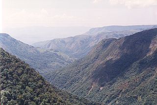
Watershed delineation is the process of identifying the boundary of a watershed, also referred to as a catchment, drainage basin, or river basin. It is an important step in many areas of environmental science, engineering, and management, for example to study flooding, aquatic habitat, or water pollution.


