
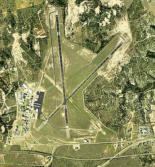
Waco Regional Airport is five miles northwest of Waco, in McLennan County, Texas. It is owned by the City of Waco.

Salinas Municipal Airport, commonly referred to as Salinas Airport is an airport in Monterey County, California, United States, three miles (4.8 km) southeast of Downtown Salinas. It is included in the 2017–21 National Plan of Integrated Airport Systems as a regional general aviation airport. It had 1,800 enplanements in 2014.

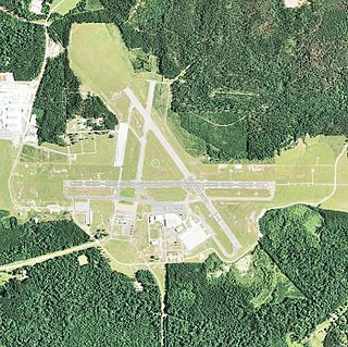
Reading Regional Airport, also known as Carl A. Spaatz Field, is a public airport three miles (5 km) northwest of Reading, in Bern Township, Berks County, Pennsylvania. It is owned by the Reading Regional Airport Authority.

Apalachicola Regional Airport is a county-owned, public-use airport located two nautical miles (4 km) west of the central business district of Apalachicola, a city in Franklin County, Florida, United States. It is included in the National Plan of Integrated Airport Systems for 2011–2015, which categorized it as a general aviation facility. It was previously known as Apalachicola Municipal Airport. The airport supports general aviation activity in the area and provides service via a tenant fixed-base operator (FBO).

Majors Airport is a city-owned airport 4 nautical miles (7.4 km) southeast of the central business district of Greenville, in Hunt County, Texas.

Cox Field is an airport seven miles east of Paris, in Lamar County, Texas. It is owned by the city of Paris but is operated and maintained by J.R. Aviation, the airport's fixed-base operator (FBO).

Jacqueline Cochran Regional Airport is a county-owned, public-use airport in Riverside County, California, United States. It is located in the southeastern Coachella Valley, 20 nautical miles southeast of the central business district of Palm Springs, in Thermal, California. This airport is included in the National Plan of Integrated Airport Systems for 2011–2015, which categorized it as a general aviation facility.
Bisbee Douglas International Airport is a county-owned airport 9 miles northwest of Douglas and 17 miles east of Bisbee, both in Cochise County, Arizona, United States, that was formerly known as Douglas Army Airfield. The FAA's National Plan of Integrated Airport Systems for 2009–2013 categorizes it as a general aviation facility.

Blythe Airport is seven miles west of Blythe, in Riverside County, California, United States. The National Plan of Integrated Airport Systems for 2011–2015 categorized it as a general aviation facility.

Brooksville–Tampa Bay Regional Airport, formerly known as Hernando County Airport, is a joint civil-military public airport located 6 nautical miles (11 km) southwest of the central business district of Brooksville, a city in Hernando County, Florida, United States. It is owned by Hernando County and is 45 miles (72 km) north of Tampa. While having consistent growth in its traffic rate, it does not yet serve the public through commercial airlines, but it does have charter and executive service.

Statesboro–Bulloch County Airport is a public airport located three miles (5 km) northeast of the central business district of Statesboro, a city in Bulloch County, Georgia, United States. It is owned by the City of Statesboro and Bulloch County. Currently, there is no commercial service to the airport.
Avenger Field is a Texas airport in Nolan County, three miles west of Sweetwater. The National Plan of Integrated Airport Systems for 2011–2015 called it a general aviation facility.

Immokalee Regional Airport is a public use airport located one nautical mile (2 km) northeast of the central business district of Immokalee, in Collier County, Florida, United States. The airport is owned by the Collier County Airport Authority. Formerly known as Immokalee Airport, it is included in the National Plan of Integrated Airport Systems for 2011–2015, which categorized it as a general aviation facility.

La Junta Municipal Airport is three miles north of La Junta, in Otero County, Colorado, United States. The National Plan of Integrated Airport Systems for 2011–2015 categorized it as a general aviation facility.

Vidalia Regional Airport is a city-owned public-use airport located three nautical miles (6 km) southeast of the central business district of the city Vidalia, in Toombs County, Georgia, United States.
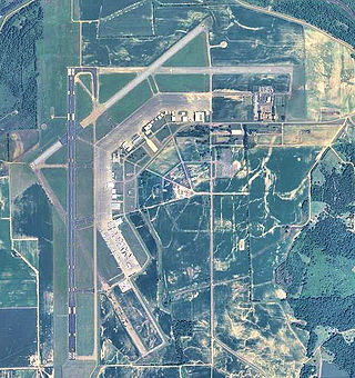
Esler Field, also known as Esler Regional Airport, is a military and public use airfield in Rapides Parish, Louisiana, United States, near the City of Pineville. It is located 10 nautical miles northeast of the central business district of Alexandria, Louisiana, The airfield is owned by the Louisiana Army National Guard and is the home of Army Aviation Support Facility #2 (AASF#2).
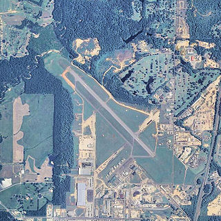
Greenwood–Leflore Airport is a public airport located seven miles east of Greenwood, the county seat of Leflore County, Mississippi, United States. It is owned by the City of Greenwood and Leflore County, but is geographically located in Carroll County.
Hesler-Noble Field is a public airport in Jones County, Mississippi. It is owned by Laurel Airport Authority and is three miles southwest of Laurel, Mississippi.

Thompson–Robbins Airport is 6 miles (9.7 km) northwest of the center of Helena–West Helena, in unincorporated Phillips County, Arkansas, United States. It is owned by the city of Helena–West Helena.
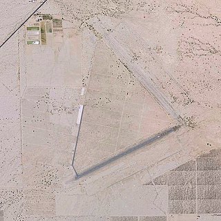
Desert Center Airport is a private-use airport located five nautical miles northeast of the central business district of Desert Center, in Riverside County, California, United States.


