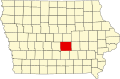
Galesburg, Iowa

Last updated

Galesburg, Iowa
USA Iowa location map.svg
Red pog.svg
Galesburg, Iowa
Coordinates: 41°33′32″N92°56′47″W / 41.55889°N 92.94639°W / 41.55889; -92.94639
Country United States
State Iowa
County Jasper
Elevation
896 ft (273 m)
Time zone UTC-6 (Central (CST))
  Summer (DST) UTC-5 (CDT)
GNIS feature ID456811 [1]

Galesburg is an unincorporated community in Jasper County, in the U.S. state of Iowa. [1]

Contents

Geography

Galesburg lies along the junction of Main Street/Sioux Avenue and Highway T14 S. [2]

History

Galesburg was platted on Section 16 of Elk Creek Township. In 1878 it was described as "a little village" with a large store and a recently completed railroad. [3]

The Galesburg post office opened in 1857 (originally under the name Galesburgh) and closed in 1904. [4]

Galesburg was once a "thriving farm community with three grocery stores, several taverns and a hotel." [5] The population of Galesburg was 160 in 1887, [6] and was 88 in 1902. [7] The population was 89 in 1917. [8] The population was 50 in 1940. [9]

In 2003, Iowa Governor Tom Vilsack made an official visit to Galesburg, where he planted a tree in the community's park. [5]

See also

Related Research Articles

<span class="mw-page-title-main">Valeria, Iowa</span> City in Iowa, United States

Valeria is a city in Jasper County, Iowa, United States. The population was 39 at the time of the 2020 census.

Ira is an unincorporated community located in Independence Township, Jasper County, Iowa, United States. The population in 2010 was 29 people.

Viola Center was an unincorporated community in Audubon County, Iowa, in the United States.

Finchford is an unincorporated community in Union Township, Black Hawk County, Iowa, United States. The community is at the intersection of county highways C55 and T71, 4.5 miles (7.2 km) west-southwest of Janesville.

Vandalia is an unincorporated community in Jasper County, in the U.S. state of Iowa.

Murphy is a former unincorporated community in Jasper County, in the U.S. state of Iowa.

Hazel Green was an unincorporated community in Delaware County, Iowa, United States.

Dahlonega is an unincorporated community in Wapello County, Iowa, United States.

Chequest was an unincorporated community in Davis County, Iowa, United States. Its elevation is 722 feet (287 m). It was on County Road V42 near Chequest Creek.

Vista was an unincorporated community in Buchanan County, Iowa, United States. It was located at the junction of local roads Freeman Avenue and 260th Street.

Newburg is an unincorporated community in Jasper County, in the U.S. state of Iowa.

Metz is an unincorporated community in Jasper County, in the U.S. state of Iowa. Metz lies along West 62nd Street south of Interstate 80.

Green Castle, also spelled Greencastle, is an unincorporated community in Jasper County, in the U.S. state of Iowa.

Clyde is an unincorporated community in Jasper County, in the U.S. state of Iowa. Clyde lies along the junction of North 102st Avenue W and Iowa Highway 330.

Fairmount is an unincorporated community in Jasper County, in the U.S. state of Iowa. Fairmount lies along the junction of Iowa Highway 163 and West 70th Street South. The community has also been known as Fairmont.

Ehler is an unincorporated community in Adams Township, Delaware County, Iowa, United States. The community lies three miles southwest of Ryan.

Wapsie is an unincorporated community in Franklin Township in Bremer County, Iowa, United States.

Knittel is an unincorporated community in Maxfield Township in Bremer County, Iowa, United States.

Horton is an unincorporated community in Polk Township in Bremer County, Iowa, United States.

Republic is an unincorporated community in southern Chickasaw County, in the U.S. state of Iowa.

References

  1. 1 2 U.S. Geological Survey Geographic Names Information System: Galesburg, Iowa
  2. "41°33'32.0"N 92°56'47.0"W · Galesburg, IA 50232". 41°33'32.0"N 92°56'47.0"W · Galesburg, IA 50232. Retrieved January 11, 2024.
  3. The History of Jasper County, Iowa, Containing a History of the County, Its Cities, Towns, &c: A Biographical Directory of Its Citizens, War Record of Its Volunteers in the Late Rebellion, General and Local Statistics ... History of the Northwest, History of Iowa ... Western Historical. 1878. p. 505.
  4. "GNIS Detail - Galesburg Post Office (historical)". geonames.usgs.gov. Archived from the original on July 9, 2021. Retrieved July 4, 2021.
  5. 1 2 Boshart, Rod (June 11, 2003). "Little Town Shows Vilsack Big Welcome". The Gazette. p. 3B. Retrieved January 11, 2024.
  6. Cram, George Franklin (1887). Cram's Universal Atlas: Geographical, Astronomical and Historical, Containing a Complete Series of Maps of Modern Geography, Illustrated by Numerous Views and Charts ; the Whole Supplemented with Valuable Statistics, Diagrams, and a Complete Gazetteer of the United States. G.F. Cram. pp. 367–369.
  7. Cram's Modern Atlas: The New Unrivaled New Census Edition. J. R. Gray & Company. 1902. pp. 203–207. Archived from the original on December 29, 2023. Retrieved July 4, 2021.
  8. Atlas of Johnson County, Iowa, 1917 :: Iowa Counties Historic Atlases. pp. 63–66.[ permanent dead link ]
  9. The Attorneys List. United States Fidelity and Guaranty Company, Attorney List Department. 1940. p. 300. Archived from the original on November 3, 2022. Retrieved January 11, 2024.