Newburg, Jasper County, Iowa

Last updated

Newburg, Iowa
USA Iowa location map.svg
Red pog.svg
Newburg, Iowa
Coordinates: 41°49′07″N92°46′28″W / 41.81861°N 92.77444°W / 41.81861; -92.77444
Country United States
State Iowa
County Jasper
Elevation
1,027 ft (313 m)
Time zone UTC-6 (Central (CST))
  Summer (DST) UTC-5 (CDT)
GNIS feature ID459502 [1]

Newburg is an unincorporated community in Jasper County, in the U.S. state of Iowa.

Contents

Geography

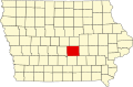
Newburg lies near the junction of county highway T38 and F17 (Newburg Road). [1]

History

Newburg in northeastern Jasper County, Iowa, in 1902 Jasper County, Iowa, 1902.png
Newburg in northeastern Jasper County, Iowa, in 1902

A post office at Newburg (originally spelled Newburgh) opened in 1878. The post office closed in January 1954. [2]

The Newburg Church was built in 1896; the congregation previously met at the Newburg schoolhouse. In 1996, the Newburg Church's congregation merged with the Chester congregation to become the Newburg Chester Church. [3]

The population of Newburg was estimated at 200 in 1887, [4] and was 41 in 1902. [5]

On March 5, 2022, an EF2 tornado struck the community, damaging several homes. [6]

See also

Vandalia, Iowa

Related Research Articles

Ira is an unincorporated community located in Independence Township, Jasper County, Iowa, United States. The population in 2010 was 29 people.

Viola Center was an unincorporated community in Audubon County, Iowa, in the United States.

Yorkshire is an unincorporated community in Harrison County, in the U.S. state of Iowa.

Zenorsville is an unincorporated community in Boone County, in the U.S. state of Iowa.

Union Mills is an unincorporated community in Mahaska County, in the U.S. state of Iowa.

Dahlonega is an unincorporated community in Wapello County, Iowa, United States.

Chequest was an unincorporated community in Davis County, Iowa, United States. Its elevation is 722 feet (287 m). It was on County Road V42 near Chequest Creek.

Vincennes is an unincorporated community in the southern part of Lee County, Iowa, United States. It lies near the junction of 320th Street and Iowa Highway 27, 2.5 miles south of Argyle. Its elevation is 554 feet.

Green Castle, also spelled Greencastle, is an unincorporated community in Jasper County, in the U.S. state of Iowa.

Clyde is an unincorporated community in Jasper County, in the U.S. state of Iowa. Clyde lies along the junction of North 102st Avenue W and Iowa Highway 330.

Galesburg is an unincorporated community in Jasper County, in the U.S. state of Iowa. Galesburg lies along the junction of Main Street/Sioux Avenue and Highway T14 S.

Fairmount is an unincorporated community in Jasper County, in the U.S. state of Iowa. Fairmount lies along the junction of Iowa Highway 163 and West 70th Street South. The community has also been known as Fairmont.

Ehler is an unincorporated community in Adams Township, Delaware County, Iowa, United States. The community lies three miles southwest of Ryan.

Bremer is a unincorporated community in Warren Township in Bremer County, Iowa, United States.

Wapsie is a unincorporated community in Franklin Township in Bremer County, Iowa, United States.

Republic is an unincorporated community in southern Chickasaw County, in the U.S. state of Iowa.

Astor was an unincorporated community in Crawford County, in the U.S. state of Iowa.

Bard was an unincorporated community in Louisa County, in the U.S. state of Iowa.

Belinda is an unincorporated community in Lucas County, in the U.S. state of Iowa.

Lafayette or La Fayette is an unincorporated community in Linn County, in the U.S. state of Iowa.

References

  1. 1 2 U.S. Geological Survey Geographic Names Information System: Newburg, Jasper County, Iowa
  2. "GNIS Detail - Newburg Post Office (historical)". geonames.usgs.gov. Retrieved July 1, 2021.
  3. "Newburg Chester Church - About". www.newburgchesterchurch.com. Retrieved July 1, 2021.
  4. Cram, George Franklin (1887). Cram's Universal Atlas: Geographical, Astronomical and Historical, Containing a Complete Series of Maps of Modern Geography, Illustrated by Numerous Views and Charts ; the Whole Supplemented with Valuable Statistics, Diagrams, and a Complete Gazetteer of the United States. G.F. Cram. pp. 367–369.
  5. Cram's Modern Atlas: The New Unrivaled New Census Edition. J. R. Gray & Company. 1902. pp. 203–207.
  6. "Emergency sirens fail during tornado warning in Newton". KCCI. March 6, 2022. Retrieved March 8, 2022.