| Ganchenpo | |
|---|---|
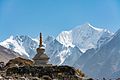
| Fluted Peak | |
 West aspect | |
| Highest point | |
| Elevation | 6,378 m (20,925 ft) [1] [2] |
| Prominence | 1,018 m (3,340 ft) [1] |
| Isolation | 6.33 km (3.93 mi) [1] |
| Coordinates | 28°10′08″N85°40′52″E / 28.16889°N 85.68111°E [2] |
| Geography | |
 Ganchenpo Location in Nepal | |
 | |
| Interactive map of Ganchenpo | |
| Location | Langtang |
| Country | Nepal |
| Province | Bagmati |
| District | Rasuwa |
| Protected area | Langtang National Park [3] |
| Parent range | Himalaya |
| Climbing | |
| First ascent | 1971 |
Ganchenpo is a mountain in Nepal.