Ranishwara is a village development committee in Gorkha District in Gandaki Pradesh of northern-central Nepal. At the time of the 1991 Nepal census it had a population of 2,993 and had 580 houses in the town.
Mukhiyapatti Musharniya is a village development committee in Dhanusa District in Province No. 2 of south-eastern Nepal. At the time of the 1991 Nepal census it had a population of 4,621 people living in 436 individual households.
Subbagaun is a village development committee in Kabhrepalanchok District in the Bagmati Zone of central Nepal. At the time of the 1991 Nepal census it had a population of 3885 in 711 individual households.
Samalpung is a town and Village Development Committee in Ilam District in the Mechi Zone of eastern Nepal. At the time of the 1991 Nepal census it had a population of 4,106 persons living in 776 individual households.
Ratnapuri is a town under Nijgadh Municipality in Bara District in the Narayani Zone of south-eastern Nepal. At the time of the 1991 Nepal census it had a population of 6,463 persons living in 1167 individual households.
Thaprek is a Village Development Committee in Nuwakot District in the Bagmati Zone of central Nepal. At the time of the 1991 Nepal census it had a population of 3585 people residing in 632 individual households.
Madanpur, Nepal is a Village Development Committee in Nuwakot District in the Bagmati Zone of central Nepal. At the time of the 1991 Nepal census it had a population of 7995 people residing in 1334 individual households.
Meghanath Gorhanna is a village development committee in Mahottari District in the Janakpur Zone of south-eastern Nepal. At the time of the 1991 Nepal census it had a population of 4612 people living in 824 individual households.
Raghunathpur, Mahottari is a village development committee in Mahottari District in the Janakpur Zone of south-eastern Nepal. At the time of the 1991 Nepal census it had a population of 4079 people living in 743 individual households.
Lakhanpur is a Village Development Committee in Ramechhap District in the Janakpur Zone of north-eastern Nepal. At the time of the 1991 Nepal census it had a population of 6058 people residing in 1100 individual households.
Korbang Jhimpe is a village development committee in Salyan District in the Rapti Zone of western-central Nepal. At the time of the 2001 Nepal census it had a population of 636. According to the 2011 Nepal census Korbang Jhimpe had a population of 6,183.
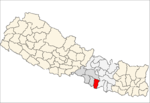
Bhalohiya is a village development committee (VDC) in Rautahat District in the Narayani Zone of south-eastern Nepal. At the time of the 2011 Nepal census, it had a population of 4,877 people living in 805 individual households. Most of the people living in this village belong to the caste of Bhumihar (brahamins) called Pandey and other like sah, mahato and few thakur and jha. People are mainly involved in business, teacher and are in Nepal police. It is situated at the bank of the river Bagmati and is 13 km from Gaur and 3 km from sukdev chok. Recently, a private school called DH Academy had been established in order to provide a better facility and to improve and give quality education in VDC, so that people from this and from some other VDCs nearby should not send the children to study outside the district. A bachelor-degree level campus, called bagmati bahumukhi campus, is in this VDC. The village is facilitated with good health facilities with some of the private clinics and a hospital. There are pitch roads connecting the different places of the village. This VDC is facilitated with drinking water. Recently, CA of rautahat 1 madav nepal proposed a project of 1 crore for building a town hall in Bhalohiya.
Vishnupurwa Manpur is a village development committee in Rautahat District in the Narayani Zone of south-eastern Nepal. At the time of the 1991 Nepal census it had a population of 2244 people living in 475 individual households.
Harsaha is a village development committee in Rautahat District in the Narayani Zone of south-eastern Nepal. At the time of the 1991 Nepal census it had a population of 3026 people living in 535 individual households.
Lakshmipur is a village development committee in Rautahat District in the Narayani Zone of south-eastern Nepal. At the time of the 1991 Nepal census it had a population of 3459 people living in 594 individual households.
Phaparbari is a village development committee in Makwanpur District in the Narayani Zone of southern Nepal. At the time of the 1991 Nepal census it had a population of 13,063 people living in 2119 individual households.
Bhairabsthan is a village development committee in the Palpa District of the Lumbini Zone in southern Nepal. According to the 1991 Nepal census, it had a population of 2937 people living in 544 individual households.
Bhuwan Pokhari is a village development committee in Palpa District in the Lumbini Zone of southern Nepal. At the time of the 1991 Nepal census it had a population of 5113 people living in 969 individual households.
Kusumkhola is a village development committee in Palpa District in the Lumbini Zone of southern Nepal. At the time of the 1991 Nepal census it had a population of 1809 people living in 349 individual households.
Palung Mainadi is a village development committee in Palpa District in the Lumbini Zone of southern Nepal. At the time of the 1991 Nepal census it had a population of 2675 people living in 445 individual households.