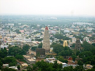
Mangalagiri is a major Sub-urban of Vijayawada in Guntur district of Indian state of Andhra Pradesh. The town is a part of Mangalagiri Tadepalli Municipal Corporation and part of Tenali revenue division. It and a part of Andhra Pradesh Capital Region. It is situated on National Highway 16 between Vijayawada and Guntur.

Krishna district is a district in the coastal Andhra Region in Indian state of Andhra Pradesh, with Machilipatnam as its administrative headquarters. It is surrounded on the East by Bay of Bengal, West by Guntur, Bapatla and North by Eluru and NTR districts and South again by Bay of Bengal.

Machilipatnam, also known as Masulipatnam and Bandar, is a city in Krishna district of the Indian state of Andhra Pradesh. It is a municipal corporation and the administrative headquarters of Krishna district. It is also the mandal headquarters of Machilipatnam mandal in Machilipatnam revenue division of the district. The ancient port town served as the settlement of European traders from the 16th century, and it was a major trading port for the Portuguese, British, Dutch and French in the 17th century.
Gudivada is a city in Krishna district of the Indian state of Andhra Pradesh. It is a municipality and the headquarters of Gudivada mandal in Gudivada revenue division. It is one of the cities in the state to be a part of Andhra Pradesh Capital Region. It is the twenty-seventh most populous city in Andhra Pradesh and the three-hundredth most populous city in India with a population of 118,167 according to the 2011 Census of India.

Nuzvid, natively spelled Nuzividu or Nuziveedu is a city in the Eluru district of the Indian state of Andhra Pradesh. It serves as the administrative headquarters for Nuzvid mandal and Nuzvid revenue division.

Nidadavole is a town in East Godavari district of the Indian state of Andhra Pradesh. It is a municipality and the mandal headquarters of Nidadavole mandal in Kovvur revenue division.

Hanuman Junction is a town which lies between the borders of Krishna and Eluru District of Andhra Pradesh state in India. Hanuman Junction gets its name because it is located in the X-Junction of NH-16 & AH-45.
Vuyyuru is a town in Krishna district of the Indian state of Andhra Pradesh. It is a Nagar panchayat and the headquarters of Vuyyuru Mandal. It is emerging as neighbourhood of Vijayawada, India situated 30 km away.
Gampalagudem is a town situated in the NTR district of Andhra Pradesh, India. It serves as the headquarters of the Gampalagudem mandal, which is under the administration of the Tiruvuru revenue division. The town is located on the banks of the Kattaleru river and is situated at a distance of 74 km (46 mi) from the district headquarters Vijayawada.
Kankipadu is a suburb of Vijayawada and a in Krishna District of the Indian state of Andhra Pradesh. It is also the mandal headquarters of Kankipadu mandal in Vuyyuru revenue division.

Andhra Pradesh State Road Transport Corporation, officially Andhra Pradesh Raastra Roadu Ravaana Samstha, is the state-owned road transport corporation in the Indian state of Andhra Pradesh. Its headquarters is located at NTR Administrative Block of RTC House in Pandit Nehru bus station of Vijayawada. Many other Indian metro towns in Telangana, Tamil Nadu, Karnataka, Odisha, Yanam, Kerala, Maharashtra and Chhattisgarh are also linked with the APSRTC services.

Mopidevi is a village in Krishna district of the Indian state of Andhra Pradesh. It is the mandal headquarters of Mopidevi mandal in Machilipatnam revenue division. It is one of the villages in the mandal to be a part of Andhra Pradesh Capital Region. The village is known for its famous Lord Subrahmanyeswar Swamy Temple. The village is situated 80Km from Vijayawada and 30Km from Machilipatnam. మోపిదేవి అవనిగడ్డ కు 5.7 కిలోమీటర్ల దూరం లో ఉన్నది. Nearby town is Avanigadda.Mopidevi is famous for శ్రీ సుబ్రహ్మణ్యేశ్వర ఆలయం.
Pamarru is a village in Krishna district of the Indian state of Andhra Pradesh. It is located in Pamarru Mandal in Gudivada revenue division.

Narasannapeta is a census town in Srikakulam district of the Indian state of Andhra Pradesh. It is the mandal headquarters of Narasannapeta mandal in Srikakulam revenue division. 43 villages are there under the administrative division of Narasannapeta.

Guntupalli is located in western part of Vijayawada in the Indian state of Andhra Pradesh. It is a Rural area falls under Ibrahimpatnam mandal in Vijayawada revenue division of NTR district. Guntupalli Railway Wagon Workshop is located here. There is a proposal to merge this village into Vijayawada Municipal Corporation (VMC) to form a Greater Vijayawada Municipal Corporation.
Rayapudi is a neighbourhood and a part of Urban Notified Area of Amaravati, the state capital of the Indian state of Andhra Pradesh. It was a village in Thullur mandal of in Guntur district, prior to its denotification as gram panchayat.
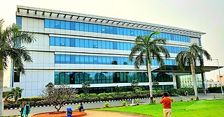
Kesarapalle is a Locality and major IT hub in Vijayawada city in Krishna district of the Indian state of Andhra Pradesh. It is located in Gannavaram mandal of Gudivada revenue division.
Pedaprolu is a village in Krishna district of the Indian state of Andhra Pradesh. It is located in Mopidevi mandal of Machilipatnam revenue division. It is a part of Andhra Pradesh Capital Region.

Vykuntapuram, also spelled as Vaikuntapuram, is a village in Guntur district of the Indian state of Andhra Pradesh. It is located in Amaravathi mandal of Guntur revenue division. The village forms a part of Andhra Pradesh Capital Region, under the jurisdiction of APCRDA.

NTR district is a district in coastal Andhra Region in the Indian state of Andhra Pradesh. The district headquarters is located at Vijayawada. The district is named after former Chief Minister of Andhra Pradesh N. T. Rama Rao. The district shares boundaries with Guntur, Palnadu, Krishna, Eluru, Khammam and Suryapet districts.


