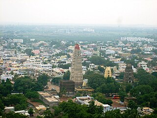
Gannavaram, Vijayawada

Last updated

Gannavaram
Town
Panorama of Vijayawada Airport 2 (November 2018).jpg
Vijayawada Airport in Gannavaram
India Andhra Pradesh location map (current).svg
Red pog.svg
Gannavaram
Location in Andhra Pradesh, India
Coordinates: 16°32′00″N80°48′00″E / 16.5333°N 80.8000°E / 16.5333; 80.8000
CountryFlag of India.svg  India
State Andhra Pradesh
District Krishna
Mandal Gannavaram
TownGannavaram
Metro Andhra Pradesh Capital Region
Area
  Total12.30 km2 (4.75 sq mi)
Population
 (2011)
  Total20,728
  Density1,700/km2 (4,400/sq mi)
Languages
  Official Telugu
Time zone UTC+5:30 (IST)
PIN
521101

Gannavaram it is a North-east sub urban of the Vijayawada in Indian state of Andhra Pradesh. It is also the mandal headquarters of Gannavaram mandal which is administered under Gudivada revenue division. [1] [2] It comes under Gudivada revenue division,and it is located in south India.Vijayawada Airport, Medha IT Park, IT companies like HCL Tech and TechMahindra are located here.

Contents

Name origin

The name Gannavaram is based on the traditional Sanskrit words "Ganna" meaning Sugarcane and "Varam" meaning 'blessing'. Historically Gannavaram used to be a primarily sugarcane-producing establishment. Hence named Gannavaram, 'blessed with sugarcane'.

Transport

APCRDA-Greenway near Gannavaram CRDA Greenway in Gannavaram.jpg
APCRDA-Greenway near Gannavaram

APSRTC operates buses from Gannavaram bus station which also has a bus depot. [3] [4] Gannavaram railway station is one of the satellite railway stations of the Vijayawada. [5] The airport is located at Gannavaram 13 KM from Centre of the city. Road connectivity is available from here to Various parts of the City.

APSRTC City Bus Routes

Route NumberStartEndVia
116Kaleswarao MarketGannavaramVijayawada Railway Station, Ramavarapadu Ring, Nidamanuru, Gannavaram
116 (METRO EXPRESS)Vijayawada City Bus TerminalGannavaramVijayawada Railway Station, Maruthinagar, gunadala, Ramavarapadu, Nidamanuru, gudavali, Gannavaram
145GKondapalli Railway StationGannavaramKondapalli Railway Station, Eluru Road, Gunadala, Ramavarapadu, Prasadampadu, Enkepadu, Nidamanuru, Kesarapalli, Gannavaram
188Kondapalli Railway StationGannavaramKondapalli Railway Station, Eluru Road, Gannavaram Centre Bus Stop
212PKaleswarao MarketGannavaramKaleswararao Market, Gannavaram (Via P Patnam)
212SKaleswarao MarketGannavaramKaleswararao Market, Gannavaram (Via S.Gudem)
241KankipaduGannavaramKankipadu, Pundaipadu Center, Uppaluru, Kesarapalli, RTO Office, Gannavaram Centre Bus Stop
252Kaleswarao MarketHanuman JunctionKaleswararao Market, Pnbs, Ramavarappadu Bus Stop, Gannavaram Centre Bus Stop, Hanuman Junction
252BKR Market Bus stopHanuman JunctionKR Market Bus Stop, Pnbs, Post Office Bus stop, Benz Circle, Ramavarappadu Bus Stop, Gannavaram Centre Bus Stop, Hanuman Junction
252B (METRO EXPRESS)Kaleswarao MarketHanuman JunctionPWD Grounds, Labbipet, benz circle, Stella College, Currency Nagar, Prasadampadu, Gannavaram
252S (METRO EXPRESS)Vijayawada City Bus TerminalHanuman JunctionVijayawada Railway Station, Eluru Road, Ramavarapadu Ring, Nidamanuru, gudavali, Gannavaram

Education

The primary and secondary school education is imparted by government, aided and private schools, under the School Education Department of the state. [6] [7] The medium of instruction followed by different schools are English and Telugu. Among the high schools in the area include, Little Lights Free Education High School, APSW Residential School, Z.P. High School, and Z.P. High School (girls). [8]

The National Institute of Disaster Management was planned to be set up at the town by the higher education department of the state. [9]

Related Research Articles

<span class="mw-page-title-main">Mangalagiri</span> Municipal Corporation in Andhra Pradesh, India

Mangalagiri is a major Sub-urban of Vijayawada in Guntur district of Indian state of Andhra Pradesh. The town is a part of Mangalagiri Tadepalli Municipal Corporation and part of Tenali revenue division. It and a part of Andhra Pradesh Capital Region. It is situated on National Highway 16 between Vijayawada and Guntur.

<span class="mw-page-title-main">Krishna district</span> District in Andhra Pradesh, India

Krishna district is a district in the coastal Andhra Region in Indian state of Andhra Pradesh, with Machilipatnam as its administrative headquarters. It is surrounded on the East by Bay of Bengal, West by Guntur, Bapatla and North by Eluru and NTR districts and South again by Bay of Bengal.

<span class="mw-page-title-main">Machilipatnam</span> City in Andhra Pradesh, India

Machilipatnam, also known as Masulipatnam and Bandar, is a city in Krishna district of the Indian state of Andhra Pradesh. It is a municipal corporation and the administrative headquarters of Krishna district. It is also the mandal headquarters of Machilipatnam mandal in Machilipatnam revenue division of the district. The ancient port town served as the settlement of European traders from the 16th century, and it was a major trading port for the Portuguese, British, Dutch and French in the 17th century.

Gudivada is a city in Krishna district of the Indian state of Andhra Pradesh. It is a municipality and the headquarters of Gudivada mandal in Gudivada revenue division. It is one of the cities in the state to be a part of Andhra Pradesh Capital Region. It is the twenty-seventh most populous city in Andhra Pradesh and the three-hundredth most populous city in India with a population of 118,167 according to the 2011 Census of India.

<span class="mw-page-title-main">Nuzvid</span> City in Andhra Pradesh, India

Nuzvid, natively spelled Nuzividu or Nuziveedu is a city in the Eluru district of the Indian state of Andhra Pradesh. It serves as the administrative headquarters for Nuzvid mandal and Nuzvid revenue division.

<span class="mw-page-title-main">Nidadavolu</span> Town in Andhra Pradesh, India

Nidadavole is a town in East Godavari district of the Indian state of Andhra Pradesh. It is a municipality and the mandal headquarters of Nidadavole mandal in Kovvur revenue division.

<span class="mw-page-title-main">Hanuman Junction</span> Town in Andhra Pradesh, India

Hanuman Junction is a town which lies between the borders of Krishna and Eluru District of Andhra Pradesh state in India. Hanuman Junction gets its name because it is located in the X-Junction of NH-16 & AH-45.

Vuyyuru is a town in Krishna district of the Indian state of Andhra Pradesh. It is a Nagar panchayat and the headquarters of Vuyyuru Mandal. It is emerging as neighbourhood of Vijayawada, India situated 30 km away.

Gampalagudem is a town situated in the NTR district of Andhra Pradesh, India. It serves as the headquarters of the Gampalagudem mandal, which is under the administration of the Tiruvuru revenue division. The town is located on the banks of the Kattaleru river and is situated at a distance of 74 km (46 mi) from the district headquarters Vijayawada.

Kankipadu is a suburb of Vijayawada and a in Krishna District of the Indian state of Andhra Pradesh. It is also the mandal headquarters of Kankipadu mandal in Vuyyuru revenue division.

<span class="mw-page-title-main">Andhra Pradesh State Road Transport Corporation</span> Indian state bus operator

Andhra Pradesh State Road Transport Corporation, officially Andhra Pradesh Raastra Roadu Ravaana Samstha, is the state-owned road transport corporation in the Indian state of Andhra Pradesh. Its headquarters is located at NTR Administrative Block of RTC House in Pandit Nehru bus station of Vijayawada. Many other Indian metro towns in Telangana, Tamil Nadu, Karnataka, Odisha, Yanam, Kerala, Maharashtra and Chhattisgarh are also linked with the APSRTC services.

<span class="mw-page-title-main">Mopidevi</span> Village in Andhra Pradesh, India

Mopidevi is a village in Krishna district of the Indian state of Andhra Pradesh. It is the mandal headquarters of Mopidevi mandal in Machilipatnam revenue division. It is one of the villages in the mandal to be a part of Andhra Pradesh Capital Region. The village is known for its famous Lord Subrahmanyeswar Swamy Temple. The village is situated 80Km from Vijayawada and 30Km from Machilipatnam. మోపిదేవి అవనిగడ్డ కు 5.7 కిలోమీటర్ల దూరం లో ఉన్నది. Nearby town is Avanigadda.Mopidevi is famous for శ్రీ సుబ్రహ్మణ్యేశ్వర ఆలయం.

Pamarru is a village in Krishna district of the Indian state of Andhra Pradesh. It is located in Pamarru Mandal in Gudivada revenue division.

<span class="mw-page-title-main">Narasannapeta</span> Census Town in Andhra Pradesh, India

Narasannapeta is a census town in Srikakulam district of the Indian state of Andhra Pradesh. It is the mandal headquarters of Narasannapeta mandal in Srikakulam revenue division. 43 villages are there under the administrative division of Narasannapeta.

<span class="mw-page-title-main">Guntupalli, NTR district</span> Census Town in Andhra Pradesh, India

Guntupalli is located in western part of Vijayawada in the Indian state of Andhra Pradesh. It is a Rural area falls under Ibrahimpatnam mandal in Vijayawada revenue division of NTR district. Guntupalli Railway Wagon Workshop is located here. There is a proposal to merge this village into Vijayawada Municipal Corporation (VMC) to form a Greater Vijayawada Municipal Corporation.

Rayapudi is a neighbourhood and a part of Urban Notified Area of Amaravati, the state capital of the Indian state of Andhra Pradesh. It was a village in Thullur mandal of in Guntur district, prior to its denotification as gram panchayat.
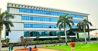
<span class="mw-page-title-main">Kesarapalle</span> Suburb in Krishna, Andhra Pradesh, India

Kesarapalle is a Locality and major IT hub in Vijayawada city in Krishna district of the Indian state of Andhra Pradesh. It is located in Gannavaram mandal of Gudivada revenue division.

Pedaprolu is a village in Krishna district of the Indian state of Andhra Pradesh. It is located in Mopidevi mandal of Machilipatnam revenue division. It is a part of Andhra Pradesh Capital Region.

<span class="mw-page-title-main">Vykuntapuram</span> Village in Andhra Pradesh, India

Vykuntapuram, also spelled as Vaikuntapuram, is a village in Guntur district of the Indian state of Andhra Pradesh. It is located in Amaravathi mandal of Guntur revenue division. The village forms a part of Andhra Pradesh Capital Region, under the jurisdiction of APCRDA.

<span class="mw-page-title-main">NTR district</span> District in Andhra Pradesh, India

NTR district is a district in coastal Andhra Region in the Indian state of Andhra Pradesh. The district headquarters is located at Vijayawada. The district is named after former Chief Minister of Andhra Pradesh N. T. Rama Rao. The district shares boundaries with Guntur, Palnadu, Krishna, Eluru, Khammam and Suryapet districts.

References

  1. "Krishna District Mandals" (PDF). Census of India. pp. 495, 526–527. Retrieved 19 January 2015.
  2. "Administrative Setup". Krishna District Official Website. National Informatics Centre. Archived from the original on 20 October 2014. Retrieved 9 February 2015.
  3. "Bus Stations in Districts". Andhra Pradesh State Road Transport Corporation. Archived from the original on 22 March 2016. Retrieved 8 March 2016.
  4. Sujatha Varma, P (7 February 2016). "RTC offers a 'sweet' journey". The Hindu. Vijayawada. Retrieved 8 March 2016.
  5. "Train services to be partially affected for nine days". The Hindu. Retrieved 20 April 2017.
  6. "School Education Department" (PDF). School Education Department, Government of Andhra Pradesh. Archived from the original (PDF) on 19 March 2016. Retrieved 7 November 2016.
  7. "The Department of School Education - Official AP State Government Portal | AP State Portal". www.ap.gov.in. Archived from the original on 7 November 2016. Retrieved 7 November 2016.
  8. "List of High Schools. District : Krishna Mandal :Gannavaram" (PDF). 18 May 2010. Archived from the original (PDF) on 12 July 2018. Retrieved 11 January 2022.
  9. Maitreyi, M. l Melly (20 February 2016). "Higher education institutions: State fast tracks process". The Hindu. Retrieved 23 September 2016.