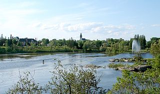
The Mattagami River is a river in Northern Ontario, Canada.

Gardiner is a Dispersed Rural Community and unincorporated place in geographic Blount Township, Cochrane District, Ontario, Canada. It is approximately 30 kilometres (19 mi) north of the town of Cochrane, and is the northern terminus of Ontario Highway 579. The community is also astride the Ontario Northland Railway line from Cochrane to Moosonee, but is not served by Polar Bear Express passenger trains.

The Kapuskasing River is a river in the James Bay drainage basin in Cochrane District and Algoma District in northeastern Ontario, Canada. The river is a left tributary of the Mattagami River.

The Ivanhoe River is a river in Cochrane District and Sudbury District in Northeastern Ontario, Canada. The river is in the James Bay drainage basin and is a left tributary of the Groundhog River.

The Groundhog River is a river in Cochrane District and Sudbury District in Northeastern Ontario, Canada. The river is in the James Bay drainage basin and is a left tributary of the Mattagami River.

The Dunrankin River is a river in Algoma District and Sudbury District in northeastern Ontario, Canada. It is in the James Bay drainage basin, begins at Upper Dunrankin Lake and is a left tributary of the Kapuskasing River.

The Little Swanson River is a river in Sudbury District in northeastern Ontario, Canada. It is in the James Bay drainage basin, begins at an unnamed lake, and is a right tributary of the Swanson River.

The Makonie River is a river in Sudbury District in northeastern Ontario, Canada. It is in the James Bay drainage basin, and is a left tributary of the Chapleau River.

The East Dunrankin River is a river in Algoma District and Sudbury District in northeastern Ontario, Canada. It is in the James Bay drainage basin, and is a right tributary of the Dunrankin River.

The Kirkwall River is a river in Algoma District and Sudbury District in northeastern Ontario, Canada. It is in the James Bay drainage basin, and is a right tributary of the Dunrankin River.

The Nemegosenda River is a river in Algoma District and Sudbury District in northeastern Ontario, Canada. It is in the James Bay drainage basin, and is a right tributary of the Kapuskasing River.

The Borden River is a river in Sudbury District in northeastern Ontario, Canada. It is in the James Bay drainage basin, and is a left tributary of the Nemegosenda River.

The Saganash River is a river in Cochrane District in northeastern Ontario, Canada. It is in the James Bay drainage basin, and is a right tributary of the Kapuskasing River.

The Little Saganash River is a river in Cochrane District in northeastern Ontario, Canada. It is in the James Bay drainage basin, and is a right tributary of the Saganash River.

The Shawmere River is a river in Sudbury District in northeastern Ontario, Canada. It is in the James Bay drainage basin, and is a left tributary of the Ivanhoe River.

The Little Shawmere River is a river in Sudbury District in northeastern Ontario, Canada. It is in the James Bay drainage basin, and is a left tributary of the Shawmere River.

Gardiner Township is a geographic township in the Unorganized North Part of Cochrane District, Ontario, Canada.

Woollings Creek is a creek in Timiskaming District and Cochrane District in northeastern Ontario, Canada. It is in the James Bay drainage basin and is a tributary of the Whiteclay River.

Benoit Creek is a creek in Timiskaming District and Cochrane District in northeastern Ontario, Canada. It is in the James Bay drainage basin and is a left tributary of Woollings Creek.

The Whiteclay River is a river in Cochrane District and Timiskaming District in northeastern Ontario, Canada. It is in the James Bay drainage basin and is a left tributary of the Black River.


