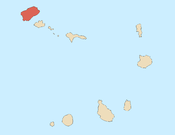
Ribeira Grande is a concelho (municipality) of Cape Verde. Situated in the northern part of the island of Santo Antão, it covers one fifth of the island area, and is home to nearly half of its population. Its seat is the city Ponta do Sol.

Tarrafal de São Nicolau is a city in the western part of the island of São Nicolau, Cape Verde. With a population of 3,733, it is the most populous settlement of the island. It is the seat of the Tarrafal de São Nicolau Municipality, and the main port of the island. It is situated on the west coast, 9 km southwest of Ribeira Brava.

Porto Inglês is a city in the southwestern part of the island of Maio in southeastern Cape Verde. It is the main urban settlement of the island, and also seat of the Maio Municipality. Its population was 2,971 in 2010. The name Porto Inglês refers to English ships that exported salt produced on the island of Maio from this town. Salt exploitation continued until the 19th century. The inconclusive Battle of Maio was fought between British and French frigate squadrons close to the town on 23 January 1814 in the last stages of the Napoleonic Wars.

Figueira Pavão is a settlement in the southeastern part of the island of Fogo, Cape Verde. In 2010 its population was 320. It is situated 3 km southwest of Cova Figueira and 20 km east of the island capital São Filipe. Nearby settlements are Achada Furna to the west and Estância Roque to the north.

Fonte Aleixo is a settlement in the southern part of the island of Fogo, Cape Verde. It is situated 3 km south of Achada Furna and 16 km southeast of the island capital São Filipe. In 2010 its population was 401.

Fajãzinha is a settlement in the northern part of the island of Fogo, Cape Verde. It is situated on the coast, 3 km northwest of Mosteiros and 23 km northeast of the island capital São Filipe. Each year on May 13, the festival of Our Lady of Fatima is celebrated in the settlement.

The Cruzinha Nature Reserve is a protected area in the northern part of the island of Santo Antão in the Cape Verde archipelago. It covers part of the north coast of the island, between the rivers Ribeira da Garça and the Ribeira do Mocho. It contains the only coastal dunes of Santo Antão. It takes its name from the village Cruzinha da Garça, part of the town Chã de Igreja.
Lombo Santa is a settlement in the northern part of the island of Santo Antão, Cape Verde. It is situated in the upper valley of the river Ribeira Grande, 10 km southwest of the town Ribeira Grande and 16 km northwest of the island capital Porto Novo.
São Pedro Apóstolo is a freguesia of Cape Verde. It covers the western part of the municipality of Ribeira Grande, on the island of Santo Antão.
Tarrafal de Monte Trigo is a settlement in the southwestern part of the island of Santo Antão, Cape Verde. In 2010 its population was 841. It is situated on the coast, 27 km west of the island capital Porto Novo. The settlement was mentioned as Terrafal in the 1747 map by Jacques-Nicolas Bellin.

Chã de Igreja is a town in the northern part of the island of Santo Antão, Cape Verde. It is situated near the north coast of the island, in the valley of the river Ribeira da Garça, 19 km northwest of the island capital Porto Novo. In 2010 its population was 672. The nature reserve Cruzinha, which includes the small seaside village Cruzinha da Garça, stretches northeast of Chã de Igreja along the coast.
Figueiras is a settlement in the northern part of the island of Santo Antão, Cape Verde. It is situated in a mountain valley, 20 km northwest of the island capital Porto Novo. The southernmost part lies in Moroços Natural Park.
Montanha is a settlement in the central part of the island of Santiago, Cape Verde. It is situated 2 km north of João Teves and 8 km southwest of Pedra Badejo. The area is intensively farmed; mainly maize, beans and sugar-cane.
Baía is a settlement in the eastern part of the island of Santiago, Cape Verde. It is part of the municipality of São Domingos. In 2010 its population was 489. It is situated near the east coast, 2 km southeast of Achada Baleia, 2 km northwest of Moia Moia and 14 km northeast of Praia. It sits at an elevation of about 20 meters. The settlement consists of several localities, including Achada Baixo, Castelinho and Covão Santana. The ruined Gothic church of Nossa Senhora da Luz, which was part of the 15th century Portuguese settlement Alcatrazes, stands at the shore near Baía.