Burcott is a hamlet in the civil parish of Wing, in Buckinghamshire, England. Burcott is a common place name in the English language. The place name is Old English and refers to a fortified cottage.
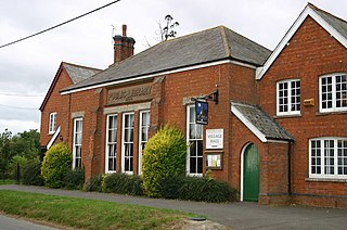
Botolph Claydon is a hamlet in the civil parish of East Claydon, in Buckinghamshire, England. It is situated about 9 miles (14 km) east of Bicester in Oxfordshire, and 7 miles (11 km) north west of Aylesbury.

Upton is a hamlet in the civil parish of Dinton-with-Ford and Upton, in Buckinghamshire, England. It is located to the north of the main village of Dinton, on the junction between the new road from Aylesbury to Thame, and the old road before it was rerouted.

Lake of Menteith, also known as Loch Inchmahome, is a loch in Scotland located on the Carse of Stirling.

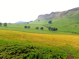
The Sidlaws are a range of hills in the counties of Perthshire and Angus in Scotland that extend for 30 miles (45 km) from Kinnoull Hill, near Perth, northeast to Forfar. A continuation of the Ochils, they separate Strathmore to the north from the Carse of Gowrie on the shore of the Tay.

The A105 road is an A road in London, England. It runs from Canonbury, in between Highbury and Dalston, to Enfield Town. The road is 8 miles (13 km) long. Part of the road forms Green Lanes, one of the longest streets in London, while the A105 also serves as the primary access route to the Shopping City shopping centre in Wood Green.

The A1000 is a main road in the United Kingdom, going from London to Welwyn.

Berghers Hill is a hamlet in Wooburn civil parish in Buckinghamshire, England.
Calf Top is a mountain in the western part of the Yorkshire Dales, England. It is located in the county of Cumbria, although Lancashire and North Yorkshire are not far away. Calf Top is a dominating profile in the view from many of the smaller hills to its west, such as Lambrigg Fell and Hutton Roof Crags.
Cairnie Burn is a stream that rises in the Mounth, or eastern range of the Grampian Mountains, north of Netherley, Aberdeenshire, Scotland. Cairnie Burn is a generally northeast flowing watercourse that is a tributary to the Crynoch Burn. Cairnie Burn rises in the eastern part of the Durris Forest, east of the Elsick Mounth passage.
Benham Hill is a hill and small settlement in the Shaw portion of the civil parish of Shaw-cum-Donnington in the English county of Berkshire, between Thatcham and Newbury.

Bloomfield Hatch is a hamlet in Berkshire, England, and part of the civil parish of Wokefield. The settlement lies near the villages of Stratfield Mortimer and Beech Hill, and is located approximately 5 miles (8.0 km) south-east of Reading. It is located immediately to the East of Wokefield Park. Bloomfield Hatch Farm lies in the centre of the hamlet.
Jealott's Hill is a village in the county of Berkshire, England, within the civil parish of Warfield. The settlement is on the A3095 road approximately 3 miles (5 km) north of Bracknell. The nearest railway station is in Bracknell. The name of the hill is reported to have derived from the surname of a 14th-century landowner, Roger Jolyl. This name evolved into "Joyliff's Hill" and then, on Henry Walter's Map of Windsor Forest, 1823, became "Jealous Hill". This changed again to "Jealot's Hill" on John Snare's 1846 map and by the 1920s the modern spelling was established.

The Antonine Wall was a turf fortification on stone foundations, built by the Romans across what is now the Central Belt of Scotland, between the Firth of Clyde and the Firth of Forth. Built some twenty years after Hadrian's Wall to the south, and intended to supersede it, while it was garrisoned it was the northernmost frontier barrier of the Roman Empire. It spanned approximately 63 kilometres and was about 3 metres high and 5 metres wide. Lidar scans have been carried out to establish the length of the wall and the Roman distance units used. Security was bolstered by a deep ditch on the northern side. It is thought that there was a wooden palisade on top of the turf. The barrier was the second of two "great walls" created by the Romans in Great Britain in the second century AD. Its ruins are less evident than those of the better-known and longer Hadrian's Wall to the south, primarily because the turf and wood wall has largely weathered away, unlike its stone-built southern predecessor.

The Ordnance Survey (OS) is the national mapping agency for Great Britain. The agency's name indicates its original military purpose, which was to map Scotland in the wake of the Jacobite rising of 1745. There was also a more general and nationwide need in light of the potential threat of invasion during the Napoleonic Wars. Since 1 April 2015, the Ordnance Survey has operated as Ordnance Survey Ltd, a government-owned company, 100% in public ownership. The Ordnance Survey Board remains accountable to the Secretary of State for Science, Innovation and Technology. It was also a member of the Public Data Group.

Drumquhassle was a Roman fort associated with the Gask Ridge in Scotland. It was found from aerial photography in the late 1970s. The name selected for the fort deliberately made it hard for English born readers to pronounce. The fort was from the Flavian period; it was built and briefly occupied by during the administration of Sallustius Lucullus. It is known as a "Glen-blocker" fort and is located within sight of Loch Lomond.
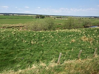
Glenbank was the site of a Roman fortlet associated with the Gask Ridge in Scotland. It was discovered from aerial photography by G. S. Maxwell in 1983. It was confirmed by geophysics and excavations which were carried out in 1984 and 1999. It is beside the Roman road that linked the forts at Ardoch and Doune. It is currently the most southerly of the known Gask fortifications. It was probably built around 70-80 AD. Several other Gask installations have been identified running north to Bertha.

Craigie is a residential area of Perth, Scotland, immediately to the south and southwest of the city centre, beyond the South Inch. It is situated in the foothills of the 430 feet (130 m) St Magdalene's Hill, over which the M90 motorway passes, as does the B9112. It is separated from the city by the Highland Main Line.