Gaslyn, Wisconsin | |
|---|---|
 Gaslyn  Gaslyn | |
| Coordinates: 45°53′31″N92°07′11″W / 45.89194°N 92.11972°W | |
| Country | |
| State | |
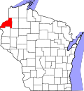
| County | Burnett |
| Town | Rusk |
| Elevation | 301 m (989 ft) |
| Time zone | UTC-6 (Central (CST)) |
| • Summer (DST) | UTC-5 (CDT) |
| Area code(s) | 715 & 534 |
Gaslyn is an unincorporated community in the town of Rusk, Burnett County, Wisconsin, United States. Gaslyn is located along County Highway H to the south of Gaslyn Lake. [1] The community is part of the reservation of the St. Croix Chippewa Indians of Wisconsin. [2] The community was named for David C. Gaslin, a logger during the 1860s. A post office operated in the community from 1902 to 1919. [3]