Blaine, Wisconsin

Last updated

Blaine, Wisconsin
WIMap-doton-Blaine.png
Location of Blaine, Wisconsin
Coordinates: 46°6′41″N92°9′11″W / 46.11139°N 92.15306°W / 46.11139; -92.15306
Country Flag of the United States.svg  United States
State Flag of Wisconsin.svg  Wisconsin
County Burnett
Area
  Total70.3 sq mi (182.1 km2)
  Land68.6 sq mi (177.6 km2)
  Water1.7 sq mi (4.4 km2)
Elevation
[1]
1,017 ft (310 m)
Population
 (2010)
  Total197
  Density3/sq mi (1.1/km2)
Time zone UTC-6 (Central (CST))
  Summer (DST) UTC-5 (CDT)
Area codes 715 & 534
FIPS code 55-08025 [2]
GNIS feature ID1582825 [1]
Website townofblaine.com

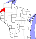
Blaine is a town in Burnett County in the U.S. state of Wisconsin. The population was 197 at the 2010 census. [3] The unincorporated communities of Riverside and Woodland Corner are located in the town.

Contents

Geography

Blaine occupies the northern end of Burnett County. It is bordered to the east by Washburn County and to the north by Douglas County, both in Wisconsin, and to the west by Pine County, Minnesota. The St. Croix River flows through the town from northeast to southwest, reaching the Minnesota border and becoming the state line about one mile northeast of the southwest corner of the town. The Namekagon River enters the town from the southeast and joins the St. Croix in the south-central part of the town. The Totagatic River enters the town from the east and joins the Namekagon River 3 miles (5 km) west of the town's eastern border.

According to the United States Census Bureau, the town has a total area of 70.3 square miles (182.1 km2), of which 68.6 square miles (177.6 km2) is land and 1.7 square miles (4.4 km2), or 2.43%, is water. [3]

Demographics

As of the census [2] of 2000, there were 224 people, 97 households, and 65 families residing in the town. The population density was 3.3 people per square mile (1.3/km2). There were 238 housing units at an average density of 3.5 per square mile (1.3/km2). The racial makeup of the town was 91.07% White, 0.89% African American, 1.34% Native American, 1.34% from other races, and 5.36% from two or more races. Hispanic or Latino of any race were 0.45% of the population.

There were 97 households, out of which 21.6% had children under the age of 18 living with them, 58.8% were married couples living together, 4.1% had a female householder with no husband present, and 32.0% were non-families. 29.9% of all households were made up of individuals, and 15.5% had someone living alone who was 65 years of age or older. The average household size was 2.31 and the average family size was 2.82.

In the town, the population was spread out, with 19.6% under the age of 18, 4.0% from 18 to 24, 20.5% from 25 to 44, 26.8% from 45 to 64, and 29.0% who were 65 years of age or older. The median age was 50 years. For every 100 females, there were 96.5 males. For every 100 females age 18 and over, there were 95.7 males.

The median income for a household in the town was $31,250, and the median income for a family was $34,531. Males had a median income of $39,375 versus $18,125 for females. The per capita income for the town was $12,895. About 6.8% of families and 15.3% of the population were below the poverty line, including 16.3% of those under the age of eighteen and 27.3% of those 65 or over.

44°18′33″N89°18′56″W / 44.30917°N 89.31556°W / 44.30917; -89.31556

Related Research Articles

<span class="mw-page-title-main">Burnett County, Wisconsin</span> County in Wisconsin, United States

Burnett County is a county located in the U.S. state of Wisconsin. As of the 2020 census, the population was 16,526. Its county seat is Siren, with the majority of county governmental services located at the Burnett County Government Center. The county was created in 1856 and organized in 1865. The St. Croix Chippewa Indians of Wisconsin have reservation lands in Burnett County and are the county's largest employer.

<span class="mw-page-title-main">Elmore, Alabama</span> Town in Alabama, United States

Elmore is a town in Elmore County, Alabama, United States. Although initially incorporated in 1906, it lapsed and was not reincorporated again until 1997. At the 2010 census the population was 1,262, up from 199 in 2000. It is part of the Montgomery Metropolitan Statistical Area.

<span class="mw-page-title-main">Cable, Wisconsin</span> Town in Wisconsin, United States

Cable is a town in Bayfield County, Wisconsin, United States. Its population was 825 at the 2010 U.S. census. The census-designated place of Cable and the unincorporated communities of Leonards and Radspur are located in the town.

<span class="mw-page-title-main">Anderson, Burnett County, Wisconsin</span> Town in Wisconsin, United States

Anderson is a town in Burnett County in the U.S. state of Wisconsin. The population was 398 at the 2010 census. The unincorporated communities of Benson, Randall, and Trade River are located within the town.

<span class="mw-page-title-main">Daniels, Wisconsin</span> Town in Wisconsin, United States

Daniels is a town in Burnett County in the U.S. state of Wisconsin. The population was 649 at the 2010 census. The unincorporated community of Falun is located within the town.

<span class="mw-page-title-main">La Follette, Wisconsin</span> Town in Wisconsin, United States

La Follette is a town in Burnett County in the U.S. state of Wisconsin. The population was 536 at the 2010 census. The unincorporated communities of Coomer and Hertel are located in the town.

<span class="mw-page-title-main">Lincoln, Burnett County, Wisconsin</span> Town in Wisconsin, United States

Lincoln is a town in Burnett County in the U.S. state of Wisconsin. The population was 309 at the 2010 census.

<span class="mw-page-title-main">Roosevelt, Burnett County, Wisconsin</span> Town in Wisconsin, United States

Roosevelt is a town in Burnett County in the U.S. state of Wisconsin. The population was 199 at the 2010 census. The unincorporated community of Timberland is located in the town.

<span class="mw-page-title-main">Rusk, Burnett County, Wisconsin</span> Town in Wisconsin, United States

Rusk is a town located in Burnett County in the U.S. state of Wisconsin. As of the 2010 census, the town had a population of 409. The unincorporated community of Gaslyn is located in the town.

<span class="mw-page-title-main">Swiss, Wisconsin</span> Town in Wisconsin, United States

Swiss is a town in Burnett County in the U.S. state of Wisconsin. The population was 790 at the 2010 census. The unincorporated community of Danbury is located within the town.

<span class="mw-page-title-main">Union, Burnett County, Wisconsin</span> Town in Wisconsin, United States

Union is a town in Burnett County in the U.S. state of Wisconsin. The population was 340 at the 2010 census.

<span class="mw-page-title-main">Webb Lake, Wisconsin</span> Town in Wisconsin, United States

Webb Lake is a town in Burnett County in the U.S. state of Wisconsin. The population was 311 at the 2010 census. It is along Wisconsin Highway 77 near County Road H. The unincorporated community of Webb Lake is located within the town of Webb Lake.

<span class="mw-page-title-main">Webster, Burnett County, Wisconsin</span> Village in Wisconsin, United States

Webster is a village in Burnett County in the U.S. state of Wisconsin. The population was 653 at the 2010 census. It is along Wisconsin Highway 35.

<span class="mw-page-title-main">West Marshland, Wisconsin</span> Town in Wisconsin, United States

West Marshland is a town in Burnett County in the U.S. state of Wisconsin. The population was 367 at the 2010 census.

The town of Spring Valley is located in Rock County, in the U.S. state of Wisconsin. The population was 728 at the 2020 census. The only incorporated municipality in the town is the village of Orfordville.

<span class="mw-page-title-main">Spring Valley, Wisconsin</span> Village in Wisconsin, United States

Spring Valley is a village in Pierce and St. Croix counties in Wisconsin, United States. The population was 1,401 at the 2020 census. Of those, 1,390 were in Pierce County and 11 in St. Croix County. The village is mostly within the Town of Spring Lake in Pierce County. Small parts also lie in the Town of Gilman, also in Pierce County, and the Town of Cady in St. Croix County.

Grantsburg is a town in Burnett County in the U.S. state of Wisconsin. The population was 1,136 at the 2010 census. The village of Grantsburg is located within the town. The unincorporated communities of Branstad and Lind are located in the town.

Siren is a town in Burnett County in the U.S. state of Wisconsin. The population was 936 at the 2010 census. The village of Siren is located within the town.

<span class="mw-page-title-main">Wyocena, Wisconsin</span> Village in Wisconsin, United States

Wyocena is a village in Columbia County, Wisconsin, United States. The population was 768 at the 2010 census. The village is located within the Town of Wyocena. It is part of the Madison Metropolitan Statistical Area.

<span class="mw-page-title-main">River Falls, Wisconsin</span> City in Wisconsin, United States

River Falls is a city in Pierce and St. Croix counties in the U.S. state of Wisconsin. It is located mostly within the town of River Falls, and adjacent to the town of Kinnickinnic in St. Croix County. River Falls is the most populous city in Pierce County. The population was 16,182 at the 2020 census, with 12,546 residing in Pierce County and 3,636 in St. Croix County. It is part of the Minneapolis-St. Paul metropolitan area and located approximately 30 miles (48 km) east of the center of that region.

References

  1. 1 2 "US Board on Geographic Names". United States Geological Survey. October 25, 2007. Retrieved January 31, 2008.
  2. 1 2 "U.S. Census website". United States Census Bureau . Retrieved January 31, 2008.
  3. 1 2 "Geographic Identifiers: 2010 Demographic Profile Data (G001): Blaine town, Burnett County, Wisconsin". U.S. Census Bureau, American Factfinder. Archived from the original on February 12, 2020. Retrieved May 28, 2014.