
Tucson is a city in and the county seat of Pima County, Arizona, United States, and is home to the University of Arizona. It is the second-largest city in Arizona behind Phoenix, with a population of 542,629 in the 2020 United States census, while the population of the entire Tucson metropolitan statistical area (MSA) is 1,043,433. The Tucson MSA forms part of the larger Tucson-Nogales combined statistical area. Both Tucson and Phoenix anchor the Arizona Sun Corridor. The city is 108 miles (174 km) southeast of Phoenix and 60 mi (100 km) north of the United States–Mexico border.
Drexel Heights is an unincorporated community and census-designated place (CDP) in Pima County, Arizona, United States. The population was 27,749 at the 2010 census.

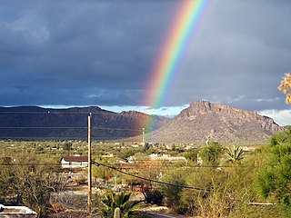
The Santa Catalina Mountains, commonly referred to as the Catalina Mountains or the Catalinas, are north and northeast of Tucson in Arizona, United States, on Tucson's north perimeter. The mountain range is the most prominent in the Tucson area, with the highest average elevation. The highest point in the Catalinas is Mount Lemmon at an elevation of 9,157 feet (2,791 m) above sea level and receives 18 inches (460 mm) of precipitation annually.

The Tucson Mountains are a minor mountain range west of Tucson, Arizona, United States. The Tucson Mountains, including Wasson Peak, are one of four notable mountain ranges surrounding the Tucson Basin. The Santa Catalina Mountains lie to the northeast, the Rincon Mountains are to the east of Tucson, and the Santa Rita Mountains lie to the south. Additionally, the Sierrita Mountains lie due south, the Roskruge Mountains lie to the west across Avra Valley, the Silver Bell Mountains lie to the northwest, and the Tortolita Mountains lie to the north across the Santa Cruz Valley.

Amphitheater Public Schools, also known as Amphi or District 10, is the third largest public school district in Tucson, Arizona, in terms of enrollment, with about 13,500 students and a staff of about 2000 employees Amphi was established on July 3, 1893. With its headquarters in Flowing Wells, presently serves segments of North Tucson, Casas Adobes, Catalina Foothills, and the communities of Oro Valley, eastern Tortolita, and Catalina northwest of the city.
The Catalina Highway, officially the General Hitchcock Highway, is the popular name for a Forest Highway and scenic route located in Pima County in southern Arizona. Also known as the Sky Island Scenic Byway, the Mount Lemmon Highway and Arizona Forest Highway 39, the Catalina Highway is the only paved roadway providing access to the resort village of Summerhaven as well as various recreational and scientific facilities located near the summit of Mount Lemmon. Ascending from the desert floor in Tucson to near the summit of Mount Lemmon, the short highway gains over 6,000 ft (1,800 m), showcasing a variety of climates ranging from lowland desert to alpine forests. The name sky island comes from the analogy of these mountains being like islands of forest in a sea of desert. It is designated as a scenic byway by the National Scenic Byways Program. and an Arizona Scenic Road by the Federal Highway Administration.

Sun Tran is the public transit system serving the city of Tucson, Arizona. In 2023, the system had 17,361,800 rides, or about 59,900 per weekday as of the second quarter of 2024. 100% of the fleet utilizes clean-burning fuels, such as compressed natural gas (CNG), biodiesel, and hybrid technologies. In addition to more than 40 bus routes, the system also includes the Sun Link modern streetcar line.

State Route 84, also known as SR 84, is a 41-mile (66 km) east–west highway in south-central Arizona, with its western terminus at Exit 151 of Interstate 8 and its eastern signed terminus at its junction with State Route 387 and State Route 287 in Casa Grande. An unsigned section, which is mostly maintained by local governments, runs from the SR 287 and SR 387 junction southeast through Arizola and Eloy. East of Eloy, SR 84 is concurrent with the beginning 0.87 miles (1.40 km) of State Route 87 just north of Interstate 10 near Picacho.

State Route 77 is a 253.93-mile (408.66-kilometre) long state highway in Arizona that traverses much of the state's length, stretching from its southern terminus at a junction with I-10 in Tucson to its northern terminus with BIA Route 6 at the Navajo Nation boundary just north of I-40.

The Little Ajo Mountains is a mountain range in southern Arizona, in extreme western Pima County, Arizona. The city of Ajo sits on the northeast of this small mountain range. Both the mountain range and city take their name from the Spanish word for garlic.
This is a list of the National Register of Historic Places listings in Pima County, Arizona.
The Gap Mountains are a mountain range in eastern Nye County, Nevada. Gap Mountain along with Fox Mountain 7.5 miles (12.1 km) to the south and the hills between overlook the White River valley to the west. Gap Mountain lies just 1.5 mi (2.4 km) southwest of the southern end of the Egan Range of adjacent Lincoln County and appears to be an extension of that range. Fox Mountain lies about 5 miles west of the south end of the Schell Creek Range and 7 mi (11 km) northeast of the north end of the Seaman Range.The Grant Range and small Golden Gate Range lie to the west across the White River Valley.
Robles Junction is a neighborhood of Three Points in Pima County, Arizona, United States. Robles Junction is located at the intersection of Arizona State Route 86 and Arizona State Route 286 southwest of Tucson.

Evo Anton DeConcini was an American judge who served as Attorney General of Arizona, and a justice of the Arizona Supreme Court from 1949 to 1953.

The Silver Bell Mountains are a northwest–southeast trending mountain range in north–central Pima County, Arizona. The range lies 14 miles (23 km) west of Marana, Arizona, located on Interstate-10, northwest of Tucson.
The West Silver Bell Mountains are a small 10 mile (16 km) long mountain range of south-central Arizona, United States. The range lies in the north-central arid Sonoran Desert; the Madrean Sky Islands region of southeast Arizona, around Tucson is adjacent to the southeast.
The Antelope Valley of southern Eureka County is a small 35 mi long valley, surrounded by four mountain ranges. Antelope Wash flows north, to endorheic flatlands at the valley's north end. Eureka, Nevada lies 20 mi east nestled among mountain ranges. From Eureka U.S. Route 50 travels west through the north end of the valley on a route to Austin.

La Veta Pass is the name associated with two mountain passes in the Sangre de Cristo Mountains of south-central Colorado in the United States, both on the boundary between Costilla and Huerfano counties.

Brawley Wash is an ephemeral stream, tributary to the Santa Cruz River, located in Pima County. Its source is in the Altar Valley between the Sierrita and Coyote Mountains at 31°58′20″N111°23′29″W, at the confluence of the Altar and Alambre washes along Arizona State Route 286. It flows north-north east through the Altar Valley and turns north as it enters Avra Valley near Robles Junction where Arizona State Route 86 crosses the streambed. The wash traverses the Avra Valley between the Roskruge Mountains and the Tucson Mountains. It joins the Santa Cruz east of the Samaniego Hills of the Silver Bell Mountains. The wash is known as the Los Robles Wash near its junction with the Santa Cruz approximately six miles west of Avra and Interstate 10.


