Gauriganga Municipality

Last updated
Gauriganga Municipality

गौरीगंगाा नगरपालिका
Nepal Sudurpashchim Pradesh adm location map.svg
Red pog.svg
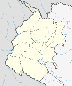
Gauriganga Municipality
Location in Nepal
Nepal adm location map.svg
Red pog.svg
Gauriganga Municipality
Gauriganga Municipality (Nepal)
Coordinates: 28°46′N80°46′E / 28.77°N 80.76°E / 28.77; 80.76 Coordinates: 28°46′N80°46′E / 28.77°N 80.76°E / 28.77; 80.76
CountryFlag of Nepal.svg    Nepal
Province Sudurpashchim Pradesh
District Kailali District
Government
   Mayor Bhim Bahadur Deuba (NCP)
   Deputy Mayor Anchala Chaudhary (NCP)
Area
  Total244 km2 (94 sq mi)
Population
(2011)
  Total58,286
  Density240/km2 (620/sq mi)
Time zone UTC+5:45 (NST)
Post code
10900
Area code(s) 091
Website www.gaurigangamun.gov.np

Gauriganga Municipality is a municipality in Kailali District in the Sudurpashchim Pradesh. At the time of the 2011 Nepal census it had a population of 58,286 living in 5,293 individual households. It is Surrounded by Ghodaghodi Municipality in the west , Godawari Municipality in the east , Mohanyal and Chure Rural Municipality in the north and Dhangadhi Sub Metropolitan City and Kailari Rural Municipality in the south.

Kailali District District in Province No. 7, Nepal

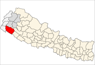
Kailali District, a part of Province No. 7 in Terai plain, is one of the 77 districts of Nepal. The district, with Dhangadhi as its district headquarters, covers an area of 3,235 square kilometres (1,249 sq mi) and has a population of 775,709.

Sudurpashchim Pradesh Province in Nepal

Sudurpashchim Pradesh is one of the seven provinces established by the new constitution of Nepal which was adopted on 20 September 2015. It borders the Tibet Autonomous Region of China to the north, Karnali Pradesh and Province No. 5 to the east, and the Indian states of Uttarakhand to the west and Uttar Pradesh to the south. Initially known as Province No. 7, the newly elected Provincial Assembly adopted Sudurpashchim Pradesh as the permanent name for the province in September 2018. As per a 28 September 2018 Assembly voting, the city of Godawari has been declared the capital of the Province. The province is coterminous with the former Far-Western Development Region, Nepal.

Nepal conducted a widespread national census in 2011 by the Nepal Central Bureau of Statistics. Working with the 58 municipalities and the 3915 Village Development Committees at a district level, they recorded data from all the municipalities and villages of each district. The data included statistics on population size, households, sex and age distribution, place of birth, residence characteristics, literacy, marital status, religion, language spoken, caste/ethnic group, economically active population, education, number of children, employment status, and occupation.

Contents

Census

Total population of Gauriganga Municipality is 58,286,. Chhetree is the dominant caste followed by Tharu Ethnic group. Brahmin Ranked third with. The male to female sex-ratio is 96.47. Total 5,293 household. [1]

Brahmin is a varna (class) in Hinduism specialising as priests, teachers (acharya) and protectors of sacred learning across generations.

Related Research Articles

Bardiya District District in Province No. 5, Nepal

Bardiya District, one of the seventy-seven Districts of Nepal, is part of Province No. 5 of Nepal. The district, with Gulariya as its headquarters, covers an area of 2,025 km² and according to the 2001 census the population was 382,649 in 2011 it has 426,576.

Bhajani Municipality in Sudurpashchim Pradesh, Nepal

Bhajani is a Municipality in Kailali District in Sudurpashchim Pradesh of Nepal. At the time of the 2011 Nepal censusit had a population of 52,128. It is surrounded by Tikapur Municipality and Joshipur Rural Municipality in the East, Kailari Rural Municipality in the West, Ghodaghodi Municipality in the North and Tikunia, Uttar Pradesh in the South. It is divided into 9 wards.

Godawari, Sudurpashchim Municipality in Sudurpaschim, Nepal

Godawari is a municipality and capital city of Sudurpaschim province located in Kailali District of Nepal.

Hasuliya Village development committee in Seti Zone, Nepal

Hasuliya is a village development committee in Kailali District in the Seti Zone of western Nepal. At the time of the 1991 Nepal census it had a population of 10638 living in 1405 individual households.

Masuriya Village development committee in Seti Zone, Nepal

Masuriya is a village development committee in Kailali District in the Seti Zone of western Nepal. At the time of the 2011 Nepal census it had a population of 22017 living in 3828 individual households.

Mohanyal Rural Municipality Gaunpalika in Province No. 7, Nepal

Mohanyal is a former village development committee that is now a Rural Municipality in Kailali District in Province No. 7 of western Nepal. At the time of the 1991 Nepal census it had a population of 3917 living in 614 individual households.

Munuwa Village development committee in Seti Zone, Nepal

Munuwa is a village development committee in Kailali District in the Seti Zone of western Nepal. At the time of the 1991 Nepal census it had a population of 9276 living in 1173 individual households.

Nigali Village development committee in Seti Zone, Nepal

Nigali is a village development committee in Kailali District in the Seti Zone of western Nepal. At the time of the 1991 Nepal census it had a population of 4480 living in 669 individual households.

Pahalmanpur Village development committee in Seti Zone, Nepal

Pahalmanpur is a village development committee in Kailali District in the Seti Zone of western Nepal. At the time of the 1991 Nepal census it had a population of 7155 living in 818 individual households.

Pandaun Village development committee in Seti Zone, Nepal

Pandaun is a village development committee in Kailali District in the Seti Zone of western Nepal. At the time of the 1991 Nepal census it had a population of 3070 living in 536 individual households.

Phulbari is a village in Dhangadhi sub-metropolitan city and former village development committee in Kailali District in the Province No. 7 of Nepal. At the time of the 2011 Nepal census it had a population of 20,508 living in 3,844 individual households.

Ratnapur, Seti Village development committee in Seti Zone, Nepal

Ratnapur is a village development committee in Kailali District in the Seti Zone of western Nepal. At the time of the 1991 Nepal census it had a population of 5410 living in 506 individual households.

Sugarkhal Village development committee in Seti Zone, Nepal

Sugarkhal is a village development committee in Kailali District in the Seti Zone of western Nepal. At the time of the 1991 Nepal census it had a population of 9599 living in 1634 individual households.

Thapapur Village development committee in Seti Zone, Nepal

Thapapur is a village development committee in Kailali District in the Seti Zone of western Nepal. At the time of the 1991 Nepal census it had a population of 9909 living in 1295 individual households.

Tikapur Municipality in Nepal

Tikapur is a Municipality in Kailali District in Province No. 7 of Nepal that was established on January 1997. Tikapur Municipality was further expanded on 10 March 2017 through merging the two former Village development committees Narayanpur and Dansinhapur. It lies on the bank of Kauriala River.

Udasipur Village development committee in Seti Zone, Nepal

Udasipur is a village development committee in Kailali District in the Seti Zone of western Nepal. At the time of the 1991 Nepal census it had a population of 5320 living in 579 individual households.

Ghodaghodi Municipality Municipality in Sudurpashchim Pradesh, Nepal

Ghodaghodi Municipality is a Municipality in Kailali District of Sudurpashchim Pradesh. Ghodaghodi lies 58 km east of Dhangadhi and 613 km west of the capital, Kathmandu. It is surrounded by Mohanyal in the North, Bhajani Municipality in the south, Bardagoriya Rural Municipality in the east & Gauriganga Municipality in the west. It is DIvided into 12 wards. It was established by merging Darakh, Sadepani, Ramsikhar Jhala and Pahalmanpur 4 existing Village development committee (Nepal).

Kailari Rural Municipality Gaunpalika in Province No. 7, Nepal

Kailari is a rural Municipality in Kailali District in Sudurpashchim Pradesh of Nepal. It is surrounded by Bajani Municipality In the East, Dhangadhi Sub Metropolitan City in the West, Gauriganga Municipality and Ghodaghodi Municipality in the North and Uttar Pradesh, India in the South.

Chure Rural Municipality Gaunpalika in Province No. 7, Nepal

Chure is a rural municipality in Kailali District in Sudurpashchim Pradesh of Nepal. It is surrounded by Mohanyal Rural Municipality in the East, Kanchanpur District in the West, Doti District in the North and Godawari Municipality and Gauriganga Municipality in the South.

References

  1. Nepal census 2011