Gavarres

Last updated
Gavarres

Serra de Cals.jpg

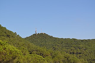
View of the Serra de Cals in the Gavarres Massif
Highest point
Elevation 532 m (1,745 ft)
Coordinates 41°54′57″N2°58′46″E / 41.91583°N 2.97944°E / 41.91583; 2.97944 Coordinates: 41°54′57″N2°58′46″E / 41.91583°N 2.97944°E / 41.91583; 2.97944
Geography
Parent range Catalan Coastal Range
Geology
Mountain type Silicious
Climbing
First ascent Unknown
Easiest route From La Bisbal d'Empordà

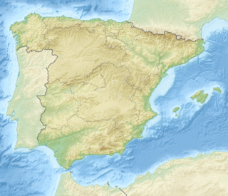
Les Gavarres or Massís de les Gavarres is a mountain massif in Catalonia, Spain. It is part of the Catalan Coastal Range. The highest point is Puig d'Arques, 532 m. Other important summits are Mare de Déu dels Àngels (485 m) and Santa Pellaia (353 m).

Catalonia Autonomous area of northeastern Spain

Catalonia is an autonomous community in Spain on the northeastern corner of the Iberian Peninsula, designated as a nationality by its Statute of Autonomy. Catalonia consists of four provinces: Barcelona, Girona, Lleida, and Tarragona. The capital and largest city is Barcelona, the second-most populated municipality in Spain and the core of the sixth most populous urban area in the European Union. It comprises most of the territory of the former Principality of Catalonia. It is bordered by France (Occitanie) and Andorra to the north, the Mediterranean Sea to the east, and the Spanish autonomous communities of Aragon to the west and Valencia to the south. The official languages are Catalan, Spanish, and the Aranese dialect of Occitan.

Spain Kingdom in Southwest Europe

Spain, officially the Kingdom of Spain, is a country mostly located in Europe. Its continental European territory is situated on the Iberian Peninsula. Its territory also includes two archipelagoes: the Canary Islands off the coast of Africa, and the Balearic Islands in the Mediterranean Sea. The African enclaves of Ceuta, Melilla, and Peñón de Vélez de la Gomera make Spain the only European country to have a physical border with an African country (Morocco). Several small islands in the Alboran Sea are also part of Spanish territory. The country's mainland is bordered to the south and east by the Mediterranean Sea except for a small land boundary with Gibraltar; to the north and northeast by France, Andorra, and the Bay of Biscay; and to the west and northwest by Portugal and the Atlantic Ocean.

Catalan Coastal Range

The Catalan Coastal Range is a system of mountain ranges running parallel to the Mediterranean Sea coast in Catalonia, Spain. It is part of the Catalan Mediterranean System. Its main axis runs between the Foix River and the Roses Gulf and the average altitude is around 500 m. The highest point is 763 m at the Montnegre.
Contents

Geography

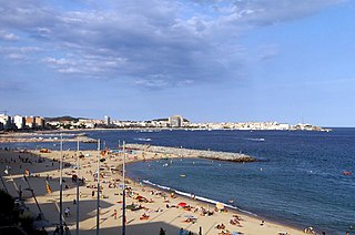
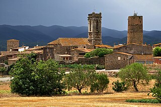
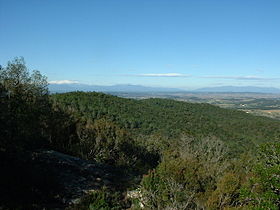
The mountains run broadly north-west, south-east in the Costa Brava region. They meet the sea between Castell-Platja d'Aro and Palamós. The range runs as far west as Girona. There are a number of villages in the mountains including Romanyà de la Selva and Santa Pellaia. The mountains also include the hermitage of Mare de Déu dels Àngels where there are views of both the Sea and Pyrenees.

Costa Brava coastal region in Catalonia, Spain

The Costa Brava is a coastal region of Catalonia in northeastern Spain, consisting of the comarques (counties) of Alt Empordà, Baix Empordà and Selva in the province of Girona. Costa Brava stretches from the town of Blanes, 60 km (37 mi) northeast of Barcelona, to the French border. In the 1950s, the Costa Brava was identified by the Spanish government and local entrepreneurs as being suitable for substantial development as a holiday destination, mainly for package holiday tourists from Northern Europe and especially, the United Kingdom and France. The combination of a very good summer climate, nature, excellent beaches and a favourable foreign exchange rate before the creation of the single European currency, which made Costa Brava an attractive tourist destination, was exploited by the construction of large numbers of hotels and apartments in such seaside resorts as Blanes, Tossa de Mar and Lloret de Mar. Tourism rapidly took over from fishing as the principal business of the area.

Castell-Platja dAro Municipality in Catalonia, Spain

Castell-Platja d'Aro is a municipality in the middle of the Costa Brava in Catalonia, Spain. It is formed from two parts: Castell d'Aro is an ancient village built around a medieval castle and a fortified church, 3 km inland on the road from Platja d'Aro to Santa Cristina d'Aro; and Platja d'Aro is a coastal town on the road from Palamós to Sant Feliu de Guíxols which stretches along a large 2 km beach. Originally a small fishing village, Platja d'Aro is now a major coastal resort, popular predominantly with Catalans and villa-owning Northern Europeans.

Palamós Municipality in Catalonia, Spain

Palamós is a town and municipality in the Mediterranean Costa Brava, located in the comarca of Baix Empordà, in the province of Girona, Catalonia, Spain.

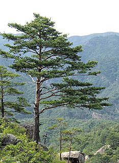
The ranges of the Gavarres are generally formed from granite rock, an extension from the volcanic area around Olot. Most mountainsides are covered in a dense forest of cork oak, holm oak, pine and other vegetation. Much of the Gavarres is a nature reserve. [1]

Granite A common type of intrusive, felsic, igneous rock with granular structure

Granite is a common type of felsic intrusive igneous rock that is granular and phaneritic in texture. Granites can be predominantly white, pink, or gray in color, depending on their mineralogy. The word "granite" comes from the Latin granum, a grain, in reference to the coarse-grained structure of such a holocrystalline rock. Strictly speaking, granite is an igneous rock with between 20% and 60% quartz by volume, and at least 35% of the total feldspar consisting of alkali feldspar, although commonly the term "granite" is used to refer to a wider range of coarse-grained igneous rocks containing quartz and feldspar.

Olot Municipality in Catalonia, Spain

Olot is the capital city of the comarca of Garrotxa, in the Province of Girona, Catalonia, Spain. The city is known for its natural landscape, including four volcanoes scattered around the city center. The municipality is part of the Garrotxa Volcanic Zone Natural Park. Olot is also well known for its cultural activity, with historical art movements like Olot school or factories of religious imagery, which contributed to the location in the city of the main Design and Arts & Crafts school of the province of Girona, the Escola d'Art i Superior de Disseny d'Olot.

Pine genus of plants

A pine is any conifer in the genus Pinus of the family Pinaceae. Pinus is the sole genus in the subfamily Pinoideae. The Plant List compiled by the Royal Botanic Gardens, Kew and Missouri Botanical Garden accepts 126 species names of pines as current, together with 35 unresolved species and many more synonyms.

Puig d'Arques summit Puig d'arques.JPG
Puig d'Arques summit
Sant Mateu de Montnegre hermitage Ermita Sant Mateu de Montnegre (Les Gavarres) Vista ubicacio.jpg
Sant Mateu de Montnegre hermitage

See also

Related Research Articles

Pre-Pyrenees

The Pre-Pyrenees are the foothills of the Pyrenees.

Lloret de Mar Municipality in Catalonia, Spain

Lloret de Mar is a Mediterranean coastal town in Catalonia, Spain. It is 40 kilometres south of Girona and 75 kilometres northeast of Barcelona. With a population of 39,363 in 2009, it is the second largest town in the Selva comarca of Catalonia.

Cantabrian Mountains

The Cantabrian Mountains or Cantabrian Range are one of the main systems of mountain ranges in Spain. They stretch for over 300 km (180 miles) across northern Spain, from the western limit of the Pyrenees to the Galician Massif in Galicia, along the coast of the Cantabrian Sea. Their easternmost end meets the Sistema Ibérico.

La Bisbal dEmpordà Municipality in Catalonia, Spain

La Bisbal d'Empordà is the county seat of the comarca of Baix Empordà in Catalonia, Spain. The town lies 29 km southeast of Girona, 12 km west of Palafrugell and 19 km northwest of Palamós along road C-66 from Girona to Palafrugell/Palamós, where it becomes C-31. Two other roads branch off at La Bisbal, GI-660 to Calonge and Sant Feliu de Guíxols and GI-664 to Cassà de la Selva; both roads cross the hilly coastal range called the Gavarres, with many twists and turns. The municipality lies on the northern edge of the Gavarres, on either side of the Daró river-bed, a dry tributary of River Ter.

Santa Coloma de Farners Municipality in Catalonia, Spain

Santa Coloma de Farners is a spa town and capital of the comarca of the Selva, in Catalonia, Spain, and of the judicial district of Santa Coloma. It is situated on the edge of the Selva Depression and of the Guilleries. The local economy is mainly commercial, given the status of the town as capital of the comarca, although summer tourism, agriculture and forestry products also contribute. The urban centre is to the north and west of the main modern communication routes, although the C-253 road links the town with the main N-II route and the AP-7 autopista and to the RENFE railway station at Sils (10 km). The GE-533 runs through the northern part of the municipality, linking it with Vic to the west and with Riudellots de la Selva, Vilobí d'Onyar and Girona-Costa Brava Airport to the east.

Calonge Municipality in Catalonia, Spain

Calonge is a municipality in the comarca of the Baix Empordà in Catalonia, Spain, on the coastline of the Costa Brava.

Mont-ras Municipality in Catalonia, Spain

Mont-Ras is a village and rural district situated between the larger towns of Palafrugell and Palamos on the Costa Brava in Baix Emporda, in the province of Girona, Catalonia, Spain. Mont-ras is approximately 40 minutes from Girona, or 80 minutes from Barcelona.

Sant Mateu Municipality in Valencian Community, Spain

Sant Mateu is a town and municipality in eastern Spain, in the province of Castellón, part of the autonomous community of Valencia.

Mare de Déu del Mont mountain in Spain

Mare de Déu del Mont, also known as Serra del Mont, is a mountain range of the Alta Garrotxa natural region, Catalonia, Spain. It has an elevation of 1,123 metres above sea level.

Cruïlles Village in Catalonia, Spain

Cruïlles is a village in the Baix Empordà, now part of the municipality of Cruïlles, Monells i Sant Sadurní de l'Heura, which is the administrative center and location of City Hall. It was its own municipality until 1973, when it merged with Monells and Sant Sadurní de l'Heura to form the current municipality.

Talaies dAlcalà mountain in Spain

Talaies d'Alcalà, also known as Serra de les Talaies or simply Les Talaies, is a 21.5 km long mountain range in the Baix Maestrat comarca, Valencian Community, Spain. Its highest point is Talaia Grossa.

Garraf Massif mountain range

The Garraf Massif is a mountain range of the Catalan Coastal Range, Catalonia, Spain. Its cliffs reach the Mediterranean waters. Its highest point on the coastal side is La Morella, 593 metres above sea level and further inland rises the higher, although less conspicuous, Montau.

Serra de la Vall dàngel mountain in the Land of Valencia

Serra de la Valldàngel or Serra de la Vall d'Àngel,, is a mountain range in the Baix Maestrat comarca, Castellón Province, Valencian Community, Spain.

Massís de lArdenya

The Massís de l'Ardenya, also known as Massís de Cadiretes after the main range in the mountainous area, is a massif in the Costa Brava region, Catalonia, Spain.

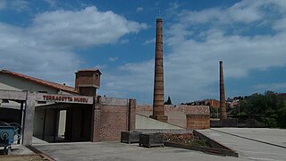
The Terracotta Ceramics Museum

The Terracotta Museum, in La Bisbal d'Empordà, is a museum of pottery and industrial ceramics that was opened in 1991.

References