Gedding

Last updated

Gedding
Gedding Hall, Gedding, Suffolk - geograph.org.uk - 220522.jpg
Gedding Hall
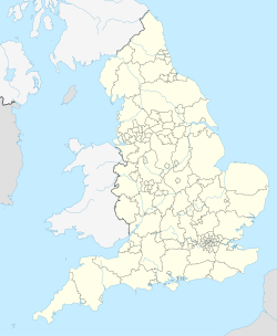
England location map.svg
Red pog.svg
Gedding
Suffolk UK location map.svg
Red pog.svg
Gedding
Location within Suffolk
Area2.00 km2 (0.77 sq mi)
Population125 (2011) [1]
  Density 63/km2 (160/sq mi)
OS grid reference TL950580
District
Shire county
Region
Country England
Sovereign state United Kingdom
Post town Bury St Edmunds
Postcode district IP30
Police Suffolk
Fire Suffolk
Ambulance East of England
UK Parliament
List of places
UK
England
Suffolk
52°11′05″N0°51′15″E / 52.18483°N 0.85410°E / 52.18483; 0.85410 Coordinates: 52°11′05″N0°51′15″E / 52.18483°N 0.85410°E / 52.18483; 0.85410

Gedding is a village and civil parish in the Mid Suffolk district of Suffolk in eastern England. Located around six miles south east of Bury St Edmunds. At the 2011 census its population was 125, rising to 134 at the 2018 ONS mid year estimate. [2]
Contents

History

The village's name derives from the old english phrase meaning Gydda's People. [3] In 1086 it is recorded in the Domesday Book as Geldinga with 18 households made up of 15 freemen and 3 smallholders along with 5 acres of meadow. The land was held by Bury Abbey and William de Warenne, 1st Earl of Surrey. [4]

There were two windmills in the parish, both were Post mills with one existing from 1783 to c. 1904. The other post mill came from Felsham in 1867 having been originally constructed in 1824, it was demolished in 1944, on the journey from Felsham it was pulled by 26 horses and got stuck at a ford. [5] [6]

There are six listed buildings in Gedding, four are grade II with the early C.16th Gedding Hall being grade II* listed and the grade I church of St Mary. [7]

Bradfield Woods

Bradfield Woods National Nature Reserve and Site of Special Scientific Interest is located just to the west of the village. [8]

Related Research Articles

Culford Village and civil parish in Suffolk, United Kingdom

Culford is a village and civil parish about 4 miles (6 km) north of Bury St Edmunds and 62 miles (100 km) north east of London in the West Suffolk district of Suffolk, England.

Thurston, Suffolk Human settlement in England

Thurston is a village and a parish in Suffolk situated about 4 miles (6 km) east of Bury St Edmunds and 10 miles (16 km) west of Stowmarket.

Ampton Human settlement in England

Ampton is a village and civil parish in the West Suffolk District of Suffolk, England, about five miles north of Bury St Edmunds.

Assington Human settlement in England

Assington is a village in Suffolk, England, 4 miles (6.4 km) south-east of Sudbury. At the 2011 Census it had a population of 402, estimated at 445 in 2019. The parish includes the hamlets of Rose Green and Dorking Tye.

Bardwell, Suffolk Human settlement in England

Bardwell is a village and civil parish in the West Suffolk district of Suffolk, England.

Brockley, Suffolk Human settlement in England

Brockley(not to be confused with Brockley Green, 8 miles southwest in Hundon parish) is a village and civil parish in the West Suffolk district of Suffolk, England. Brockley parish includes the hamlets of Pound Green and Gulling Green. According to the 2001 Census parish population was 281, and increased to 312 at the 2011 Census.

Burgh St Peter Human settlement in England

Burgh St Peter is a village and civil parish in the South Norfolk district of Norfolk, England. The village is about 3+12 miles (6 km) northeast of Beccles in Suffolk. The village is about 50 feet (15 m) above sea level, sharing the same slight hill with Wheatacre about 12 mile (800 m) to the northwest.

Grundisburgh Human settlement in England

Grundisburgh is a village of 1,584 residents situated in the English county of Suffolk. It is in the East Suffolk district, six 6 miles (10 km) north-east from Ipswich and 4 miles (6 km) north-west of Woodbridge located on the B1079. Flowing through the village are the rivers Lark and Gull. The finding of Ipswich and Thetford-type pottery suggests that there was settlement in the Middle Saxon era. The village is recorded in the Domesday Book as "Grundesbur", "Grundesburg", "Grundesburh" or "Grundesburc". Grundisburgh is pronounced "Gruns-bruh".

Keyingham Village and civil parish in the East Riding of Yorkshire, England

Keyingham is a village and civil parish in the East Riding of Yorkshire, England. The village is situated approximately 10 miles (16 km) east of Kingston upon Hull city centre and lies on the A1033 road.

Rossett Village in Clwyd, Wales

Rossett is a village, local government community and electoral ward in Wrexham County Borough, Wales. Rossett is served by the A483 road.

Flempton Human settlement in England

Flempton is a village and civil parish in the West Suffolk district of Suffolk, England. It is on the A1101 road 5 miles NW from Bury St Edmunds.

Great Barton Human settlement in England

Great Barton is a large village and civil parish in the West Suffolk district of Suffolk, England, about 3 miles (5 km) East of Bury St Edmunds on the A143. At the 2011 census the village had a population of 2,191 rising to 2,236 at the 2018 mid year estimate.

Bradfield Combust Human settlement in England

Bradfield Combust is a village and former manor and civil parish, now in the parish of Bradfield Combust with Stanningfield in Suffolk, England, located on the A134 between Windsor Green and Great Whelnetham. In 1961 the parish had a population of 108. In 1988 the parish was merged with Stanningfield to form "Bradfield Combust with Stanningfield".

Mareham le Fen Village in Lincolnshire, England

Mareham le Fen is a village and civil parish about 6 miles (10 km) south from the town of Horncastle, Lincolnshire, England. The hamlet of Mareham Gate lies about 0.5 miles (0.8 km) south from the village, and it is believed that the deserted medieval village (DMV) of Birkwood is situated nearby.

Thorpe Morieux Human settlement in England

Thorpe Morieux is a small village and civil parish in Suffolk, England. It is 10 miles south-east of Bury St Edmunds and 10 miles north east of Sudbury.

Pettaugh Human settlement in England

Pettaugh is a village and civil parish located within the district council area of Mid Suffolk, England.

Drinkstone Human settlement in England

Drinkstone is a small settlement and civil parish in Suffolk, England. Its name is derived from Dremic's homestead. It was located in the hundred of Thedwastre. It is near the A14 road and is 6 miles (10 km) southeast of the town of Bury St Edmunds. It is mentioned in the Domesday Book, 1086.

Felsham Human settlement in England

Felsham is a village and civil parish in the Mid Suffolk district of Suffolk in eastern England. In 2005 its population was 420.

Timworth Human settlement in England

Timworth is a village and civil parish 65 mi (105 km) north east of London and 26 mi (42 km) east of Cambridge in the West Suffolk district of Suffolk, eastern England. Located around two miles north of Bury St Edmunds, its 2005 population was 50. At the 2011 Census the appropriate Postal Code showed the population as being included in Ampton.

Stanningfield Village in Suffolk, England

Stanningfield is a village and former civil parish, since 1988 in the parish of Bradfield Combust with Stanningfield, in the West Suffolk district of the county of Suffolk, England. The village lies just off of the A134 road, about 5 miles (8 km) south-east of Bury St Edmunds, 5 miles/8 km north-west of Lavenham, and 10 miles/16 km north of Sudbury.

References

  1. UK Census (2011). "Local Area Report – Gedding Parish (E04009202)". Nomis. Office for National Statistics . Retrieved 20 August 2020.
  2. "Gedding (Parish, United Kingdom) - Population Statistics, Charts, Map and Location". www.citypopulation.de. Retrieved 3 June 2020.
  3. "Key to English Place-names". kepn.nottingham.ac.uk. Retrieved 3 June 2020.
  4. "Gedding | Domesday Book". opendomesday.org. Retrieved 3 June 2020.
  5. Flint, Brian. (1979). Suffolk windmills. Woodbridge [England]: Boydell Press. ISBN   0-85115-112-4. OCLC   6422007.
  6. "Gedding - Archive Catalogue". catalogue.millsarchive.org. Retrieved 3 June 2020.
  7. "Listed Buildings in Gedding, Mid Suffolk, Suffolk". britishlistedbuildings.co.uk. Retrieved 3 June 2020.
  8. Bradfield Woods NNR Archived 2013-08-15 at the Wayback Machine , Natural England. Retrieved 2013-05-29.

Commons-logo.svg Media related to Gedding at Wikimedia Commons