Geikie River (Saskatchewan)

Last updated

Geikie River
Churchill river hudson basin map.png
Churchill River drainage basin
Canada Saskatchewan relief location map.jpg
Red pog.svg
Location of the mouth of the Geikie River in Saskatchewan
Canada relief map 2.svg
Red pog.svg
Geikie River (Saskatchewan) (Canada)
Location
Country Canada
Province Saskatchewan
Physical characteristics
SourceCostigan Lake
  coordinates 56°58′14″N105°52′33″W / 56.97056°N 105.87583°W / 56.97056; -105.87583
  elevation543 m (1,781 ft) [1]
Mouth Wollaston Lake
  coordinates
57°45′00″N103°52′02″W / 57.75000°N 103.86722°W / 57.75000; -103.86722
  elevation
398 m (1,306 ft)
Basin size7,730 km2 (2,980 sq mi)
Basin features
River system Mackenzie River drainage basin
and
Churchill River drainage basin
[2]

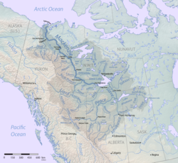
Geikie River [3] is a river in the northern part of the Canadian province of Saskatchewan. [2] The river's source is Costigan Lake, which is near the uranium producing areas around the Key Lake mine in the Athabasca Basin. It flows in a north-easterly direction and flows into Wollaston Lake.

Contents

As the primary inflow of Wollaston Lake, the largest natural bifurcation lake in the world, the Geikie River's most unusual feature is that it straddles a major drainage divide which separates waters flowing into Hudson Bay from those flowing into the Arctic Ocean.

From Wollaston Lake, waters from the Geikie River can flow into either the Fond du Lac River which flows out of the lake to the north-west where it drains into Lake Athabasca which ultimately drains into the Arctic Ocean via the Mackenzie River system, or into the Cochrane River which flows out of the north-eastern side of the lake and into Reindeer Lake which drains via the Churchill River system into Hudson Bay. If Hudson Bay is defined as part of the Atlantic Ocean then the Geikie River is the largest river in the world that drains naturally into two oceans.

Geikie River Recreation Site

Geikie River Recreation Site ( 57°42′23″N103°57′05″W / 57.7064°N 103.9513°W / 57.7064; -103.9513 ), [4] also called Geikie River Campground, is a provincially run park on the north side of the Geikie River, near its mouth. The campground features eight free campsites, a boat launch, and a fish cleaning station. [5] It is located along Highway 905 at the highway's 184-kilometre mark, 30 kilometres (19 mi) south of Wollaston Lake Landing and 210 kilometres (130 mi) north of the community of Southend. [6] [7] [8]

See also

Related Research Articles

<span class="mw-page-title-main">Churchill River (Hudson Bay)</span> River in Manitoba and Saskatchewan, Canada

The Churchill River is a major river in Alberta, Saskatchewan and Manitoba, Canada. From the head of the Churchill Lake it is 1,609 kilometres (1,000 mi) long. It was named after John Churchill, 1st Duke of Marlborough and governor of the Hudson's Bay Company from 1685 to 1691.

The Fond du Lac River is one of the upper branches of the Mackenzie River system, draining into the Arctic Ocean, located in northern Saskatchewan, Canada. The river is 277 kilometres (172 mi) long, has a watershed of 66,800 km2 (25,800 sq mi), and its mean discharge is 300 m3/s (11,000 cu ft/s).

<span class="mw-page-title-main">Wollaston Lake</span> Lake in Saskatchewan, Canada

Wollaston Lake is a lake in the north-eastern part of the Canadian province of Saskatchewan. It is about 550 kilometres (340 mi) north-east of Prince Albert. With a surface area of 2,286 square kilometres (883 sq mi), it is the largest bifurcation lake in the world — that is, a lake that drains naturally in two directions.

Highway 995, also known as Welcome Street, is a provincial highway in the far north region of the Canadian province of Saskatchewan. It is one of the few highways in Saskatchewan that is completely isolated from the other highways. Seasonal access is provided to Highway 905 by way of the Wollaston Lake Barge.

<span class="mw-page-title-main">Last Mountain Lake</span> Lake in Saskatchewan, Canada

Last Mountain Lake, also known as Long Lake, is a prairie lake formed from glaciation 11,000 years ago. It is located in south central Saskatchewan, Canada, about 40 kilometres (25 mi) north-west of the city of Regina. It flows into the Qu'Appelle River via Last Mountain Creek, which flows past Craven. It is approximately 93 km (58 mi) long, and 3 km (1.9 mi) wide at its widest point. It is the largest naturally occurring body of water in southern Saskatchewan. Only Lake Diefenbaker, which is man-made, is larger. The lake is a popular resort area for residents of south-eastern Saskatchewan.

<span class="mw-page-title-main">Waterhen River (Saskatchewan)</span> River in Saskatchewan, Canada

Waterhen River is an east-flowing river in the north-west area of the Canadian province of Saskatchewan in the drainage basin of the Beaver River. It is north of and parallel to the east-flowing part of the Beaver River and joins the north-flowing part of that river. Most of the river and its drainage basin is at the southern edge of the boreal forest belt. While the river's source is Lac des Îles, its drainage basin reaches north into the Mostoos Hills and west well into the neighbouring province of Alberta.

Waterhen Lake is a lake in Meadow Lake Provincial Park in the Canadian province of Saskatchewan, located about 40 km (25 mi) north of the city of Meadow Lake. The lake is situated along the course of the Waterhen River in the boreal forest ecozone of Canada.

Costigan Lake is a lake in northern Saskatchewan, Canada. It is the source of the Geikie River which flows to Wollaston Lake, which drains via two river systems: through the Churchill River system to Hudson Bay; and the Mackenzie River system to the Arctic Ocean.

<span class="mw-page-title-main">Moose Mountain Creek</span> River in southern Saskatchewan, Canada

Moose Mountain Creek is a river in the Canadian province of Saskatchewan. Its source is the Chapleau Lakes near Montmartre and it is a tributary of the Souris River, which, in turn, is a tributary of the Assiniboine River. The whole system is part of the Red River watershed, which is part of the Hudson Bay drainage basin and in a region called the Prairie Pothole Region of North America, which extends throughout three Canadian provinces and five U.S. states. It is also within Palliser's Triangle and the Great Plains ecoregion.

<span class="mw-page-title-main">Porcupine Hills Provincial Park</span> Provincial park in Saskatchewan, Canada

Porcupine Hills Provincial Park is the newest provincial park in the Canadian Province of Saskatchewan. It was created in 2018 through the amalgamation of five pre-existing provincial recreation sites south-east of the town of Hudson Bay. The park is in the Porcupine Provincial Forest in the Porcupine Hills, which is a geographical feature in eastern Saskatchewan and western Manitoba. The hills are part of a range of hills called the Manitoba Escarpment.

Hudson Bay Regional Park is a regional park in the Canadian province of Saskatchewan. It is located on the south side of the town of Hudson Bay in the RM of Hudson Bay No. 394 along the shores of the Red Deer River. The park is the site of a North West Company fur trading fort called Fort Red Deer River that was built in 1790. About 14 kilometres (8.7 mi) downstream, near Erwood, was a Hudson's Bay Company trading post that was built in 1757.

Pasquia Hills are hills in the Canadian province of Saskatchewan. They are located in the east central part of the province in the RM of Hudson Bay No. 394 near the Manitoba border. The hills are the northern most in a series of hills called the Manitoba Escarpment. The Manitoba Escarpment marks the western edge of the pre-historical glacial Lake Agassiz. The other four hills include Porcupine Hills, Duck Mountain, and Riding Mountain.

<span class="mw-page-title-main">Cold River (Saskatchewan)</span> River in Saskatchewan, Canada

Cold River is a river in the Canadian province of Saskatchewan. The river's source is Cold Lake, which is a large lake on the provincial border of Saskatchewan and Alberta, and its mouth is at the western end of Lac des Îles in Meadow Lake Provincial Park. It is an east flowing river and the entirety of its course is in Meadow Lake Provincial Park and the boreal forest.

Kimball Lake is a lake in Meadow Lake Provincial Park in the Canadian Province of Saskatchewan in the boreal forest ecozone of Canada. The lake is located near the centre of the park, north of the Waterhen River and Little Raspberry Lake and south of First Mustus Lake. Rusty and Greig Lakes are to the east. Several small streams feed into the lake and the outflow is at the southern shore, which feeds into the Waterhen River, a tributary of Beaver River. The Beaver River, in turn, flows north into Lac Île-à-la-Crosse and the Churchill River, a major tributary in the Hudson Bay drainage basin.

Matheson Lake is a lake in Meadow Lake Provincial Park in the Canadian Province of Saskatchewan in the boreal forest ecozone of Canada. The lake is located near the centre of the park, north of the Waterhen River, west of Vivian Lake and south of Peitahigan Lake. Several small streams feed into the lake and the outflow is at the southern shore, which feeds into the Waterhen River, a tributary of Beaver River. The Beaver River, in turn, flows north into Lac Île-à-la-Crosse and the Churchill River, a major tributary in the Hudson Bay drainage basin.

First Mustus Lake is a lake in Meadow Lake Provincial Park in the Canadian Province of Saskatchewan in the boreal forest ecozone of Canada. The lake is the first of four lakes in a row named Mustus in the Rusty Creek watershed. The other lakes are Second, Third, and Fourth Mustus. Rusty Creek and the lakes are part of the Waterhen River drainage basin. The Waterhen River is a tributary of the Beaver River, which flows north into Lac Île-à-la-Crosse and the Churchill River, a major tributary in the Hudson Bay drainage basin. Highway 224 provides access to both First and Second Mustus Lakes.

Peitahigan Lake is a lake in Meadow Lake Provincial Park in the Canadian Province of Saskatchewan in the boreal forest ecozone of Canada. The lake is one of six notable lakes in the Rusty Creek watershed. The other lakes include Rusty, First Mustus, Second Mustus, Third Mustus, and Fourth Mustus. Rusty Creek and the lakes are part of the Waterhen River drainage basin. The Waterhen River is a tributary of the Beaver River, which flows north into Lac Île-à-la-Crosse and the Churchill River, a major tributary in the Hudson Bay drainage basin.

Mistohay Lake is a lake in Meadow Lake Provincial Park in the Canadian Province of Saskatchewan in the boreal forest ecozone of Canada. The lake is part of the Waterhen River drainage basin. The Waterhen River is a tributary of the Beaver River, which flows north into Lac Île-à-la-Crosse and the Churchill River, a major tributary in the Hudson Bay drainage basin.

Lower Fishing Lake is a lake in the east-central part of the Canadian province of Saskatchewan in Narrow Hills Provincial Park. It is situated in the Cub Hills and the boreal forest ecozone of Canada. The lake is accessed from Highway 920, which connects to Hanson Lake Road and Highway 120. The Fishing Lakes Fire of 1977 burned much of the region upstream and around the lake and now the area is now dominated by jack pine, which is a tree species that is well adapted fire burned forests.

Baldy Lake is a lake in the east-central part of the Canadian province of Saskatchewan in Narrow Hills Provincial Park. It is situated in the Cub Hills and the boreal forest ecozone of Canada.

References

  1. "Costigan Lake". Mapcoordinates.net. Vivid Planet Software GmbH. Retrieved 20 July 2017.
  2. 1 2 "Geikie River". Geographical Names Data Base . Natural Resources Canada . Retrieved 29 August 2014.
  3. Government of Canada, Natural Resources Canada. "Place names - Geikie River". www4.rncan.gc.ca.
  4. Government of Canada, Natural Resources Canada. "Place names - Geikie River Recreation Site". www4.rncan.gc.ca.
  5. "BRMB Maps | Canada's Best Backcountry Navigation Tool".
  6. "Geikie River Campground". Tourism Saskatchewan. Government of Saskatchewan. Retrieved 15 March 2024.
  7. Lemna, Sam (3 January 2023). "Where to Camp for Free in Saskatchewan". RV Direct Insurance. RV Direct Insurance Ltd. Retrieved 15 March 2024.
  8. "30 Free Places to Camp in Saskatchewan". Explore. Explore Magazine. Retrieved 3 April 2024.