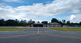
Karnal Aerodrome is being operated as a pilot training institute owned and operated by the Haryana Institute of Civil Aviation (HICA) under the guidance of the Civil Aviation Department, Government of Haryana. The flying school is spread over an area of 104 acres and is situated about 3 km east of Karnal in the state of Haryana, India.
Constanza National Airport is an airport for domestic flights serving Constanza, a town in the La Vega Province of the Dominican Republic.

Antonio Nariño Airport is an airport located in the town of Chachagüí and which serves the city of Pasto in the Nariño Department of Colombia. The airport is 35 kilometres (22 mi) north of Pasto. It handles only domestic flights in addition to military operations and private charters. A new terminal, administrative and tower control were built, also new navigation equipment was set up due to the increasing number of passengers and cargo flights. Usually Airbus 318, 319, 320, Boeing 737, 727, turboprop and different types of smaller aircraft use the airport

El Embrujo Airport is an airport serving Providencia Island, Colombia. The airport is located in the north east side of the island, in the limits of the Old Providence McBean Lagoon National Natural Park.
Golfo de Morrosquillo Airport is a commercial airport serving the Caribbean coast municipality of Tolú in the Sucre Department of Colombia. The airport is on the coast south of the town, and north approaches and departures are over the water.
Monteagudo Airport is an airport serving Monteagudo, a town in the Chuquisaca Department of Bolivia.
Copacabana Airport is an extremely high elevation airport serving Copacabana, a town on Lake Titicaca in the La Paz Department of Bolivia.
Uspallata Airport is a public use airport located 5 kilometres (3 mi) north of Uspallata, a small town in the Mendoza Province of Argentina.
Alto Palena Airport is an airport serving Palena, a small town in the mountains of the Los Lagos Region of Chile. Palena is 5 kilometres (3.1 mi) from the Argentina border. The airport is just north of the town, and south of a bend in the Palena River.
Chile Chico Airport Spanish: Aeródromo Chile Chico, is an airport serving Chile Chico, a lakeside town in the Aysén Region of Chile. Chile Chico is on the south shore of General Carrera Lake, 3 kilometres (1.9 mi) west of the Argentina border. The airport is 5 kilometres (3.1 mi) southeast of the town.

Cochrane Airport Spanish: Aeródromo Cochrane, is an airport serving Cochrane, a town in the Aysén Region of Chile. The airport is just northwest of the town, at the foot of Cerro Tamanguito (sv).
Futaleufú Airfield is an airport serving Futaleufú, a town in the Los Lagos Region of Chile.
Barriles Airport Spanish: Aeropuerto Barriles is an airport 15 kilometres (9.3 mi) east-southeast of Tocopilla, a Pacific coastal town in the Antofagasta Region of Chile.
Garachiné Airport is an airport serving the Pacific coastal town of Garachiné, in the Darién Province of Panama.
Pinjore Airfield is being operated as a pilot training institute owned and operated by Haryana Institute of Civil Aviation (HICA) under guidance of Civil Aviation Department, Government of Haryana. The flying school is spread over an area of 96 acres and is located on Pinjore - Baddi main highway near the cities of Kalka and Pinjore in the Panchkula district of the Indian state of Haryana.
San Miguel Airport is an airport serving San Miguel, a town in the Pearl Islands of Panama. It is just east of the town, on the northern side of Isla del Rey, the largest of the islands.
Uribe Airport is an airport serving the town of La Uribe, in the Meta Department of Colombia. The runway and town are on the northern bank of the small Duda River, a tributary of the Guayabero River. High terrain exists north and west.
Furatena Airport is an airport serving the emerald region of the western emerald belt and town of Quípama in the Boyacá Department of Colombia. The airport is four nautical miles west of Muzo Airport.
Miraflores Airport is an airport serving the town of Miraflores, in the Guaviare Department of Colombia. The runway and town are on the east bank of the Vaupés River, a tributary of the Rio Negro River.
Capurganá Airport is an airport serving the Caribbean coastal town of Capurganá in the Chocó Department of Colombia. No roads go to Capurganá, so boats and aircraft are the primary means in and out.
