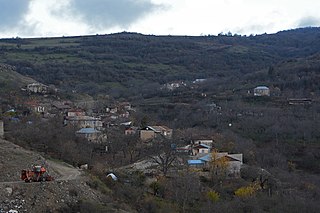
Khojavend District is one of the 66 districts of Azerbaijan. It is located in the west of the country in the Karabakh Economic Region. The district borders the districts of Lachin, Shusha, Khojaly, Aghdam, Aghjabadi, Fuzuli, Jabrayil, and Qubadli. Its capital and largest city is Khojavend. As of 2020, the district had a nominal population of 44,100.
Çullu is a village situated on Goyan steppe, 27 km west of the city of Jabrayil, within the Dagh Tumas administrative-territorial unit of Jabrayil District, Azerbaijan.

Soltanlı is a village in the Jabrayil District of Azerbaijan, located on Araz plain, 14 km south of the city of Jabrayil.
Sarıcallı is a village in the Shukurbayli administrative unit of Jabrayil district, Azerbaijan, located on Goyana steppe, 12 km south of the city of Jabrayil.
Şəybəy is a village situated in Jabrayil district of Azerbaijan, being placed on the left bank of Chaylag River 14 km east of the city of JabrayilAzerbaijan.
Horovlu village within the administrative-territorial unit of the same name in the Jabrayil district of Azerbaijan, located on a plain, 8 km east of the city of Jabrayil.
Çərəkən is a village in Horovlu administrative-territorial unit of Jabrayil district, Azerbaijan, located on a plain, 3 km northeast of the city of Jabrayil.
Yuxarı Veysəlli is a former village in the current Khojavend District of Azerbaijan. Before its abolition, the village was part of the Veysalli Rural administrative division of the Fuzuli District. By the Law of the Republic of Azerbaijan dated December 5, 2023, Yuxari Veysalli was abolished, and its territory was transferred to the Khojavend District.
Məmər is a village in the Qubadli District of Azerbaijan. It is situated along the Vorotan river.

Mkhitarashen or Mukhtar is a village located in the Khojaly District of Azerbaijan, in the disputed region of Nagorno-Karabakh.

Tsakuri or Hunarli is a village in the Khojavend District of Azerbaijan, in the disputed region of Nagorno-Karabakh. The village had an ethnic Armenian-majority population prior to the 2020 Nagorno-Karabakh war, and also had an Armenian majority in 1989.

Shekher is a village in the Khojavend District of Azerbaijan, in the region of Nagorno-Karabakh.
Divanalılar is a village in the Fuzuli District of Azerbaijan. The village had an Azerbaijani majority prior to their expulsion during the First Nagorno-Karabakh War. It was under the control of Armenian forces of the self-proclaimed Republic of Artsakh since the First Nagorno-Karabakh War. However, it was announced to be recaptured by the Azerbaijani Army on November 7, 2020.
Dəlləkli is a village located in the administrative-territorial district of the village of Chopadara in Zangilan district, Azerbaijan.
Jahangirbeyli is a village located in Zangilan District, Azerbaijan. The village is situated on the left bank of the Okhchuchay River, southeast of Zangilan and northeast of Minjivan, at an altitude of 409 m above sea level.
Sirik is a village in the administrative unit of the same name, Jabrayil district, Azerbaijan, located on the slopes of the Karabakh ridge, 15 km northwest of the city of Jabrayil.
Bartaz is a village located in Zangilan district of Azerbaijan. It is situated in the administrative-territorial rural district of the village of Bartaz.
Çələbilər the ruins of a village located 17 km west of the city of Jabrayil, within the Dagh Tumas administrative-territorial unit, Jabrayil district, Azerbaijan.
Yuxarı Məzrə is a former village in the current Khojavend District of Azerbaijan. Before its abolition, the village was part of the Sarijali Rural administrative division of the Jabrayil District. By the Law of the Republic of Azerbaijan dated December 5, 2023, Yukhary Mazra was abolished, and its territory transferred to Khojavend District.
Hajyly is a village within the administrative-territorial unit with the same name in Jabrayil district, Azerbaijan, located on a plain. It is located 5 km south of Jabrayil city.


