A digital elevation model (DEM) or digital surface model (DSM) is a 3D computer graphics representation of elevation data to represent terrain or overlaying objects, commonly of a planet, moon, or asteroid. A "global DEM" refers to a discrete global grid. DEMs are used often in geographic information systems (GIS), and are the most common basis for digitally produced relief maps. A digital terrain model (DTM) represents specifically the ground surface while DEM and DSM may represent tree top canopy or building roofs.

Remote sensing is the acquisition of information about an object or phenomenon without making physical contact with the object, in contrast to in situ or on-site observation. The term is applied especially to acquiring information about Earth and other planets. Remote sensing is used in numerous fields, including geophysics, geography, land surveying and most Earth science disciplines. It also has military, intelligence, commercial, economic, planning, and humanitarian applications, among others.

The Landsat program is the longest-running enterprise for acquisition of satellite imagery of Earth. It is a joint NASA / USGS program. On 23 July 1972, the Earth Resources Technology Satellite was launched. This was eventually renamed to Landsat 1 in 1975. The most recent, Landsat 9, was launched on 27 September 2021.
The Moderate Resolution Imaging Spectroradiometer (MODIS) is a satellite-based sensor used for earth and climate measurements. There are two MODIS sensors in Earth orbit: one on board the Terra satellite, launched by NASA in 1999; and one on board the Aqua satellite, launched in 2002. MODIS has now been replaced by the VIIRS, which first launched in 2011 aboard the Suomi NPP satellite.

Geomatics is defined in the ISO/TC 211 series of standards as the "discipline concerned with the collection, distribution, storage, analysis, processing, presentation of geographic data or geographic information". Under another definition, it consists of products, services and tools involved in the collection, integration and management of geographic (geospatial) data. Surveying engineering was the widely used name for geomatic(s) engineering in the past. Geomatics was placed by the UNESCO Encyclopedia of Life Support Systems under the branch of technical geography.

OpenStreetMap is a website that uses an open geographic database which is updated and maintained by a community of volunteers via open collaboration. Contributors collect data from surveys, trace from aerial photo imagery or satellite imagery, and also import from other freely licensed geodata sources. OpenStreetMap is freely licensed under the Open Database License and as a result commonly used to make electronic maps, inform turn-by-turn navigation, assist in humanitarian aid and data visualisation. OpenStreetMap uses its own topology to store geographical features which can then be exported into other GIS file formats. The OpenStreetMap website itself is an online map, geodata search engine and editor.
Wikimapia is a geographic online encyclopedia project. The project implements an interactive "clickable" web map that utilizes Google Maps with a geographically-referenced wiki system, with the aim to mark and describe all geographical objects in the world.

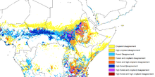
Land cover is the physical material at the land surface of Earth. Land covers include flora, concrete, built structures, bare ground, and temporary water. Earth cover is the expression used by ecologist Frederick Edward Clements that has its closest modern equivalent being vegetation. The expression continues to be used by the United States Bureau of Land Management.
Digital Earth is the name given to a concept by former US vice president Al Gore in 1998, describing a virtual representation of the Earth that is georeferenced and connected to the world's digital knowledge archives.
Geospatial metadata is a type of metadata applicable to geographic data and information. Such objects may be stored in a geographic information system (GIS) or may simply be documents, data-sets, images or other objects, services, or related items that exist in some other native environment but whose features may be appropriate to describe in a (geographic) metadata catalog.

eBird is an online database of bird observations providing scientists, researchers and amateur naturalists with real-time data about bird distribution and abundance. Originally restricted to sightings from the Western Hemisphere, the project expanded to include New Zealand in 2008, and again expanded to cover the whole world in June 2010. eBird has been described as an ambitious example of enlisting amateurs to gather data on biodiversity for use in science.
Collaborative mapping, also known as citizen mapping, is the aggregation of Web mapping and user-generated content, from a group of individuals or entities, and can take several distinct forms. With the growth of technology for storing and sharing maps, collaborative maps have become competitors to commercial services, in the case of OpenStreetMap, or components of them, as in Google Map Maker, Waze and Yandex Map Editor.
Volunteered geographic information (VGI) is the harnessing of tools to create, assemble, and disseminate geographic data provided voluntarily by individuals. VGI is a special case of the larger phenomenon known as user-generated content, and allows people to have a more active role in activities such as urban planning and mapping.

Sentinel-2 is an Earth observation mission from the Copernicus Programme that acquires optical imagery at high spatial resolution over land and coastal waters. The mission's Sentinel-2A and Sentinel-2B satellites were joined in orbit in 2024 by a third, Sentinel-2C, and in the future by Sentinel-2D, eventually replacing the A and B satellites, respectively.

Geography is the study of the lands, features, inhabitants, and phenomena of Earth. Geography is an all-encompassing discipline that seeks an understanding of Earth and its human and natural complexities—not merely where objects are, but also how they have changed and come to be. While geography is specific to Earth, many concepts can be applied more broadly to other celestial bodies in the field of planetary science. Geography has been called "a bridge between natural science and social science disciplines."
Bhuvan is an Indian web-based utility which allows users to explore a set of geographic content prepared by the Indian Space Research Organisation. The content which the utility serves is mostly restricted to within Indian boundaries and is offered in four regional languages. The content includes thematic maps related to disasters, agriculture, water resources, land cover, and processed satellite data generated by ISRO.
Land cover maps are tools that provide vital information about the Earth's land use and cover patterns. They aid policy development, urban planning, and forest and agricultural monitoring.
The World Urban Database and Access Portal Tools (WUDAPT) is a global initiative of tools to create local climate zone maps for a given city using a standard methodology. It has both a database and a portal. The database has hierarchical layers of increasing detail, with data acquired via crowdsourcing methods such as Geo-Wiki.

Qihao Weng is an American geographer, urban, environmental sustainability, and remote sensing scientist. He has been a Chair Professor at the Hong Kong Polytechnic University since July 2021, and was the Director of the Center for Urban and Environmental Change and is a professor of geography in the Department of Earth and Environmental Systems at the Indiana State University.
Applications of machine learning (ML) in earth sciences include geological mapping, gas leakage detection and geological feature identification. Machine learning is a subdiscipline of artificial intelligence aimed at developing programs that are able to classify, cluster, identify, and analyze vast and complex data sets without the need for explicit programming to do so. Earth science is the study of the origin, evolution, and future of the Earth. The earth's system can be subdivided into four major components including the solid earth, atmosphere, hydrosphere, and biosphere.