George V. Voinovich Bridges

Last updated

George V. Voinovich Bridge westbound
George Voinovich Bridge 09-2016.jpg
The eastbound bridge, shortly after completion, September 2016
Coordinates 41°29′10″N81°41′24″W / 41.4861°N 81.69°W / 41.4861; -81.69
CarriesI-90.svg I-90 (Innerbelt Freeway)
CrossesUS 422.svgOH-8.svgOH-10.svgOH-14.svgOH-43.svgOH-87.svg US 422  / SR 8  / SR 10  / SR 14  / SR 43  / SR 87 (Ontario Street/Broadway Avenue)

RTA Rapid Transit Red Line
Cuyahoga River

Norfolk Southern Railway
Locale Cleveland, Ohio
Owner ODOT
Maintained byODOT
Characteristics
MaterialSteel, concrete
Total length4,347 feet (1,325 m)
Height136 feet (41 m)
History
Designer HNTB Ohio
Engineering design byWalsh Construction
Construction startMarch 30, 2011
Construction cost$293 million
OpenedNovember 9, 2013
InauguratedNovember 8, 2013
Replaces Innerbelt Bridge
Location
George V. Voinovich Bridges
References
[1] [2] [3] [4]
George V. Voinovich Bridge eastbound
Coordinates 41°29′N81°41′W / 41.49°N 81.69°W / 41.49; -81.69
CarriesI-90.svg I-90
CrossesNorfolk Southern Railway

Cuyahoga River
RTA Rapid Transit Red Line

US 422.svgOH-8.svgOH-10.svgOH-14.svgOH-43.svgOH-87.svg US 422  / SR 8  / SR 10  / SR 14  / SR 43  / SR 87 (Ontario Street/Broadway Avenue)
LocaleCleveland, Ohio
OwnerODOT
Maintained byODOT
Characteristics
Total length3,918 feet (1,194 m)
Height136 feet (41 m)
History
Designer URS Corporation
Engineering design byTrumbull Corporation, The Great Lakes Construction Company, & The Ruhlin Company (TGR)
Construction cost$273 million
OpenedSeptember 24, 2016
InauguratedSeptember 24, 2016
ReplacesInnerbelt Bridge
Location
George V. Voinovich Bridges
References
[4] [5] [6] [7]

The George V. Voinovich Bridges are two bridges in Cleveland, Ohio, U.S., that carry Interstate 90 (I-90, Innerbelt Freeway) over the Cuyahoga River. They are named for George Voinovich, former mayor of Cleveland, Governor of Ohio, and United States Senator.

Contents

The bridges' 200-foot (61 m) piles are the largest ever manufactured in the United States. [8] Combined the bridges cost $566 million. [9]

Predecessor

The bridges were conceived as part of the Innerbelt Freeway rebuild to replace the 1959 Innerbelt Bridge, and the schedule of the project to build them was accelerated due to the deteriorating condition of the Innerbelt Bridge. [10]

Westbound bridge

The westbound bridge was built immediately to the north of the Innerbelt Bridge. Construction on this bridge began on March 30, 2011, [1] with a ceremonial groundbreaking following on May 2. [11] [12] It opened to Ontario Street ramp traffic on November 9, 2013, [13] had opened to other ramp traffic and I-90 westbound mainline traffic by November 17, [14] and opened to eastbound traffic, which used the westbound bridge until the completion of the eastbound bridge, on November 23. [15] The bridge was dedicated to George Voinovich during the ribbon-cutting ceremony on November 8, 2013. [2]

Eastbound bridge

The eastbound bridge was built in the former location of the Innerbelt Bridge. [4] Early in the project, the proposed date of completion varied widely. [16] [17] [18] [19] [20] Construction on the bridge had begun by November 3, 2014; [21] the bridge opened in limited capacity the evening of September 24, 2016 [7] after a ribbon-cutting ceremony earlier in the day, [6] opening in full on October 24. [22] This bridge was named for George Voinovich prior to the naming of the westbound bridge. [23]

See also

Related Research Articles

<span class="mw-page-title-main">Interstate 71</span> Interstate Highway in Ohio and Kentucky

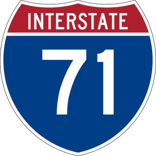
Interstate 71 (I-71) is a north–south Interstate Highway in the midwestern and southeastern regions of the United States. Its southern terminus is at an interchange with I-64 and I-65 in Louisville, Kentucky, and its northern terminus at an interchange with I-90 in Cleveland, Ohio. I-71 runs concurrently with I-75 from a point about 20 miles (32 km) south of Cincinnati, Ohio, into Downtown Cincinnati. While most odd numbered Interstates run north–south, I-71 takes more of a northeast–southwest course, with some east–west sections, and is mainly a regional route serving Kentucky and Ohio. It links I-80 and I-90 to I-70 and ultimately links to I-40. Major metropolitan areas served by I-71 include Louisville, Cincinnati, Columbus, and Cleveland.

<span class="mw-page-title-main">Ohio State Route 2</span> State highway in Ohio, United States

State Route 2, formerly known as Inter-county Highway 2 until 1921 and State Highway 2 in 1922, is an east–west highway crossing most of northern Ohio. Its western terminus is at the Indiana state line near Hicksville where the route becomes Indiana State Road 37 which continues to Fort Wayne, Indiana. The eastern terminus of the route is in Painesville Township in Lake County at U.S. Route 20 (US 20).

<span class="mw-page-title-main">Ohio Turnpike</span> Highway in Ohio, United States

The Ohio Turnpike, officially the James W. Shocknessy Ohio Turnpike, is a controlled-access toll road in the U.S. state of Ohio, serving as a primary corridor between Chicago and Pittsburgh. The road runs east–west for 241 miles (388 km) in the northern section of the state, with the western end at the Indiana–Ohio border near Edon where it meets the Indiana Toll Road, and the eastern end at the Ohio–Pennsylvania border near Petersburg, where it meets the Pennsylvania Turnpike. The road is owned and maintained by the Ohio Turnpike and Infrastructure Commission (OTIC), headquartered in Berea.

<span class="mw-page-title-main">Ohio State Route 59</span> State highway in Ohio, US

State Route 59 is an east–west state highway in the U.S. state of Ohio, serving the Akron metropolitan area. The western terminus of State Route 59 is in downtown Akron at a partial interchange with the Interstate 76/Interstate 77 concurrency, and the eastern terminus is at State Route 5, 0.5 miles (0.80 km) east of Ravenna. The route is approximately 23 miles (37 km) long and was certified in 1969 over what had previously been part of SR 5. It serves as a major or as the primary east–west roadway for the cities of Cuyahoga Falls, Kent, Ravenna, and Stow, the village of Silver Lake, and Franklin and Ravenna Townships.

<span class="mw-page-title-main">Interstate 490 (Ohio)</span> Highway in Ohio

Interstate 490 (I-490) is a 2.43-mile (3.91 km) auxiliary Interstate Highway in Cleveland, Ohio. The western terminus is a junction with I-90 and I-71 on Cleveland's west side. After spanning the Cuyahoga River, I-490 reaches its eastern terminus at a junction with East 55th Street, just east of I-77.

<span class="mw-page-title-main">Interstate 480 (Ohio)</span> Highway in Ohio

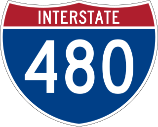
Interstate 480 (I-480) is a 41.77-mile-long (67.22 km) auxiliary Interstate Highway of I-80 in the US state of Ohio that passes through much of the Greater Cleveland area, including the southern parts of the city of Cleveland. I-480 is one of 13 auxiliary Interstate Highways in the state. The western terminus of I-480 is an interchange with I-80 and the Ohio Turnpike in North Ridgeville. Starting east through suburban Lorain County, I-480 enters Cuyahoga County, then approaches Cleveland Hopkins International Airport, which serves as the primary airport for Northeast Ohio. After traversing Brooklyn and crossing the Cuyahoga River on the Valley View Bridge, the highway continues east toward the communities of Bedford and Twinsburg toward its eastern terminus at I-80 and the Ohio Turnpike in Streetsboro. On its route, I-480 crosses I-71 and I-77 and is concurrent with I-271 for approximately four miles (6.4 km). In 1998, the governor of Ohio, George Voinovich, gave I-480 the additional name of the "Senator John Glenn Highway", in honor of the former NASA astronaut and US senator from Ohio for 24 years.

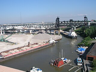
The Cleveland Memorial Shoreway, often shortened to "the Shoreway", is a limited-access freeway in Cleveland and Bratenahl, Ohio. It closely follows the shore of Lake Erie and connects the east and west sides of Cleveland via the Main Avenue Bridge over the Cuyahoga River. The entire length of the Shoreway is part of the Lake Erie Circle Tour (LECT) and all but the very eastern end of the Shoreway is part of State Route 2. The Shoreway also carries parts of Interstate 90 and State Route 283 on its eastern side, and parts of U.S. Route 6 and U.S. Route 20 on its western side. The Cleveland neighborhood of Detroit-Shoreway is named after the two roads that form the northern border, the Shoreway and Detroit Avenue.

<span class="mw-page-title-main">Interstate 670 (Ohio)</span> Highway in Ohio

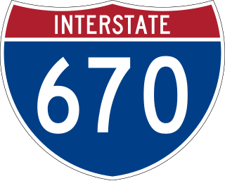
Interstate 670 (I-670) is an Interstate Highway in the US state of Ohio that passes through Columbus connecting I-70 west of Downtown Columbus with I-270 and U.S. Route 62 (US 62) near the eastern suburb of Gahanna. I-670 provides access to John Glenn Columbus International Airport and intersects State Route 315 (SR 315) and I-71 downtown. The section between SR 315 and I-71 is commonly referred to by locals as the "North Innerbelt"; the rest of the Innerbelt consists of SR 315 (west), I-70 (south), and I-71.

<span class="mw-page-title-main">Interstate 470 (Ohio–West Virginia)</span> Highway in Ohio and West Virginia

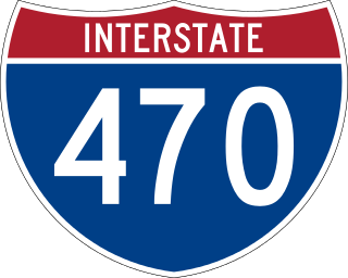
Interstate 470 (I-470) is a 10.63-mile-long (17.11 km) auxiliary Interstate Highway of I-70 that bypasses the city of Wheeling, West Virginia, United States. I-470 is one of 13 auxiliary Interstate Highways in Ohio and the only auxiliary Interstate Highway in West Virginia. The western terminus of I-470 is an interchange with I-70 in Richland Township, Ohio. Traveling southeast through rural Belmont County, I-470 approaches the Vietnam Veterans Memorial Bridge, which spans the Ohio River. After crossing the river into Ohio County, West Virginia, the highway continues east toward the Wheeling communities of Bethlehem and Elm Grove and its eastern terminus at I-70 near Elm Grove. The portion of the highway in West Virginia is named the USS West Virginia Memorial Highway by proclamation of then-Governor Cecil H. Underwood on the 59th anniversary of the attack on Pearl Harbor.

An innerbelt or outerbelt is a ring road or collection of roadways which is or implies that it is inner or outer ring road in relation to another ring road. Use of these terms is most common and near-exclusive to routes in the United States, mostly in the state of Ohio.

<span class="mw-page-title-main">Ohio Department of Transportation</span> Transportation agency of the U.S. state of Ohio

The Ohio Department of Transportation is the administrative department of the Ohio state government responsible for developing and maintaining all state and U.S. roadways outside of municipalities and all Interstates except the Ohio Turnpike. In addition to highways, the department also helps develop public transportation and public aviation programs. ODOT is headquartered in Columbus, Ohio. Formerly, under the direction of Michael Massa, ODOT initiated a series of interstate-based Travel Information Centers, which were later transferred to local sectors. The Director of Transportation is part of the Governor's Cabinet.

<span class="mw-page-title-main">Interstate 77 in Ohio</span> Highway in Ohio

Interstate 77 (I-77) in Ohio is an Interstate Highway that runs for 163.03 miles (262.37 km) through the state. The highway crosses into Ohio on the Marietta–Williamstown Interstate Bridge over the Ohio River near Marietta. The northern terminus is in Cleveland at the junction with I-90. From the West Virginia state line to Cleveland, I-77 serves the cities of Marietta, Cambridge, New Philadelphia, Canton, Akron, and the Cleveland suburban city of Brecksville.

<span class="mw-page-title-main">Interstate 90 in Ohio</span> Section of Interstate Highway in Ohio, United States

Interstate 90 (I-90) runs east–west across the northern tier of the US state of Ohio. Much of it is along the Ohio Turnpike, but sections outside the turnpike pass through Cleveland and northeast into Pennsylvania.

<span class="mw-page-title-main">Vista Ridge Tunnels</span>

The Vista Ridge Tunnels are highway tunnels through the Tualatin Mountains of Portland, Oregon, United States. Located in the Goose Hollow neighborhood, the tunnels pass through a hillside locally known as Vista Ridge which is a half mile (1 km) west of downtown Portland. Sunset Highway, also known as U.S. Route 26, is carried through the tunnels, three lanes in each direction. They are Oregon's busiest tunnels.

<span class="mw-page-title-main">Interstate 75 in Ohio</span> Interstate Highway in Ohio, United States

Interstate 75 (I-75) runs from Cincinnati to Toledo by way of Dayton in the US state of Ohio. The highway enters the state running concurrently with I-71 from Kentucky on the Brent Spence Bridge over the Ohio River and into the Bluegrass region. I-75 continues along the Mill Creek Expressway northward to the Butler County line just north of I-275. From there, the freeway runs into the Miami Valley and then passes through the Great Black Swamp before crossing into Michigan.

<span class="mw-page-title-main">Valley View Bridge</span> Bridge in Cuyahoga County, Ohio

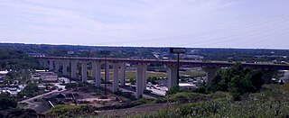
The Valley View Bridge is a trio of steel multi-stringer highway girder bridges that carry Interstate 480 over the Cuyahoga River valley in Valley View and Independence, Ohio. They are 215 feet (66 m) high and 4,150 feet (1,260 m) long.

<span class="mw-page-title-main">Innerbelt Bridge</span> Former truss arch bridge in Cleveland, Ohio

The Innerbelt Bridge was a truss arch bridge in Cleveland, Ohio carrying Interstate 90/Innerbelt Freeway over the Cuyahoga River.

<span class="mw-page-title-main">Opportunity Corridor</span> Urban boulevard in Cleveland, OH

The Opportunity Corridor is a linear project in Cleveland, Ohio, with a boulevard that connects Interstate 77 (I-77) and I-490 to the University Circle neighborhood. "The purpose of the project is to improve the roadway network within a historically under-served, economically depressed area within the City of Cleveland." The corridor is entirely concurrent with Ohio State Route 10.

<span class="mw-page-title-main">Main Avenue Bridge</span> Bridge in Cleveland, Ohio

The Main Avenue Bridge is a cantilever truss bridge in Cleveland, Ohio carrying Ohio State Route 2/Cleveland Memorial Shoreway over the Cuyahoga River. The bridge, completed in 1939, is 8,000 feet (2,400 m) in length, and was the longest elevated structure in Ohio until the 2007 completion of the Veterans' Glass City Skyway in Toledo. It was named for Harold H. Burton, 45th mayor of Cleveland, in late January 1986. The bridge replaced an 1869 bridge at the same site, and was built in conjunction with construction of the Cleveland Memorial Shoreway.

The Interstate 90 Grand River bridges are two steel girder bridges in Lake County, Ohio, on the Leroy Township/Perry Township boundary southwest of Madison, carrying Interstate 90 (I-90) over the Grand River.

References

  1. 1 2 Breckenridge, Tom (March 30, 2011). "Inner Belt Bridge Construction Begins as Massive Supports are Hammered into Bedrock". The Plain Dealer . Cleveland. Retrieved March 31, 2011.
  2. 1 2 Grant, Alison (November 8, 2013). "Inner Belt Bridge Brings Crowd of Onlookers with Cameras, Babies in Strollers". The Plain Dealer. Cleveland. Retrieved November 9, 2013.
  3. District 12 (January 10, 2011). "Cleveland City Planning Commission Approves Innerbelt Bridge Aesthetic Details" (Press release). Ohio Department of Transportation . Retrieved November 10, 2013.{{cite press release}}: CS1 maint: numeric names: authors list (link)
  4. 1 2 3 "Frequently Asked Questions". Ohio Department of Transportation.
  5. District 12 (September 13, 2013). "Apparent Winning Team for Historic Bridge Construction Revealed" (Press release). Ohio Department of Transportation. Retrieved November 10, 2013.{{cite press release}}: CS1 maint: numeric names: authors list (link)
  6. 1 2 Ewinger, James (September 24, 2016). "Voinovich family dedicates eastbound Innerbelt span". The Plain Dealer. Cleveland. Retrieved September 25, 2016.
  7. 1 2 Ohio Department of Transportation District 12 [@ODOT_Innerbelt] (September 25, 2016). "Those fireworks in the background are probably for the @Indians, however it could also be to let you know the EB bridge is open to traffic!" (Tweet) via Twitter.{{cite web}}: CS1 maint: numeric names: authors list (link)
  8. Grant, Alison (April 20, 2015). "See what's going on with the Inner Belt Bridge project during ODOT's public tours". The Plain Dealer. Cleveland. Retrieved April 21, 2015.
  9. News 5, Web Staff (September 24, 2016). "Family of George V. Voinovich cuts ribbon to open bridge in his honor". WEWS. Cleveland. Retrieved June 15, 2022.{{cite news}}: CS1 maint: numeric names: authors list (link)
  10. "Project Overview". Ohio Department of Transportation. Archived from the original on November 10, 2013.
  11. Freeman, Kevin (May 2, 2011). "New Innerbelt Bridge to Connect, Improve Communities". Cleveland: WJW-TV. Archived from the original on July 25, 2011. Retrieved May 3, 2011.
  12. District 12 (May 2, 2011). "Innerbelt Bridge Ceremonial Groundbreaking Held Today" (Press release). Ohio Department of Transportation. Retrieved May 10, 2011.{{cite press release}}: CS1 maint: numeric names: authors list (link)
  13. Volante, Monica (November 9, 2013). "Innerbelt Bridge Open in Both Directions". Cleveland: WJW-TV. Retrieved November 10, 2013.
  14. Ohio Department of Transportation District 12 [@ODOT_Innerbelt] (November 17, 2013). "Attention Motorists: I-90 west is open and as of 8a this morning, westbound traffic is on the NEW #Innerbelt..." (Tweet). Retrieved July 24, 2015 via Twitter.{{cite web}}: CS1 maint: numeric names: authors list (link)
  15. District 12 (November 23, 2013). "Interstate 90 Now OPEN: All Traffic on NEW Innerbelt Bridge!" (Press release). Ohio Department of Transportation. Retrieved November 24, 2013.{{cite press release}}: CS1 maint: numeric names: authors list (link)
  16. Farkas, Karen (December 1, 2009). "Construction of new Inner Belt Bridge likely will cause traffic tie-ups for many years". The Plain Dealer. Cleveland. Retrieved December 1, 2009.
  17. Breckenridge, Tom (January 17, 2012). "Cleveland's Business, Traffic Would Suffer if 2nd Inner Belt Bridge is Delayed a Decade, Officials Say". The Plain Dealer. Cleveland. Retrieved January 19, 2012.
  18. Breckenridge, Tom (January 29, 2012). "Funding for Second Inner Belt Bridge Could Take a Back Seat to Statewide Projects". The Plain Dealer. Cleveland. Retrieved January 31, 2012.
  19. Amigo, Elisa (June 6, 2012). "Innerbelt Bridge Project Moved up to 2016". Cleveland: WJW-TV. Retrieved June 7, 2012.
  20. Breckenridge, Tom (June 6, 2012). "Cleveland's 2nd Inner Belt Bridge Could Be Built 7 Years Earlier than Expected". The Plain Dealer. Cleveland. Retrieved June 7, 2012.
  21. Fong, Marvin (November 3, 2014). "Second Inner Belt bridge work continues in Cleveland (slideshow)". The Plain Dealer. Cleveland. Retrieved December 19, 2014.
  22. Christ, Ginger (October 24, 2016). "Inner Belt Bridge is completely open today". The Plain Dealer. Cleveland. Retrieved October 24, 2016.
  23. Ohio Revised Code 5533.359