
State Route 21 (SR 21) is a north–south state highway in northeastern Ohio. The southern terminus is north of Strasburg on U.S. Route 250. The northern terminus is at an interchange with Interstate 77 in Cuyahoga Heights.

U.S. Route 322 is a 494 mi (795.0 km) long, east–west United States Highway, traversing Ohio, Pennsylvania, and New Jersey. The road is a spur of US 22 and one of the original highways from 1926. A portion of it at one time was concurrent with the Lakes-to-Sea Highway.
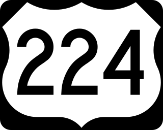
U.S. Route 224 (US 224) is a spur of US 24 that runs through the states of Indiana, Ohio and Pennsylvania. It currently runs for 289 miles (465 km) from US 24 in Huntington, Indiana, east to US 422 Business and Pennsylvania Route 18 (PA 18) in New Castle, Pennsylvania. It goes through the cities of Canfield, Ohio, Akron, Ohio, and Findlay, Ohio. In Northeast Ohio, US 224 is located a short distance north of the Western Reserve's southern boundary.
State Route 8 is a road in the U.S. state of Ohio. SR 8 stretches from the eastern junction of Interstate 76 (I-76) and I-77 in Akron to Public Square in Cleveland. It is one of nine routes to enter downtown Cleveland at Public Square. The route's first few miles are as a limited-access freeway from I-76 and I-77, heading north. The freeway section of the highway has 16 interchanges, and is cosigned with SR 59 for a short distance from Perkins Street in Akron to Front Street in Cuyahoga Falls. The freeway portion ends at I-271 in Macedonia.

State Route 42 (SR 42) is a 115.3-mile-long (185.6 km) state highway that runs southeast-to-northwest through portions of Peach, Crawford, Monroe, Butts, Henry, Clayton, and DeKalb counties in the central and north-central parts of the U.S. state of Georgia. The route connects Byron with the Atlanta metropolitan area, via Forsyth, McDonough, and Forest Park.

U.S. Route 422 (US 422) is a 271-mile (436 km) long spur route of US 22 split into two segments in the U.S. states of Ohio and Pennsylvania. The western segment of US 422 runs from downtown Cleveland, Ohio, east to Ebensburg, Pennsylvania. The eastern segment, located entirely within Pennsylvania, runs from Hershey east to King of Prussia, near Philadelphia. US 422 Business serves as a business route into each of four towns along the way.

State Route 237 is a nearly 14-mile (23 km) north–south signed route in Cuyahoga County, Ohio. Its southern terminus is at SR 82 in Strongsville, and its northern terminus is in Lakewood where U.S. Route 20 (US 20) joins the US 6 / SR 2 concurrency.
State Route 82 is a state route in northeastern Ohio, with a western terminus at State Route 57 in Lorain County, southeast of Elyria.

State Route 198 is a north–south state highway in the western portion of the U.S. state of Ohio. Its southern terminus is at an interchange with U.S. Route 33 just south of Wapakoneta, which is also the western terminus of State Route 67 and the southern terminus of State Route 501; its northern terminus is at State Route 117 nearly 4 miles (6.4 km) east of Spencerville.
Pennsylvania Route 65, is a major 51-mile-long (82 km) state highway located in western Pennsylvania, United States. The route, traveling north–south from the Interstate 279/U.S. Route 19 Truck concurrency in Pittsburgh north to the PA 108/PA 168 concurrency in New Castle, connects downtown Pittsburgh to the northwestern portion of the Pittsburgh Metropolitan Area. PA 65 is similar in its purpose to PA 18 and PA 51, both of which run parallel to PA 65 at one point or another; however, the three routes pass through different cities for most of their respective alignments.
State Route 88 is a highway generally running in an east–west direction in the northeastern portion of the U.S. state of Ohio. Its southern terminus is in Portage County at SR 59 at the intersection of Freedom Street with Main Street in Ravenna. SR 88 is labeled north-south southwest of U.S. Route 422 (US 422) and SR 168/SR 528, and labeled east-west east of there. SR follows a northerly direction for a little more than one mile (1.6 km) along Freedom Street, to the SR 14 and SR 44 concurrency bypass. From here, the route heads in a northeasterly direction. Its next intersection is with SR 700, at the southern terminus of the latter route. One-quarter mile (0.40 km) further to the northeast, SR 88 joins SR 303 for about one-half mile (0.80 km). SR 88 then continues northeast, crossing over Interstate 80 and the Ohio Turnpike, before turning due north as it enters Garrettsville. Here, as South Street, the route intersects SR 82, then becomes North Street before exiting the corporation limits.

State Route 43 is a mainly north–south state highway that runs through the northeastern quadrant of the U.S. state of Ohio. Its southern terminus is at a signalized intersection with State Route 7 along the Ohio River in Steubenville, and its western terminus is approximately 123 miles (198 km) to the north at Public Square in Cleveland. It is one of ten routes to enter Public Square.
State Route 10 is a state highway located in and around Cleveland, Ohio. The route's western terminus is in Eaton Township in Lorain County, and the eastern terminus is in Cleveland's University Circle neighborhood.

State Route 165 is a primary state highway in the U.S. state of Virginia. The state highway runs 39.75 miles (63.97 km) from U.S. Route 17 Business in Chesapeake north to SR 337 in Norfolk. SR 165 is a C-shaped route that connects Chesapeake and Norfolk in the Hampton Roads metropolitan area indirectly via Virginia Beach. The highway's east–west segment connects the Chesapeake communities of Deep Creek and Great Bridge with the Princess Anne part of Virginia Beach. SR 165's northwest–southeast portion connects the Princess Anne area with Virginia Beach's Salem and Kempsville communities and with Norfolk. Within Norfolk, the state highway parallels Interstate 64 (I-64) while passing through the eastern and northern areas of the city near Norfolk International Airport and Naval Station Norfolk. Much of SR 165 is a multi-lane divided highway, but there are significant two-lane stretches in all three of the independent cities the highway serves.

State Route 169 is a state highway in the northeastern portion of the U.S. state of Ohio that is signed north–south, but trends more east–west. The southern (eastern) terminus of SR 169 is at a signalized intersection with U.S. Route 422 (US 422) just east of Niles. The northern (western) terminus of the highway is at a signalized intersection with US 422 in Warren.

State Route 528 (SR 528) is north–south state highway in the northeastern portion of the U.S. state of Ohio. The southern terminus is at an intersection with U.S. Route 422 (US 422) and SR 88 in the village of Parkman, about 6½ miles south of Middlefield, and its northern terminus is at U.S. Route 20 about 2 miles (3.2 km) north of Madison. The entire highway is a two-lane highway, that passes through woodland and farmland. SR 528 was commissioned in the mid-1930s on the same route. The highway was extended in 1940, to US 20, replacing another state route. In the mid-1960s the route was extended south to US 422.

State Route 168 is north–south state highway in the northeastern portion of the U.S. state of Ohio. The southern terminus of State Route 168, which doubles as the southern endpoint of State Route 528, is along State Route 88 at a signalized intersection with U.S. Route 422 in the hamlet of Parkman. State Route 168's northern terminus, which is concurrently the northern endpoint of State Route 700, is at the junction with State Route 87 at a traffic circle in Burton.

State Route 304 is an east–west state highway in the northeastern portion of Ohio. The western terminus of SR 304 is at a signalized intersection with US 422 in Girard. Its eastern terminus is at the Pennsylvania State Line nearly 3 miles (4.8 km) east of Hubbard, where the highway continues east as Pennsylvania Route 318.

State Route 282 is a north–south state highway in northeastern Ohio, a U.S. state. The southern terminus of SR 282 is at a T-intersection with SR 305 near the hamlet of Nelson. Its northern terminus is also at a T-intersection, this time with the four-lane divided U.S. Route 422 (US 422) approximately two miles (3.2 km) southeast of Parkman. SR 282 primarily serves as an access route for Nelson Kennedy Ledges State Park. For its duration, the highway is also known as Nelson Ledge Road.

State Route 175 (SR 175) is a 15.70-mile (25.27 km) long north–south state highway in the northeastern part of the U.S. state of Ohio. The southern terminus of SR 175 is at a signalized intersection with SR 43 in Solon. Its northern terminus is at a signalized intersection with SR 283 in Euclid.


