Related Research Articles

A ramp meter, ramp signal, or metering light is a device, usually a basic traffic light or a two-section signal light together with a signal controller, that regulates the flow of traffic entering freeways according to current traffic conditions. Ramp meters are used at freeway on-ramps to manage the rate of automobiles entering the freeway. Ramp metering systems have proved to be successful in decreasing traffic congestion and improving driver safety.
In Downtown Atlanta, the Downtown Connector or 75/85 is the concurrent section of Interstate 75 and Interstate 85 through the core of the city. Beginning at the I-85/Langford Parkway interchange, the Downtown Connector runs generally due north, meeting the west–east I-20 in the middle. Just north of this is the Grady Curve around Grady Memorial Hospital. Continuing north, the terminus of the Downtown Connector is the Brookwood Interchange or Brookwood Split in the Brookwood area of the city. The overall length of the Downtown Connector is approximately 7.5 miles (12 km). Since the 2000s, it has been officially named James Wendell George Parkway for most of its length, although it is still designated the Connector in the mainstream. It also has unsigned designations State Route 401 (I-75) and State Route 403 (I-85) along its length, due to I-75 and I-85 having 400-series reference numbers.

Interstate 285 (I-285) is an auxiliary Interstate Highway encircling Atlanta, Georgia, for 63.98 miles (102.97 km). It connects the three major Interstate Highways to Atlanta: I-20, I-75, and I-85. Colloquially referred to as the Perimeter, it also carries unsigned State Route 407 (SR 407) and is signed as Atlanta Bypass on I-20, I-75, and I-85.

Georgia State Route 400 is a freeway and state highway in the U.S. state of Georgia serving parts of Metro Atlanta. It is concurrent with U.S. Route 19 (US 19) from exit 4 (Interstate 285) until its northern terminus south-southeast of Dahlonega, linking the city of Atlanta to its north-central suburbs and exurbs. SR 400 travels from the Lindbergh neighborhood in the Buckhead district of Atlanta, at Interstate 85 (I-85), to just south-southeast of Dahlonega. Like the Interstate highways, it is a limited-access road, but unlike the interstates, the exit numbers are not mileage-based, they are sequential. Once SR 400 passes exit 18 (SR 369), it changes from a limited-access freeway into an at-grade divided highway with traffic lights, but still with a high speed limit of 65 miles per hour (105 km/h), and ends at the J.B. Jones Intersection at SR 60/SR 115 in Lumpkin County.

The Highway Emergency Response Operators (HERO) program is a freeway service patrol operated in metro Atlanta, United States by the Georgia Department of Transportation (GDOT). It is a part of the GDOT's Office of Traffic Operations. Both the program and the individual vehicles are typically referred to by the bacronym HERO.

The Georgia Department of Transportation (GDOT) is the organization in charge of developing and maintaining all state and federal roadways in the U.S. state of Georgia. In addition to highways, the department also has a limited role in developing public transportation and general aviation programs. GDOT is headquartered in downtown Atlanta and is part of the executive branch of state government.

State Route 316 (SR 316), also known as University Parkway, or Georgia 316, is a 38.9-mile-long (62.6 km) state highway that exists in the northern part of the U.S. state of Georgia. It links the Atlanta metropolitan area with Athens, home of the University of Georgia.

State Route 141 (SR 141) is a 34.1-mile-long (54.9 km) state highway that runs southwest-to-northeast in the northwest part of the U.S. state of Georgia. It connects the Buckhead area of Atlanta with Cumming. Its routing exists within portions of Fulton, DeKalb, Gwinnett, Forsyth counties.

Interstate 675 (I-675) is an 11.04-mile-long (17.77 km) auxiliary Interstate Highway in the southeast part of the Atlanta metropolitan area. It travels from I-75 in Stockbridge in the south to I-285 in the north. I-675 is also designated as the Terrell Starr Parkway and also has the unsigned internal state route designation of State Route 413 (SR 413).

Tom Moreland Interchange, colloquially known as Spaghetti Junction, is the interchange of Interstate 85 (I-85) and I-285, along with several access roads, in northern DeKalb County, Georgia, northeast of Atlanta and just to the south of Norcross in Gwinnett County. It is named for Tom Moreland, a former commissioner of the Georgia Department of Transportation (GDOT) from 1975 to 1987.
The Northwest Corridor Express Lanes and locally known as the Tollercoaster, is a completed Georgia Department of Transportation (GDOT) project which has put Peach Pass-only toll lanes along Interstate 75 (I-75) and I-575 in the northwestern suburbs of the Atlanta metropolitan area. It carries traffic between northwest Atlanta and Cobb and Cherokee counties by adding two lanes for paying vehicles along I-75, with one continuing up a dedicated exit onto I-575 to Sixes Road, and the other straight on I-75 to Hickory Grove Road, just past Wade Green Road. North of the interchange where they split, the new lanes are located in the median, between the original northbound and southbound lanes. From the Perimeter to I-575, the road had already been built with 12 to 16 lanes, which required other plans, including via eminent domain.

State Route 13 (SR 13) is a 49.5-mile-long (79.7 km) state highway in the north-central part of the U.S. state of Georgia, that travels through portions of Fulton, DeKalb, Gwinnett, and Hall counties.

Interstate 75 (I-75) in the US state of Georgia travels north–south along the U.S. Route 41 (US 41) corridor in the central part of the state, traveling through the cities of Valdosta, Macon, and Atlanta. It is also designated—but not signed—as State Route 401 (SR 401).

Interstate 85 (I-85) is a major Interstate Highway that travels northeast–southwest in the US state of Georgia. It enters the state at the Alabama state line near West Point, and Lanett, Alabama, traveling through the Atlanta metropolitan area and to the South Carolina state line, where it crosses the Savannah River near Lake Hartwell. I-85 connects North Georgia with Montgomery, Alabama, to the southwest, and with South Carolina, North Carolina, and Virginia to the northeast. Within Georgia, I-85 is also designated as the unsigned State Route 403 (SR 403).

The Outer Perimeter is a freeway originally planned to encircle Atlanta, in the U.S. state of Georgia about 20 to 25 miles outside of Interstate 285, which is colloquially referred to as the Perimeter and is a point of reference for local travel outside Atlanta's city core.

In the US state of Georgia, Interstate 20 (I-20) travels from the Alabama state line to the Savannah River, which is the South Carolina state line. The highway enters the state near Tallapoosa. It travels through the Atlanta metropolitan area and exits the state in Augusta. The highway also travels through the cities of Bremen, Douglasville, Conyers, Covington, and Madison. I-20 has the unsigned state highway designation of State Route 402 (SR 402).
The Advanced Traffic Management System (ATMS) field is a primary subfield within the Intelligent Transportation System (ITS) domain, and is used in the United States. The ATMS view is a top-down management perspective that integrates technology primarily to improve the flow of vehicle traffic and improve safety. Real-time traffic data from cameras, speed sensors, etc. flows into a Transportation Management Center (TMC) where it is integrated and processed, and may result in actions taken with the goal of improving traffic flow. The National ITS Architecture defines the following primary goals and metrics for ITS:

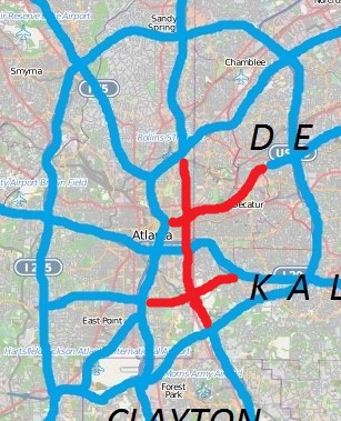
There have been multiple freeway revolts in Atlanta, Georgia. The longest and most famous examples of Interstate opposition were against I-485 and the Stone Mountain Freeway through Intown Atlanta, lasting over 30 years, from the early 1960s until the final construction of Freedom Parkway on a small portion of the contested routes in 1994.
Atlanta's transportation system is a complex infrastructure of several systems, including 47.6 miles of heavy rail, 91 bus transit routes, 1,600 licensed taxis, a comprehensive network of freeways, the world's busiest airport and over 45 miles of bike paths.

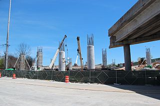
A massive fire collapsed an Interstate 85 (I-85) bridge in Atlanta, Georgia, United States, on the evening of Thursday, March 30, 2017. After the 92-foot-long (28 m) section collapsed, I-85 was closed to traffic for 43 days between its split with I-75 and the interchange with State Route 400 (SR 400) — approximately two miles (3 km). Three sections of northbound I-85 and three sections of southbound I-85 were replaced at a cost of $15 million; re-opening of the interstate was on May 12.
References
- ↑ "Georgia renews traffic monitoring contract" Traffic Technology International
- ↑ "Georgia Department of Transportation provides real-time traffic data" Archived 2008-05-04 at the Wayback Machine Government Technology, October 11, 2007
- ↑ "Southern Telecom provides dark fiber to Georgia Department of Transportation" Archived 2007-07-11 at the Wayback Machine Southern Company press release
- ↑ "Georgia launches 511 Traffic Information Service" Broadcast Atlanta, August 16, 2007
- ↑ "Georgia DOT Fast Forward Program". Archived from the original on 2012-02-08. Retrieved 2014-02-06.
- ↑ "Georgia DOT Ramp Meter Deployment". Archived from the original on 2008-10-15. Retrieved 2014-02-06.
- ↑ "Georgia DOT Ramp Meter Deployment". Archived from the original on 2010-01-14. Retrieved 2014-02-06.