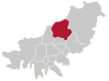
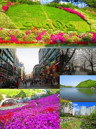
Cheongju is the capital and largest city of North Chungcheong Province in South Korea.

Muju County (Muju-gun), is a county in North Jeolla Province (Jeollabuk-do), South Korea. Muju is known for its Muju Firefly Festival and is a tourist area.

South Korea is made up of 22 first-tier administrative divisions: 6 metropolitan cities, 1 special city, 1 special self-governing city, and 14 provinces, including three special self-governing provinces and five claimed by the ROK government. These are further subdivided into a variety of smaller entities, including cities, counties, districts, towns, townships, neighborhoods and villages.
Gunpo, formerly romanized as Kunp'o, is a small city in South Korea's Gyeonggi Province, located south of Seoul in the Seoul National Capital Area. It borders Anyang to the north, Uiwang to the east, and Ansan to the south and west, and is connected to its neighbors and to Seoul by lines 1 and 4 of the Seoul Metropolitan Subway. Gunpo is also home to three stops on the Gyeongbu Line, a national railway that links it to the rest of the country. Although 73.2% of the city is greenspace, owing largely to Surisan and various smaller mountains, Gunpo is home to over 286,000 residents in several urban areas. The city's downtown core is Sanbon New Town, a commercial hub which centers on a pedestrian "street of culture" that Gunpo has designated as one of its eight scenic locations.

Mungyeong is a city in North Gyeongsang Province, South Korea. The local government, economy, and transportation networks are all centered in Jeomchon, the principal town. Mungyeong has a lengthy history, and is known today for its various historic and scenic tourist attractions. The city's name means roughly "hearing good news." Recently, development has been somewhat stagnant with the decline of the coal industry. Since the 1990s, the proportion of people who rely on the tourism industry through Mungyeong Saejae has gradually increased.
Sangju is a city in North Gyeongsang Province, central South Korea. Although Sangju is rather rural, it is very old and was once a key city. Along with Gyeongju, it gives rise to half of the name of the Gyeongsang provinces. Sangju is nicknamed Sam Baek, or "Three Whites", referring to three prominent agricultural products rice, silkworm cocoons, and dried persimmons from the area.

Masan is an administrative region of Changwon, a city in the South Gyeongsang Province. It was formerly an independent city from 1949 until 30 June 2010, when it was absorbed to Changwon along with Jinhae. Masan was redistricted as two districts within Changwon, Masanhappo-gu and Masanhoewon-gu. On 31 December 2012, the population of the districts combined was 406,893.

Haeundae District is a district (gu) of Busan, South Korea.
Hwamyeong (Korean: 화명) is a region in Buk-gu, northern Busan, South Korea. It is situated along the east bank of the Nakdong River, and since 2003 has been divided into three dong, Hwamyeong 1, 2, and 3-dong. The total area of the three dong is approximately 12 km2 (5 sq mi). It was designed to serve as a commuter town for Busan, and was home to about 99,000 people as of February 2020.

Geumjeong District is a district in north central Busan, South Korea. Approximately 7.3% of Busan's population is in Geumjeong District. The Hoedong Reservoir is located on the district's eastern boundary, and the mountain Geumjeongsan on the west. Because of this, 75% of the district's land is restricted from residential development. The district's population is concentrated in the valley of the Oncheoncheon stream, a tributary of the Suyeonggang.

Suyeong District (Korean: 수영구) is a district (gu) in central Busan, South Korea. It has a population density of about 17,768 inhabitants per square kilometer (46,020/sq mi).
Seo District is a gu, or district, in south-west central Busan, South Korea.
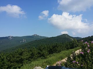
Geumjeongsan is a mountain in Busan, South Korea. Its highest peak, Godangbong, stands at 801.5 meters.

Dong District is a gu in central Busan, South Korea. It was one of the first 6 gu of Busan established in 1957.

Jangjeon is a dong, or precinct, in Geumjeong-gu, Busan, South Korea. A heavily populated district, it is located between the slopes of Geumjeongsan and the valley of the Oncheoncheon. It is bounded to the south by Oncheon-dong in Dongnae-gu and to the north by Guseo-dong. Due to its large population, Jangjeon-dong is divided into three "administrative dong," Jangjeon 1, 2, and 3-dong.

Gijang County is a gun, or county, located between Haeundae-gu and Ulsan in northern Busan, South Korea.
Geumjeong can refer to the following locations in South Korea:

Geumjeongsanseong is a Joseon-era Korean fortress on the mountain Geumjeongsan in Busan, South Korea. It is the largest fortress in Korea.

Jangjeon Station (Korean: 장전역) is a station of Busan Metro Line 1 in Jangjeon-dong, Geumjeong District, Busan, South Korea.
Allak is a dong in Dongnae District, Busan, South Korea. It is divided into two administrative dong, Allak 1-dong and Allak 2-dong. The total area is 2.31 km2, with a population of 18,560. It borders Geumjeong District on the north.