This article needs additional citations for verification .(June 2013) |
Ghangaria | |
|---|---|
village | |
 | |
 Ghangaria Location in Uttarakhand, India  Ghangaria Ghangaria (India) | |
| Coordinates: 30°42′06″N79°35′37″E / 30.701697°N 79.593587°E | |
| Country | |
| State | Uttarakhand |
| Elevation | 3,049 m (10,003 ft) |
| Languages | |
| • Official | Hindi |
| • Native | Bhotia [1] |
| Time zone | UTC+5:30 (IST) |
| Vehicle registration | UK 11 |
| Website | uk |
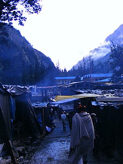
Ghangaria is a village in Uttarakhand state of India. It is located at an altitude of 3049 meters.
Contents
Ghangaria is situated at the confluence of the river Pushpawati, which forms Lakshman Ganga, that later meets the river Alaknanda at Govindghat. It is the last human habitation in the Ghangaria valley. [2] It is only open from June till October. The rest of the year, the valley is covered under snow.